Vinišnik - Koča pod Kremžarjevim vrhom (over the peak)
Starting point: Vinišnik (550 m)
Name of path: over the peak
Time of walking: 1 h 40 min
Difficulty: easy marked way
Altitude difference: 552 m
Altitude difference po putu: 615 m
Map: Pohorje 1:50.000
Recommended equipment (summer):
Recommended equipment (winter):
Views: 2.260
 | 1 person likes this post |
Access to the starting point:
a) From Velenje or Dravograd, drive to Slovenj Gradec and take the Kope and Legen exit at the roundabout on the main Dravograd - Velenje road. The road will then soon lead you to the next junction, where you turn right (towards the Kope ski centre). In this direction, drive for about 2. 2 km to the next crossroads, where you turn left (there are signs for some routes and a marked trail to Kremžarica). At the next crossroads, after 500 m, turn left again (towards the Vinišnik picnic area). Continue uphill for a short distance, meet a macadam road and you will see a parking lot on the left.
b) From the regional road Mislinja - Slovenj Gradec, take the road to the village of Šmartno pri Slovenj Gradcu and later Legen, pass the church of St. George and then turn right in the direction of the Kope ski centre. Continue in this direction for about 300 m to the next crossroads, where you turn left (there are signs for some farms in this direction and a marked trail to Kremžarca). At the next crossroads, after 500 m, turn left again in the direction of the Vinišnik picnic area. Continue uphill for a short distance, meet a macadam road and on your left you will see a parking area for hikers to Kremžarjev Vrch.
Path description:
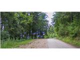
From the parking lot, continue along the road that leads to the Vinišnik picnic area. After a few minutes of walking along the road, a signpost tells you to turn right along a less steep road, past small farms. The road slowly turns into a forest logging trail or cart track. In this part, the path joins the road, starting from the farm Orešnik. Ahead of us is a 40-minute walk uphill on a marked path which follows the shaded cart track and a forest path which crosses a macadam road a few times. After the end of cart track cross a crossroads of dirt roads where the "main road" leads to Sv. Barbara, and in the other direction to the valley or the hut below Kremžarjevi vrh. Our marked route continues on the other side of the road. In this part of the route you can observe Slovenj Gradec and the peaks of the nearby mountains (Uršlja gora, Peca). After 15 minutes of walking along the cart track and along the pastures past the Lampret farm, you cross the road and reach a crossroads. You have the option of taking the shorter route, either below the summit or along the path to the summit.
A few steps to the right of Lampret Farm, climb over the upper road, where the path to the summit is marked. The path to the top will take us 35 minutes and takes us over short but steep climbs through the forest. The path through the forest slowly turns into cart track, which winds along a hill meadow. From this meadow, a view slowly opens up from the top of Peć and Uršlá Gora to Slovenjgraje Airport in the lowlands. A few steps into the forest, we join the path from the Grmovský's home at Kopy. Continue walking through the meadow, keeping to the right-hand path (Vrh - koča). (If you wish to visit the summit, descend in the direction of the hut and during the descent, on the right-hand side, you will see a wall and markings indicating the way to the summit, to the hut and to Vuzenica). If you continue descending, you will come to an indistinct ridge where there is a semi-open glass chapel and a wishing bell. A little further on, there is a marking indicating a horizontal path or road leading from the valley to the hut below Kremžarjevim vrh.

Pictures:
 1
1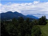 2
2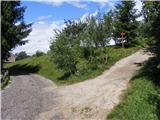 3
3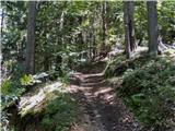 4
4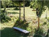 5
5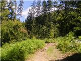 6
6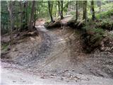 7
7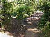 8
8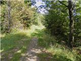 9
9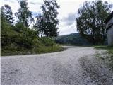 10
10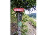 11
11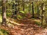 12
12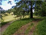 13
13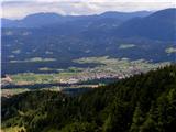 14
14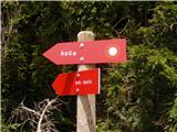 15
15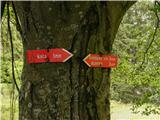 16
16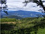 17
17 18
18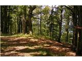 19
19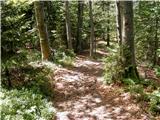 20
20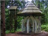 21
21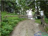 22
22
Discussion about the trail Vinišnik - Koča pod Kremžarjevim vrhom (over the peak)