Vent - Fineilspitze (običajna smer preko SV grebena)
Starting point: Vent (1895 m)
| Lat/Lon: | 46,8605°N 10,91494°E |
| |
Name of path: običajna smer preko SV grebena
Time of walking: 6 h 30 min
Difficulty: difficult marked way, very difficult unmarked way
Altitude difference: 1619 m
Altitude difference po putu: 1619 m
Map: Ötztaler Alpen Weißkugel, 30/2 1:25.000
Recommended equipment (summer): helmet, ice axe, crampons
Recommended equipment (winter): ice axe, crampons
Views: 520
 | 2 people like this post |
Access to the starting point:
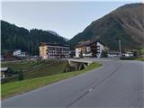
From Ljubljana, take the motorway past Salzburg towards Munich. At the Dreieck Inntal multi-level junction, take the A93 towards Innsbruck/Kufstein/Brenner. On returning to Austria, continue on the A12 motorway past Innsbruck, Telfs and Mötz, then turn off at exit 123 near Ötztal Bahnhof onto the B186/B171/Ötztal/Haiming. Follow the B186 into the Ötztal Valley past Oetz, Längenfeld and the centre of the valley, Sölden. Just a few kilometres further on from Sölden, at the village of Zwieselstein, turn onto the fast climbing but comfortable asphalted road towards Vent. In the tourist village of Vent, park in one of the many (paid) car parks. The parking fee in Vent is €5/day in 2020.
Path description:
From one of the car parks in Vent, head through the village to its south-western edge, where you will see signs leading you over a small bridge in the direction of Martin-Busch-Hütte and Similaunhütte. Follow the rather sloping path, which in the first part of the trip follows the route of a minor dirt road, to a small private hut, shortly after which take a slightly narrower path to the east, which leads through a small canyon of the Niedertalbach river. After about fifteen minutes of further walking, follow the track over an iron bridge to join back to the mountain road. Follow the road, which ascends barely perceptibly and on which you will often encounter cyclists in the warm summer months, around a bend below the northernmost slopes of the Hintere Schwärze to the Martin-Busch-Hütte.
The path between Martin-Busch-Hütte and Similaunhütte mostly follows a relatively gentle, open grassy slope below the expanses of the Marzellferner and Niederjochferner glaciers. The easy route, exposed to the summer heat, initially leads past a crossroads where the direct approach to the Ötzi Monument branches off (this option is a shorter, easier but less scenic approach to the summit, which I would definitely recommend, at least on your return), and later winds past small glacial lakes and climbs slightly steeper to the Similaunhütte hut. From Venta, it is about a 4 hour walk to the hut below Similaun, and the whole route is marked accordingly.
At the hut, follow the signs for Ötzi - Fundstelle and Fineilspitze north-westwards and climb in switchbacks to a scenic ridge linking the Similaun and Fineilspitze massifs. The ridge path, which leads along and over a number of large stone blocks, is mostly quite wide and easy, but over some of the more precipitous and steeper spots we are helped by the reliable fixed safety gear.
After less than half an hour's walk from the hut, in order to avoid a sharp continuation, we descend below the ridge with the help of a rope and stops and continue our way towards the Ötzi Monument in a gentle ascent through a rugged landscape. The winding and not too steep path, with the help of occasional markings and individual cairns, leads to a large year-round snowfield, over which you walk to a memorial to the discovery of the natural Ötzi mummy, which two German hikers accidentally discovered in the immediate vicinity of the monument.
From the memorial, continue along the trail towards the shoulder west of the Hauslabjoch pass; it is also possible to continue further right (east) along the better marked trail directly towards the pass, but this lengthens the hike and requires a shorter crossing of the Hochjochferner glacier.
Following the footsteps of the passers-by and the footprints of the men, one ascends over the crumbly rubble directly towards the edge of the Fineilspitze summit building to the plain below the NE ridge of the mountain. Here we follow a slightly more difficult to see but geographically obvious ascent route over the eastern back of Fineilspitze; the terrain is quite crumbly in places in the first part of the final ascent, but unexposed and only moderately steep, with individual cairns to help orientation. Higher up, we gradually enter a more difficult world, where we have to use our hands more and more to help us cross the crumbly scree, but the climbing remains within the loose framework of Level I. After crossing a more technically demanding pitch (I+), the terrain temporarily flattens out and after a short traverse below the summit, the route leads to the connecting ridge between it and the main peak Fineilspitze.
After crossing an airy but short ridge cut, we find ourselves just below the summit head of Fineilspitze. The summit can be reached by a short but exposed climb over the top of the jagged east face (II) or, preferably, by continuing directly along the ridge to the highest point. From the saddle below the NE ridge of Fineilspitze it is a 45 minute climb to the summit.
The ascent of Fineilspitze was until recently considered a moderately difficult, all-snow tour, the character of which has changed drastically in recent years and serves as a direct indication of the extent of climate change. Instead of a snow-covered ridge, the final part of the climb in the summer-autumn days of the high season is likely to be a relatively strenuous climb over a rather crumbly world, which in large part dictates easier climbing over sometimes unreliable scree. Although the technical difficulty is not particularly high, several factors make the summit less visited than the neighbouring Similaun, despite its close proximity to the popular Ötzi Memorial - but it is the greater isolation and less accessibility that can make it a nobler goal for the experienced climber; a summit that, in the peak high-mountain season, does not usually require winter gear.
For the return, I recommend the shorter and more direct route to Vent, which from the Ötzi Memorial follows a well-marked trail that takes you safely on a gentle downhill to the crossroads between the Martin-Busch-Hütte and Similaunhütte huts, which slightly reduces the length and difficulty of the hike.

Pictures:
 1
1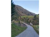 2
2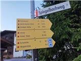 3
3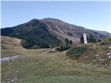 4
4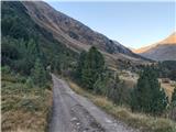 5
5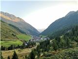 6
6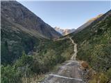 7
7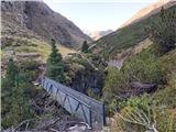 8
8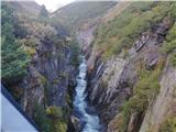 9
9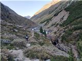 10
10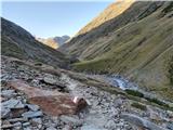 11
11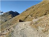 12
12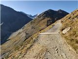 13
13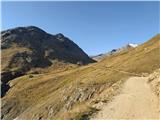 14
14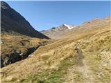 15
15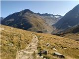 16
16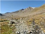 17
17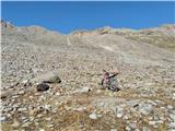 18
18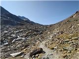 19
19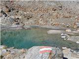 20
20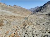 21
21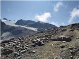 22
22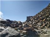 23
23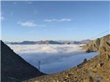 24
24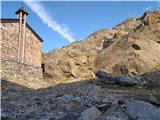 25
25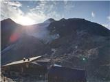 26
26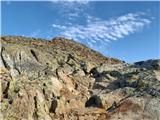 27
27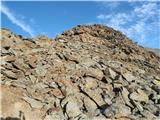 28
28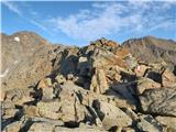 29
29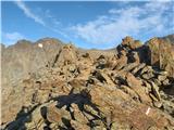 30
30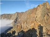 31
31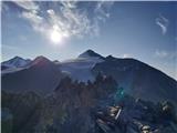 32
32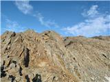 33
33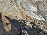 34
34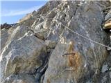 35
35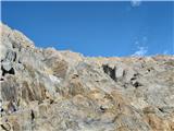 36
36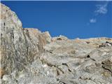 37
37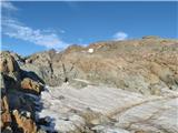 38
38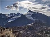 39
39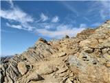 40
40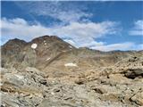 41
41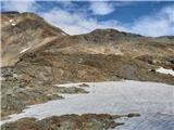 42
42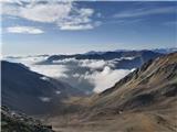 43
43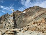 44
44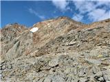 45
45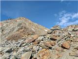 46
46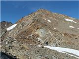 47
47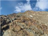 48
48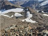 49
49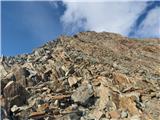 50
50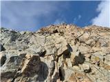 51
51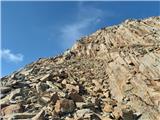 52
52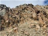 53
53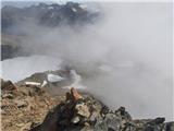 54
54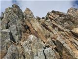 55
55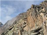 56
56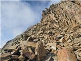 57
57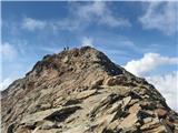 58
58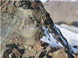 59
59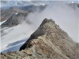 60
60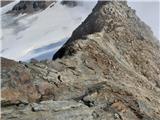 61
61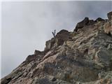 62
62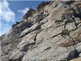 63
63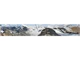 64
64
Discussion about the trail Vent - Fineilspitze (običajna smer preko SV grebena)