Ullachtal - Westliche Mitterspitze (Leoganger Süd Klettersteig)
Starting point: Ullachtal (878 m)
| Lat/Lon: | 47,45278°N 12,75577°E |
| |
Name of path: Leoganger Süd Klettersteig
Time of walking: 5 h
Difficulty: extremely difficult marked way
Ferata: E
Altitude difference: 1282 m
Altitude difference po putu: 1300 m
Map:
Recommended equipment (summer): helmet, self belay set
Recommended equipment (winter): helmet, self belay set, ice axe, crampons
Views: 523
 | 1 person likes this post |
Access to the starting point:
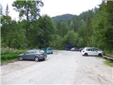
Drive through the Karavanke Tunnel into Austria, then continue along the Tauern motorway. We continue through the Katschberg Tunnel and later the Thuringian Tunnel / Tauerntunnel, and follow the motorway to Salzburg (aka Solnograd) only as far as the exit for Bischofshofen, from where we continue on the four-lane road to the aforementioned town. From Bischofshofen, follow the signs for Zell am See and then Saalfelden and Lofer. At Saalfelden, turn left towards Leogang. In Leogang, leave the main road and turn right onto a narrow road, where you will be directed by signs to the Passauer Hütte hut. Follow the signs for hut Passauer Hütte and the parking lot Parkplatz Ullachtal. Park in the parking lot mentioned above, where there are also some information boards and signs.
Path description:
At the starting point, focus on the macadam road where we are directed by signs for the Passauer Hütte hut. The dirt road passes through the forest and quickly leads to a wide torrent bed. Across the torrent bed the road is somewhat destroyed and less visible, but then it gets better again and leads us to a marked crossroads.
At the crossroads, leave the macadam road and turn right uphill and start climbing up the grassy slopes. The path then crosses a grazing fence and continues to climb up the mountain pasture and leads to another marked crossroads.
A path branches off to the left towards the Birnbachloch cave, from which the Birnbach stream flows, and we continue to the right towards hut Passauer Hütte. The path then soon leads into the woods and along the way you will see a number of information boards describing various plants and animals. After a short climb through the forest, another path branches off to the left towards the aforementioned Birnbachloch cave, and we continue to the right again. We then continue to climb for a long time through the forest, occasionally crossing short gullies which offer views of the surrounding peaks. There is also the occasional bench along the way. At a place called Kaserstein there is a table and a small woodshed.
Further on, the slope then becomes a shade steeper and the path leads us out of the forest into dwarf pines from which we have an increasingly beautiful view of the surrounding peaks. A little higher up the path leads us past another bench at which the path turns to the right and then soon becomes a little more difficult.
Further on, the path climbs up a rather steep slope and we are also helped by the ropes, and in a few places there are also steps to make the climb easier. The path over the Plattenkopf summit soon joins from the right. We continue to the left along a well maintained path, which is still occasionally protected by a steel cable. This path then leads us to the saddle Hochtor from which we can see towards the hut Passauer Hütte
At the saddle where the crossroads are, leave the path towards hut Passauer Hütte and head right towards the protected climbing route Leoganger Süd. From the saddle, the trail crosses relatively steep slopes to the east and descends a little. After a few minutes of traversing, you will reach the entrance to the climbing part of the route, which is located at 1940 metres. It is about 3 hours' walk from the starting point.
The climbing route ascends vertically from the very beginning and is aided by some very small scrambles (difficulty D). The route continues to climb almost vertically for some time alongside the scramble (C), then turns slightly to the left and crosses the smooth slabs (B) in a slight ascent. Turn right again and start climbing steeply along the steel cable (C) to the side ridge, which is partly covered with grass and dwarf pines. The path then climbs mostly along the left-hand side of the ridge (to B/C) and leads to slightly more vegetated terrain. For a short time the route becomes slightly less difficult (A, A/B), but then the climb gradually becomes more difficult again and climbs steeply alongside the glacier. In a few places, small jumps are helpful. There is a very difficult, almost vertical climb (C), which leads to a grassy ledge. Here you continue right on the ledge (A) and then left again up the vertical wall (C/D). There are a few very steep climbs, and in a few places you have the help of a rock. The steepness then eases a little and the climb on smooth slabs (B) leads to the bottom of the overhang.
This is followed by 20 metres of extremely difficult overhanging traverse to the left of difficulty E. The traverse is not completely horizontal, but it also climbs a little across, which makes climbing and traversing a little more difficult. If you use an additional short umbilical for a rest, the difficulty is slightly lower, D.
Immediately after the overhanging traverse, there is a vertical climb right up (C). The route here leads into a short jam from which there is another vertical climb over which we are helped by a few crampons (C). The slope then becomes less steep for a short time and there is a final difficult climb to the summit over which we are helped by a number of crampons (C).
This route is not suitable for descending, so descend via the Leoganger Nord route, which is also not entirely easy and reaches difficulty level C. When planning your ascent, bear in mind that the descent route is on the northern side of the mountain and the snow may persist a little longer than on the southern side.
The difficulty ratings given in the description are as shown in the sketches on the information boards along the route. Note that the grades are quite strictly assigned and many routes of the same difficulty would have a difficulty rating at least half as high. In addition, the fixed safety gear on the route are sometimes placed in such a way that natural holds have to be used, which could also make climbing a little more difficult for the less experienced.
The route described is one of the more difficult routes of its kind and is only suitable for climbers and experienced mountaineers with sufficient strength in their arms. The use of a helmet and self-belay is compulsory, and the use of climbing gloves and an extra umbilical cord for resting is highly recommended.

Pictures:
 1
1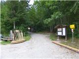 2
2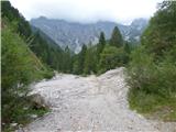 3
3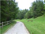 4
4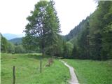 5
5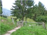 6
6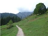 7
7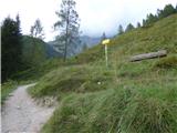 8
8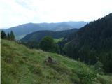 9
9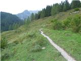 10
10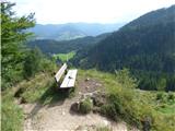 11
11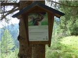 12
12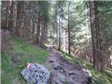 13
13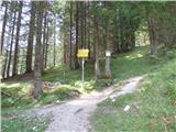 14
14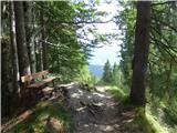 15
15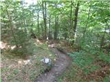 16
16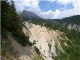 17
17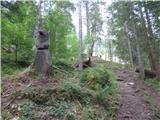 18
18 19
19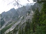 20
20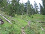 21
21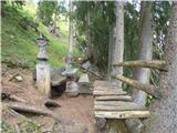 22
22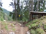 23
23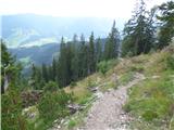 24
24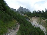 25
25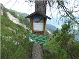 26
26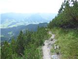 27
27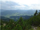 28
28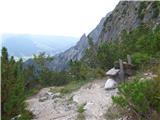 29
29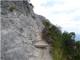 30
30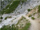 31
31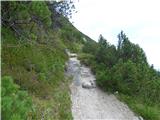 32
32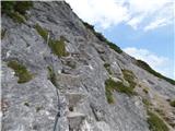 33
33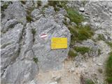 34
34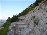 35
35 36
36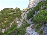 37
37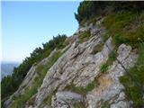 38
38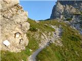 39
39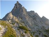 40
40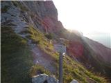 41
41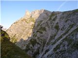 42
42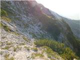 43
43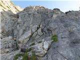 44
44 45
45 46
46 47
47 48
48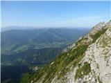 49
49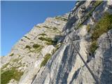 50
50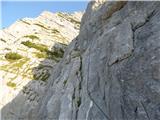 51
51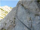 52
52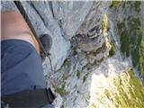 53
53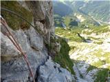 54
54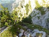 55
55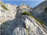 56
56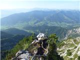 57
57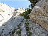 58
58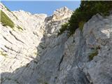 59
59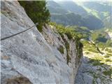 60
60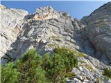 61
61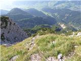 62
62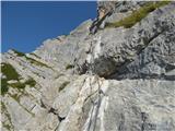 63
63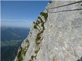 64
64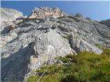 65
65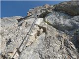 66
66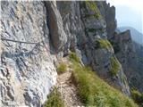 67
67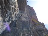 68
68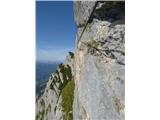 69
69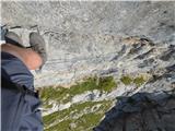 70
70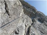 71
71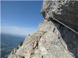 72
72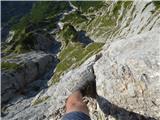 73
73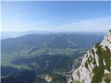 74
74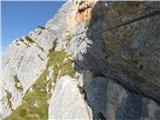 75
75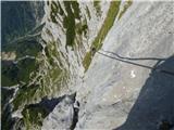 76
76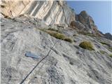 77
77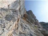 78
78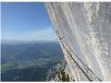 79
79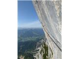 80
80 81
81 82
82 83
83 84
84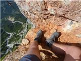 85
85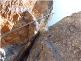 86
86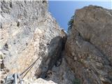 87
87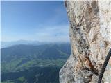 88
88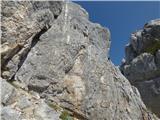 89
89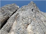 90
90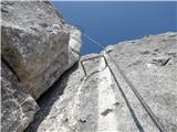 91
91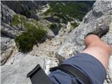 92
92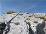 93
93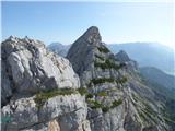 94
94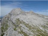 95
95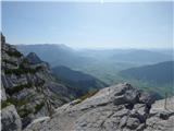 96
96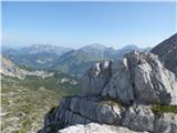 97
97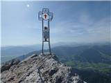 98
98
Discussion about the trail Ullachtal - Westliche Mitterspitze (Leoganger Süd Klettersteig)