Ukanc - Planinska koča Merjasec (via Žagarjev graben)
Starting point: Ukanc (570 m)
| Lat/Lon: | 46,2758°N 13,8358°E |
| |
Name of path: via Žagarjev graben
Time of walking: 2 h 45 min
Difficulty: easy marked way
Altitude difference: 965 m
Altitude difference po putu: 965 m
Map: TNP 1:50.000
Recommended equipment (summer):
Recommended equipment (winter): ice axe, crampons
Views: 11.120
 | 1 person likes this post |
Access to the starting point:
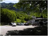
From the motorway Ljubljana - Jesenica take the exit Lesce and follow the road towards Bled, Bohinjska Bistrica, Ribčev Laz and the Vogel ski resort. Park in the large parking lot at the bottom station of the lift to Vogel.
Path description:
Below the lower cable car station at Vogel, a forest road (ski slope in winter) is seen, which starts to climb moderately westwards. The path continues for some time climbing gently to moderately, then leads us out of the forest to a scenic slope from where we have a beautiful view of Komarčo, Pršivec and Lake Bohinj.
After this, the road starts to turn more and more to the left and becomes steeper and steeper. Higher up, we continue along a relatively steep ski slope, which is constantly being guided by a poorer and rough transport and rescue road. After a while, the road or ski slope is transiently laid, and then it climbs steeply again and leads us to a marked crossroads, where we continue to the left in the direction of the Ski Hotel on the Vogel (straight to the lower station of the double-seater Last Vogel).
Just a little further on we reach the next crossroads, where we again continue left (right mountain pasture Posledni Vogel), and we follow the increasingly steep transport-rescue road to the Vogel plateau. Here we continue to the left and in a few minutes we walk up a steep ascent to the Merjasec mountain hut.

Pictures:
 1
1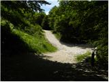 2
2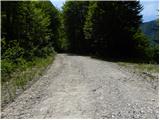 3
3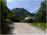 4
4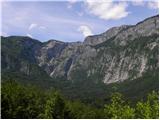 5
5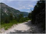 6
6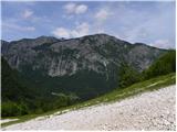 7
7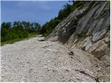 8
8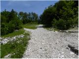 9
9 10
10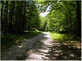 11
11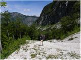 12
12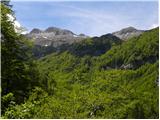 13
13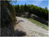 14
14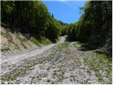 15
15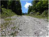 16
16 17
17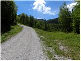 18
18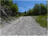 19
19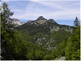 20
20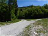 21
21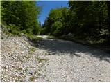 22
22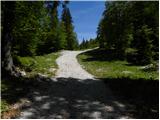 23
23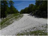 24
24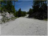 25
25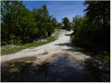 26
26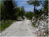 27
27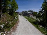 28
28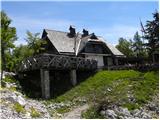 29
29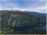 30
30
Discussion about the trail Ukanc - Planinska koča Merjasec (via Žagarjev graben)
|
| Enka7. 08. 2016 |
Enolična in za hojo zoprna pot (grušč).
|
|
|
|
| ejas123411. 08. 2024 20:03:33 |
Danes sem po tej poti sestopila
Od koče Merjasec do spodnje postaje nihalke za na Vogel. Rabila sem eno uro in petintrideset minut
Je pa ne priporočam zelo veliko grušča po strmih delih je prau neprijetno.
Lp
|
|
|