Turracher Höhe - Schoberriegel
Starting point: Turracher Höhe (1795 m)
| Lat/Lon: | 46,9147°N 13,875°E |
| |
Time of walking: 1 h 20 min
Difficulty: easy marked way
Altitude difference: 413 m
Altitude difference po putu: 430 m
Map:
Recommended equipment (summer):
Recommended equipment (winter): ice axe, crampons
Views: 4.913
 | 2 people like this post |
Access to the starting point:
From Austrian Carinthia: first drive to Feldkirchen, then follow the well-marked road to the Turracher Höhe pass.
From Styria and Salzburger Land, drive into the Mura/Mur valley and follow the road to Predlitz (located to the west of Murau). In Predlitz, leave the main road and continue towards the Turracher Höhe mountain pass.
Path description:
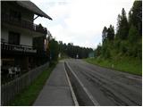
From the parking lot, first cross the main road and then take the narrow asphalt road that branches off at the "Elizabeth" guesthouse. The road first descends slightly past the car parks and then turns slightly to the right. Follow the signs for Schoberriegel. The tarmac then ends and we continue to follow the macadam road, which leads us to a junction with signs. Continue in the direction of Schoberriegel, Eisenhut. The deteriorating road leads us to hut Sonnalmhütte, which is located next to the ski resort.
From the hut, continue along the road following the signs for Eisenhut. After a few bends, when you reach the top station of the cable car, leave the road and turn right onto the footpath. The path initially passes through a sparse forest and occasionally offers a beautiful view of Lake Turrachsee, which is located on the Turracher Höhe mountain pass. When you reach the ridge, the path turns slightly to the left and the last trees slowly disappear. The path then continues along the ridge and leads to the grassy summit of the Schoberriegel.

Pictures:
 1
1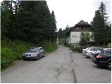 2
2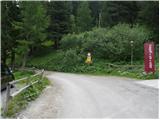 3
3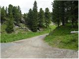 4
4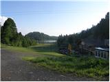 5
5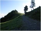 6
6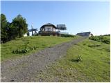 7
7 8
8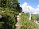 9
9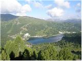 10
10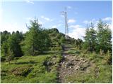 11
11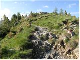 12
12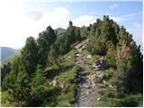 13
13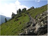 14
14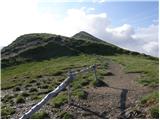 15
15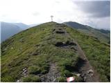 16
16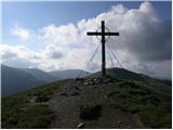 17
17
Discussion about the trail Turracher Höhe - Schoberriegel
|
| švedrc20. 12. 2010 |
Ker je v soboto ponoči snežilo, sem si nataknil škrplje in naredil gaz na Schoberriegel. Na izhodišču je kazal termometer -12°. Snega je kar dosti, samo na vrhu ga je veter zapihal.
|
|
|
|
| švedrc21. 12. 2010 |
popravljam...napisati sem hotel krplje
lp
|
|
|