Turracher Höhe - Rinsennock (southern way)
Starting point: Turracher Höhe (1795 m)
| Lat/Lon: | 46,9147°N 13,875°E |
| |
Name of path: southern way
Time of walking: 1 h 45 min
Difficulty: easy marked way
Altitude difference: 539 m
Altitude difference po putu: 539 m
Map:
Recommended equipment (summer):
Recommended equipment (winter): ice axe, crampons
Views: 3.408
 | 1 person likes this post |
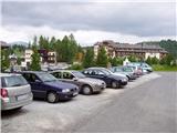
Access to the starting point:
From Austrian Carinthia: first drive to Feldkirchen, then follow the well-marked road to the Turracher Höhe pass.
From Styria and Salzburger Land, drive into the Mura/Mur valley and follow the road to Predlitz (located to the west of Murau). In Predlitz, leave the main road and continue towards the Turracher Höhe mountain pass.
Path description:
From the parking lot at Turracher Höhu, follow the path towards the Kornock and Rinsennock summits. After a few minutes' walk along the road, you will reach a crossroads in the immediate vicinity of the summer toboggan run. At the crossroads there are mountain signs saying Kornock and Rinsennock to the left and right (possible circular route). If you decide to climb the slightly more southerly route, continue left and then immediately right over the pasture fence onto the footpath. Further on, a path that climbs moderately through the forest leads to an area where a sign warns you that you are entering an area of falling rocks. The path ahead leads past a small spring and the aforementioned avalanche area. After this, the path starts to climb steeply and quickly leads us to a bench, which is just calling out for us to sit down and look around the surroundings.
Next, the path leads us to a flatter area, the partly abandoned mountain pasture, in the middle of which we see a dilapidated shepherd's hut. Just before the hut, turn left, cross the stream and climb up the bush-covered path. After a few minutes' cross-climb, you will emerge from the scrub onto a wide grassy slope, which continues for some time on a rather steep ascent. Soon, however, the path begins to climb steeply, turns right and leads us to the top slope of the mountain. Follow this scenic and not too steep ridge path all the way to the grassy summit.

Pictures:
 1
1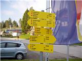 2
2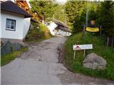 3
3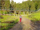 4
4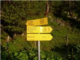 5
5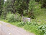 6
6 7
7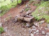 8
8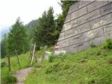 9
9 10
10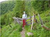 11
11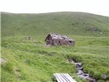 12
12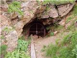 13
13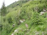 14
14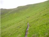 15
15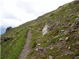 16
16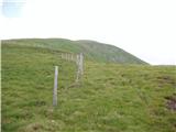 17
17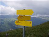 18
18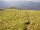 19
19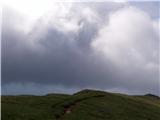 20
20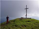 21
21
Discussion about the trail Turracher Höhe - Rinsennock (southern way)
|
| felix2. 08. 2022 18:49:13 |
Potrebno je opozoriti, da je v bližini opuščenega rudnika razpotje, ki pa ni označeno. Levo pelje pot, ki je v tem opisu, desno pa pelje tako imenovana "Barbaraweg" na Kornock. Ker so oznake za to pot bolj vidne, nas tu v primeru nepazljivosti lahko zavede.
|
|
|