Turracher Höhe - Kornock (northern way)
Starting point: Turracher Höhe (1795 m)
| Lat/Lon: | 46,9147°N 13,875°E |
| |
Name of path: northern way
Time of walking: 1 h 15 min
Difficulty: easy marked way
Altitude difference: 398 m
Altitude difference po putu: 398 m
Map:
Recommended equipment (summer):
Recommended equipment (winter):
Views: 3.296
 | 1 person likes this post |
Access to the starting point:
From Austrian Carinthia: first drive to Feldkirchen, then follow the well-marked road to the Turracher Höhe pass.
From Styria and Salzburger Land, drive into the Mura/Mur valley and follow the road to Predlitz (located to the west of Murau). In Predlitz, leave the main road and continue towards the Turracher Höhe mountain pass.
Path description:
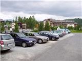
From the parking lot at Turracher Höhu, follow the path towards the Kornock and Rinsennock summits. After a few minutes' walk along the road, you will reach a crossroads in the immediate vicinity of the summer toboggan run. At the crossroads there are mountain signs saying Kornock and Rinsennock left and right (possible circular route). If you decide to take the slightly more northerly route, continue right along the road, which crosses the toboggan run via an underpass and then turns left uphill. A gently ascending road soon leads out of the woods and into open grazing land. Further on, the road slowly turns into an increasingly steep cart track, which leads us higher up to the next crossroads on the route. Continue right again (climbing to the top is also possible on the left) and follow cart track, which climbs over grassy slopes, to a concrete building (a transformer) on which you can see the markings from a distance. The path then turns slightly to the left and after a short climb leads to the top of the slope of Kornock. Then climb up the grassy slope to the top of the hill, in the middle of which you can see the upper station of the cable car. After the cable car, the path narrows and leads to information boards at the top.

Pictures:
 1
1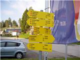 2
2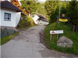 3
3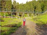 4
4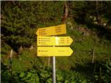 5
5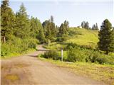 6
6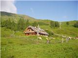 7
7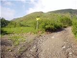 8
8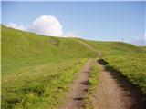 9
9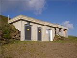 10
10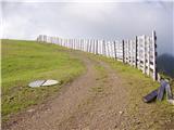 11
11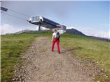 12
12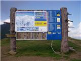 13
13
Discussion about the trail Turracher Höhe - Kornock (northern way)