Tremerje - Malič (on eastern ridge of Malič)
Starting point: Tremerje (231 m)
| Lat/Lon: | 46,19538°N 15,23067°E |
| |
Name of path: on eastern ridge of Malič
Time of walking: 1 h 40 min
Difficulty: easy marked way, easy unmarked way
Altitude difference: 705 m
Altitude difference po putu: 729 m
Map: Celjska kotlina, 1:50000
Recommended equipment (summer):
Recommended equipment (winter):
Views: 2.990
 | 1 person likes this post |
Access to the starting point:
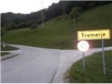
Tremerje is a settlement between Celjem and Laško. From the route of Celje, on the way to Laško, before the Hochkraut Inn, turn right at the crossroads towards Tremerjem. In the opposite direction of the turn at the junction is a bridge over the Savinja, where the central wastewater treatment plant Celje, financed by European funds, is located on the other side of the Savinja, as shown on the notice board. From the route of Laško, turn left at this junction. Immediately after the turn, the settlement is marked with a sign "Tremerje". Continue along the main road to the left turn, then straight on through the settlement for about 1 km southwards until you reach a large parking lot on the left hand side just next to the railway. Near the parking lot, on the opposite side of the road, there is a sign for Žerdoner's mountain trail to "Veliki Slomnik". Even otherwise, it is no longer viable to continue the route by car, as the flat part of the road ends about 300 metres further on, and there used to be an underpass Tremerje, which has been flooded several times.
Path description:
From the parking place, follow the asphalt road southwards towards Laško for about 300 metres, until you reach the former famous underpass Tremerje, which years ago was "paralysing and nerve-wracking", mainly because of frequent floods and too narrow a passage. Before the underpass, bypass the farmhouse around its left flank or turn right up the asphalt road to the west. At first, between the isolated farmhouses, follow the tarmac road, the markings and the signs for 'Šmohor', then the tarmac and gravel alternate. Before the Rutar homestead, continue along the main road, which goes straight ahead and then flattens out. A few 10 metres further on there is a major road crossroads. Straight ahead on the road is a marked path towards Šmohor, and we continue sharp left on an unmarked road or cart track, bypassing the Rutar homestead and following the path towards the Raven homestead. Walk uphill in a south-easterly direction for about 1 km until you reach an asphalt road. Follow the signs to the left down the asphalt road slightly, and after 300 metres the signs point us off the road to the right back into the forest. Continue along the cart track towards the Zamalič (or Malšek) homestead. After 600 metres of walking, you will emerge from the forest, where you will find a pleasant meadow, a children's hunting observatory (a forest house) and a fork in the trail below the homestead. Follow the signpost for "TOP" and "thank you for walking along the path" and bypass the homestead. At the top of the clearing at the edge of the forest, we are greeted by beautiful views of the surrounding hills and a cosy little house for chopsticks. We re-enter the forest, where the undulating path along the serpentines, mainly in a north-north-easterly direction, leads us to the eastern ridge of Malič. Here, turn sharp left in a westerly direction and climb the ridge, where the steepness and difficulty of the path increase a little. Up the ridge we can still see the old markings from the 70s, and to the left towards Laško, initially shy views open up. At a height of 802 metres, we are surprised by a beautiful viewpoint with a table and a bench. The view extends eastwards over the entire surrounding hills above the Savinja. We continue along the ridge, where the steepness begins to subside. A few minutes more, and we are at the top of Malič, which is unfortunately not overlooked, but we are greeted by a rather large telecommunications tower. It is about 5 km from the starting point. The summit stamp is located in the Šmohor Mountain Lodge.

Pictures:
 1
1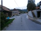 2
2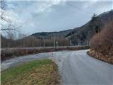 3
3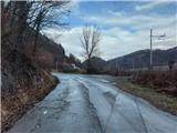 4
4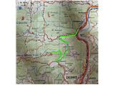 5
5 6
6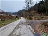 7
7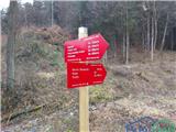 8
8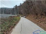 9
9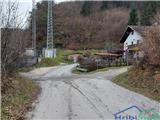 10
10 11
11 12
12 13
13 14
14 15
15 16
16 17
17 18
18 19
19 20
20 21
21 22
22 23
23 24
24 25
25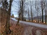 26
26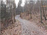 27
27 28
28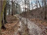 29
29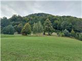 30
30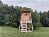 31
31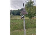 32
32 33
33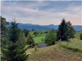 34
34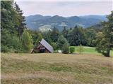 35
35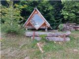 36
36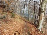 37
37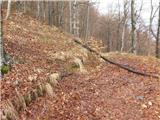 38
38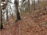 39
39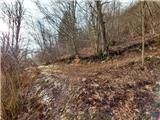 40
40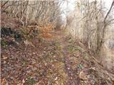 41
41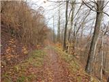 42
42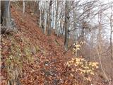 43
43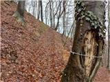 44
44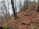 45
45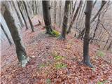 46
46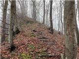 47
47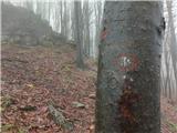 48
48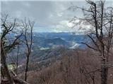 49
49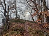 50
50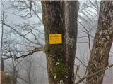 51
51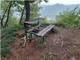 52
52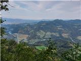 53
53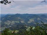 54
54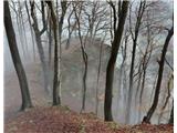 55
55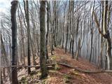 56
56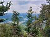 57
57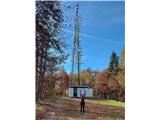 58
58
Discussion about the trail Tremerje - Malič (on eastern ridge of Malič)