Starting point: Topol (783 m)
| Lat/Lon: | 45,7545°N 14,5437°E |
| |
Time of walking: 15 min
Difficulty: easy unmarked way
Altitude difference: 65 m
Altitude difference po putu: 65 m
Map: Snežnik 1:50.000
Recommended equipment (summer):
Recommended equipment (winter):
Views: 2.443
 | 1 person likes this post |
Access to the starting point:
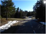
a) From the Ljubljana - Koper motorway, take the Unec exit, then follow the road in the direction of Cerknica and further in the direction of Bloška Polica and Nova vas. From Nová vas, continue on the main road towards Sodražica, and follow it to the nearby junction where a slightly narrower road branches off to the right towards Studeno na Blokah and the settlement Hrib - Loški Potok. We continue through Studeno na Blokah, after which we soon reach a crossroads where the road to Ravne na Blokah branches off to the left, the road to Hrib - Loški Potok continues straight ahead, and the road to Topol branches off to the right. Park in a suitable place near the junction.
b) From the road Ljubljana - Kočevje, at Žlebič, take the road towards Sodražica. From Sodražica continue on the main road towards Nová vas na Blokah, and we follow the road to the settlement Runarsko, or the crossroads a few 100 metres beyond the end of the town. From this junction, take a sharp left in the direction of Studeno na Blokah and the settlement Hrib - Loški Potok. Continue through Studeno na Blokah, after which you will soon reach a crossroads where the road to the village of Ravne na Blokah branches off to the left, the road continues straight on towards the settlement of Hrib - Loški Potok, and the road to the village of Topol branches off to the right. Park in a suitable place near the junction.
Path description:
From where you parked, first walk to the nearby cross, and from there follow cart track, which begins to climb northwards, and which immediately leads you to open pastures (during the grazing season, crossing the grazing fence is forbidden, in which case you must walk around the left side of the pasture and return to cart track). Continue up the relatively undulating cart track, which climbs over a grassy slope that becomes increasingly more scenic. Higher up, cart track turns slightly more to the right and climbs almost to the ridge, which it does not reach, continuing to the left of it. A little further on, cart track gradually ends, but ruts are still visible across the grassy slope overlooking the ridge. A few minutes of easy walking later, and we reach the top of the 848-metre-high Belovka, the summit of which can be identified by a small brick building.
Pictures:
 1
1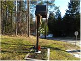 2
2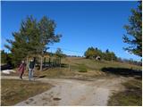 3
3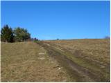 4
4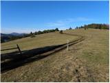 5
5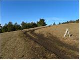 6
6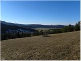 7
7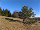 8
8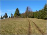 9
9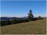 10
10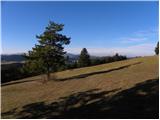 11
11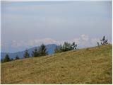 12
12 13
13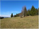 14
14 15
15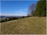 16
16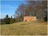 17
17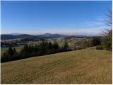 18
18
Discussion about the trail Topol - Belovka
|
| grega_p26. 04. 2021 12:34:23 |
Zidanega objekta ni več, namesto njega je tam zdaj kontejner.
Drugače pa lepi razgledi - Snežnik še zmeraj opravičuje svoje ime.
|
|
|
|
| rokeg25. 02. 2023 08:59:41 |
Zidani objekt je še gor. Gre za dva vršička. Na prvem je ta zidani objekt, na drugem pa kontejner.
|
|
|