Sveti Ivan (Baška) - Diviška
Starting point: Sveti Ivan (Baška) (134 m)
| Lat/Lon: | 44,9731°N 14,7613°E |
| |
Time of walking: 2 h
Difficulty: easy marked way
Altitude difference: 337 m
Altitude difference po putu: 385 m
Map:
Recommended equipment (summer):
Recommended equipment (winter):
Views: 1.951
 | 2 people like this post |
Access to the starting point:
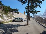
From the motorway Rupa - Rijeka / Rijeka or Zagreb - Rijeka / Rijeka, drive towards Rijeka, and from there follow the signs for Krk Island. When the motorway or expressway in the last part ends, we descend to the Krk Bridge (toll 35 kuna - March 2014) and then continue driving to Omisalj, Njivice, Malinska, Krk, Punat and Baška. After Punat, which you pass on the left, the road starts to climb steeply towards the Treskavac pass (Treskavac is a good starting point for some mountain tours, including the climb to the highest peak of Krka - Obzova (569 m)). After the pass, the road starts to descend and is quite winding, flattening out a bit only when you reach the valley. Continue on through Draga Bašćanska and Jurandvor, and then reach Baška, where signs for St Ivan's Church direct you to the left (the left fork is just a few metres further on from a large car and bus park) onto a slightly narrower road that climbs up to the parking lot in front of St Ivan's Church.
Between 9 pm and 6 am, the road leading from Baška to St Ivan is closed to public traffic.
Path description:
At the end of the parking lot, the road turns sharp left (straight over the fence to reach the cemetery and St Ivan's Church, from where there is a beautiful view of Baška and the sea) and after a few 10 metres leads to a place where you cross a pasture fence.
Beyond the fence, a minor road continues to the right, leading to the upper part of the cemetery, while we continue straight on along the mulatier, which climbs moderately through a pleasant pine forest, which provides shade on hot days. Along the path, which climbs gently to moderately, there are several benches where we can rest, and during the climb we often get a nice view of Baška, Senjski vrata, Prvić island, the mountain ridge west of Baška, ending with Cape Škuljica, Velebit and more. There are a few marked serpentines, and then the slopes gradually change to a more plateau-like world, where a path branches off to the right towards Strazica, which is about a 500 metre walk away, and we continue along a wider and well-maintained path. Further on, the path is quite sloping, but within a few minutes of further walking we reach the shelter and information boards at Planina Mjesec / mountain pasture Mjesec.
From Planina Mjesec we continue in the direction of Kalić - Lokva, Hlam and Lokva Diviška, following the path that immediately crosses the stone fence and leads us out of the forest into the rocky expanse. We continue straight for a short time, then the path splits into two parts, and we take the right path (Hlam on the left).
From the crossroads, first descend slightly and then follow the path to the nearby dirt track or stone road, which you follow to the left. Follow the road around the top of Hlam on the right and follow the waymarked trail at the crossroads or junctions. The route continues for some time along a winding road, which has some ascents and descents, and there are several watering places for animals, especially sheep grazing here, and a number of stone fences, mostly marking property boundaries. As the road gets a little worse, look out for a marked path branching off the road and turning slightly to the left. Once off the road, the path becomes rather monotonous terrain, where you have to follow carefully, in parts, the sparse markings. The trail, which is quite difficult in terms of orientation, slowly begins to climb moderately and turns slightly to the left. Later, the path is completely laid and leads us to a larger watering point, behind which it climbs more steeply along a stone fence, which we cross at a higher level, and then in a few steps we climb to the scenic peak of Diviška. The uniformity of the terrain makes orientation difficult and, in fog, virtually impossible without a compass or navigation device.

Pictures:
 1
1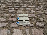 2
2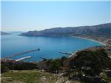 3
3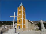 4
4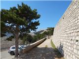 5
5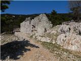 6
6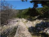 7
7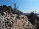 8
8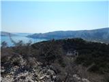 9
9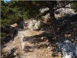 10
10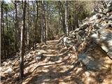 11
11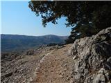 12
12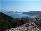 13
13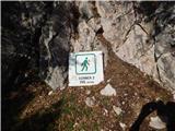 14
14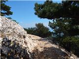 15
15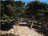 16
16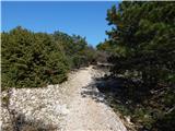 17
17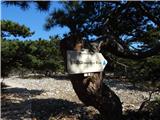 18
18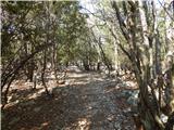 19
19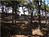 20
20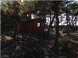 21
21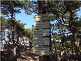 22
22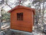 23
23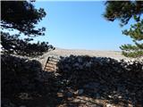 24
24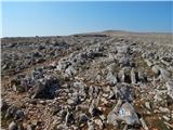 25
25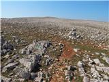 26
26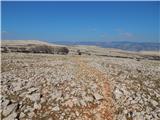 27
27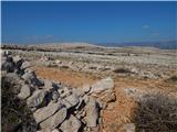 28
28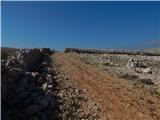 29
29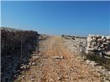 30
30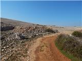 31
31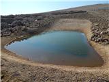 32
32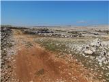 33
33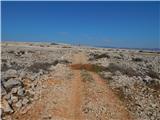 34
34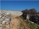 35
35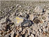 36
36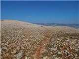 37
37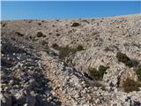 38
38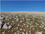 39
39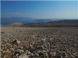 40
40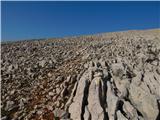 41
41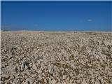 42
42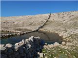 43
43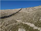 44
44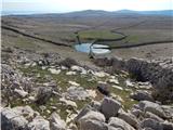 45
45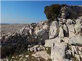 46
46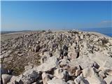 47
47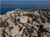 48
48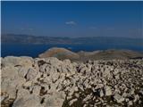 49
49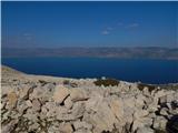 50
50
Discussion about the trail Sveti Ivan (Baška) - Diviška