Starting point: Sveta Trojica (527 m)
| Lat/Lon: | 46,1188°N 14,6805°E |
| |
Time of walking: 45 min
Difficulty: easy marked way
Altitude difference: 216 m
Altitude difference po putu: 216 m
Map:
Recommended equipment (summer):
Recommended equipment (winter):
Views: 17.233
 | 1 person likes this post |
Access to the starting point:
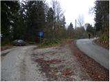
a) From the motorway Ljubljana - Maribor, take the exit Domžale, then turn left towards Gorjuša. When you arrive at Gorjuša, turn right at a non-priority junction in the direction of Svete Trojice, which is approximately 6 km away. Continue through the villages of Spodnje Brezovo, Žeje and Sveta Trojica. Through Sveta Trojica, follow the signs for Murovica, and we follow a slightly narrower road almost to the end of the village, where we park at a small crossroads and by a sign.
b) From the motorway Maribor - Ljubljana, take the exit Krtina, and then continue in the direction of Moravce. At the end of Krtina, more precisely at Brezje pri Dobu, leave the main road and turn right towards Gorjuša and Sveti Trojici. Just after a few houses, the road splits into two parts, and we take the left, which leads us through the lane of a forest, and then across the Raško polje to the village of Rača and Račni Vrh. Just after Račni Vrh, we join the road from Gorjuša, which we follow to the left, and we follow it almost to the end of the village of Sveta Trojica, where we park at a small crossroads and by a sign.
Path description:
From the crossroads at the sign, continue along the upper right and continue on the asphalted road, which climbs moderately through the forest. Soon you will reach a small crossroads, where a path branches off sharply to the right towards the ruins of the nearby castle and the castle fountain. Continue straight ahead and follow the road leading out of the forest to a hamlet of a few cottages, where there is also a small parking lot and mountain direction signs.
From the signposts, continue along the marked mountain path in the direction of Murovica and Ciclja. The way forward initially continues along the fence, and then gradually passes into a dense forest, through which it mostly climbs moderately. Higher up, the path turns slightly to the right, and we are joined on the left by a waymarked path from the village of Zgornja Javoršica. Continue straight ahead and after two minutes of further walking you will reach the top of Murovica, where there are several wooden benches.

We can extend the trip to the following destinations: Cicelj (1 h)
Pictures:
 1
1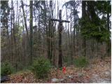 2
2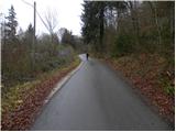 3
3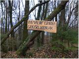 4
4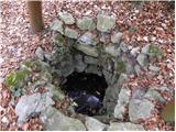 5
5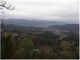 6
6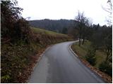 7
7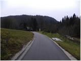 8
8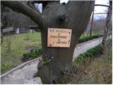 9
9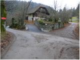 10
10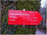 11
11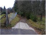 12
12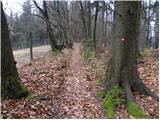 13
13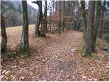 14
14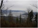 15
15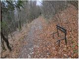 16
16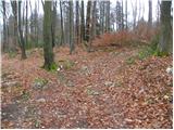 17
17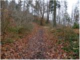 18
18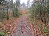 19
19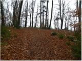 20
20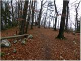 21
21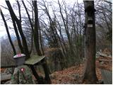 22
22 23
23
Discussion about the trail Sveta Trojica - Murovica
|
| Kokta26. 03. 2012 |
Lepa lahka pot. Ta moment na poti vse cveti  . Žig in vpisna knjiga na vrhu.
|
|
|
|
| balon15. 03. 2014 |
Pozdravljeni! Zanima me ali je pot do vrha po zledu prehodna? Hvala za odgovor.
|
|
|
|
| matic415. 03. 2014 |
Pot je praktično normalno prehodna, na poti je nekaj vej. Od Murovice proti Ciclju je na mestih malo več vejevja, vendar se vse da obiti brez problema.
|
|
|
|
| Levacic19. 08. 2024 17:24:35 |
Lahka in čudovita pot. Malo razdrta, a proti vrhu je v redu. Lep razgled
|
|
|