Štore - Hotel Celjska koča (via Resevna, Almin dom and over Tolsti vrh)
Starting point: Štore (240 m)
| Lat/Lon: | 46,2213°N 15,3215°E |
| |
Name of path: via Resevna, Almin dom and over Tolsti vrh
Time of walking: 4 h 30 min
Difficulty: easy marked way
Altitude difference: 412 m
Altitude difference po putu: 1200 m
Map: Posavsko hribovje Boč - Bohor 1:50.000
Recommended equipment (summer):
Recommended equipment (winter):
Views: 3.686
 | 2 people like this post |
Access to the starting point:
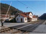
Štore ideally accessible by rail. By road. . . leave the motorway in Celje and head towards Štore or Šentjur, practically in the centre of Celje. Park your car near the Štore railway station, where there are plenty of parking spaces and also the start of a marked mountain trail.
Path description:
The route starts at the railway station in Štore. Go via Voglajna, where a direction sign immediately directs you to the left a few tens of metres up the hill. Turn left at the first building and follow the mountain path through the forest directly above Voglajna. On leaving the forest in the village of Draga, follow the meadow path also directly above Voglajna and continue along the asphalt road to the bridge over the river Voglajna, or the crossroads called Opoka. To the left over the bridge is the trail to Dramlje, Konjiška gora. . . , to the right along a narrow forest road through Kompole and Šentjanž higher up into the world of the hills above Štorá and Celje, and we continue straight on along the asphalt road and after a few hundred metres pass through the settlement of Prožinska vas and turn slightly to the left some three times in succession. Of course, the route is properly marked, marked and easy to follow. Then we move on to cart track, which after a few hundred metres leads us slightly downhill to a stream, which after a few hundred metres we cross with the help of a small bridge, continue alongside a water supply facility, a small water spring where we can take a drink and a wooden cross. Shortly after the cross, move away from the water and continue higher up by a trestle and through the courtyard of the homestead. After the homestead, slightly steeper uphill partly on the road and further along a meadow path, where you soon cross a forest road. With the help of a few metres of steel ropes, continue higher up the pleasant forest path and soon the path from Šentjur joins from the left.
Continue along a slightly wider forest path below the only farmhouse in this part of the area and continue slightly right through the forest, where after a few hundred metres you reach an asphalt road leading higher up. Continue following the asphalt road and after a few hundred metres a steep path from Šentjur joins from the left.
Continue on the asphalt surface and, with the help of wooden steps, onto the meadow plain, where, by the NOB monument, turn right onto the forest/wooded road to the Resevna mountain lodge and soon reach the lodge.
From the house, of course, extend a few steps higher to a modern lookout tower from which you continue immediately down the marked mountain path. After descending in the wooded area, we descend to the open field next to the homestead, two. Signposts direct us further in the direction of Svetina and we continue along the upper forest road straight ahead again in a more thorough embrace of the forest. Follow the well-marked forest road and continue alongside the monument to the Celje detachment, which is to the left of the path slightly right up a narrower forest path, partly also logging trail. Soon you reach a slightly larger hunting lodge and, after a short distance, the somewhere undistinguished peak of Resje above Štorá. A few metres below the summit, the monument to the founding of the Celje troops is again on the homestead, which is a few tens of metres below the summit. There are also possible views somewhere to the south and west. From Resje, descend down the asphalt road and reach the wider asphalt road in Slemena by two farmsteads. Continue right along the asphalt road for a few hundred metres and at the marked crossroads, turn right again into the forest along the forest mountain path. On leaving the forest, return to the asphalt surface and go slightly uphill through the central part of the village of Javornik. Continue through the area called Mrzla Mountain pasture, somewhere near five or six homesteads you will soon reach the road Štore - Svetina and continue along it for about two hundred metres. At a marked crossroads, turn right off the asphalt road and up a narrow forest track. Soon you reach a well-kept cottage with a beehive and continue in the slightly more compacted forest higher up, reaching the Dobošek crossroads on reaching a grassy pasture under a sadly abandoned farmstead. Continue slightly uphill, downhill to Kompole or Štore via Šentjanž and turn right at the chapel up the asphalt road. Soon reach the Vrunčev dom (Vrunčev dom) a little to the right of the trail and continue onwards on weekends back on the forest mountain trail. After an easy short descent, the mountain trail from Štor over Žlajfa joins from the right, as does the trail over Bojanski graben. Continue a few hundred metres further along the rugged forest path and you will reach Ramanka or Almin dom na Svetini, which is unfortunately closed (the information about the closed home is from the beginning of 2014, but the home has been closed for a long time).
From Alma's home, continue along the marked mountain trail to Tolsti vrh, which is reached from the east side.
From Tolsti vrh, descend along the western path to the top of the ski slope/ski facilities. Continue through the forest on a narrower forest path to a fork, where you turn right towards Hotel Celjska koča (to the left Laško). The path is again a bit wider and before the hunting lodge you go left downhill, along the artificial lake behind the ski resort and after three or four bends on a narrower path in a conifer-rich forest, you descend to the road, from where it is a few steps to your destination, the Celjska hut.
The total length of the trail from Štora is about 16. 50 kilometres, 1200 positive vertical metres and 670 negative vertical metres.

Pictures:
 1
1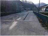 2
2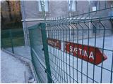 3
3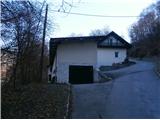 4
4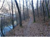 5
5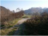 6
6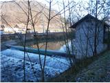 7
7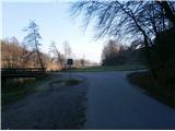 8
8 9
9 10
10 11
11 12
12 13
13 14
14 15
15 16
16 17
17 18
18 19
19 20
20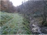 21
21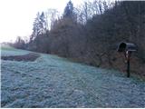 22
22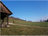 23
23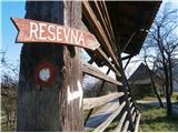 24
24 25
25 26
26 27
27 28
28 29
29 30
30 31
31 32
32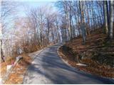 33
33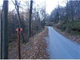 34
34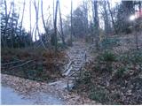 35
35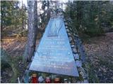 36
36 37
37 38
38 39
39 40
40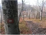 41
41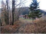 42
42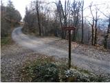 43
43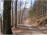 44
44 45
45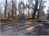 46
46 47
47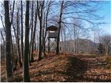 48
48 49
49 50
50 51
51 52
52 53
53 54
54 55
55 56
56 57
57 58
58 59
59 60
60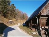 61
61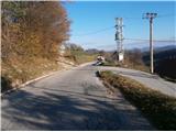 62
62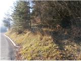 63
63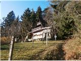 64
64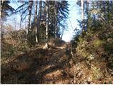 65
65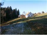 66
66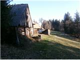 67
67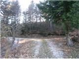 68
68 69
69 70
70 71
71 72
72 73
73 74
74 75
75 76
76 77
77 78
78 79
79 80
80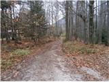 81
81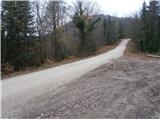 82
82 83
83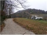 84
84 85
85 86
86 87
87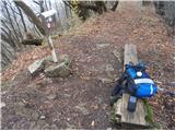 88
88 89
89 90
90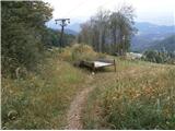 91
91 92
92 93
93 94
94 95
95 96
96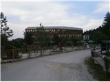 97
97
Discussion about the trail Štore - Hotel Celjska koča (via Resevna, Almin dom and over Tolsti vrh)