Stara Fužina - Pršivec (direct way)
Starting point: Stara Fužina (600 m)
| Lat/Lon: | 46,2903°N 13,8868°E |
| |
Name of path: direct way
Time of walking: 3 h 45 min
Difficulty: easy marked way
Altitude difference: 1161 m
Altitude difference po putu: 1161 m
Map: Triglav 1:25.000
Recommended equipment (summer):
Recommended equipment (winter): ice axe, crampons
Views: 23.542
 | 2 people like this post |
Access to the starting point:
From the Ljubljana - Jesenice motorway, take the Lesce exit and follow the road towards Bled and on to Bohinjska Bistrica. Continue towards Bohinjsko jezero (Ribčev laz), at which you will come to a crossroads where you will turn right towards Stara Fužina. At Stara Fužina, at the crossroads by the chapel, turn sharp left onto the ascending road towards mountain pasture Blato, mountain pasture Vogar and the Voja valley. Follow this road to the parking lot where tolls and parking fees are collected.
Path description:
From the parking lot, continue along the asphalt road, which continues towards mountain pasture Blato, mountain pasture Vogar and the Voje valley. The road, at first relatively steep, quickly becomes steeper and then leads to a signpost marking a crossroads.
At the sign, leave the asphalt road and continue to the left in the direction of Vogar and Pršivec. The path first crosses a scenic pasture and then passes into the forest, through which it climbs on the stone cart track. In a few long serpentines, the path ascends a step higher, where it becomes a little more level. Just a little further on, we see the signs for the NOB monument, which is situated next to a nice lookout point and a paragliding take-off point, from which we have a nice view of Bohinjsko jezero, Rudnica and the Lower Bohinj Mountains.
From the viewpoint we return to the marked path, which quickly leads us to the eastern edge of mountain pasture Spodnji Vogar. The way forward is mostly a gentle climb through meadows, and we see a large number of former shepherd's huts along the way, which are now mainly converted into cottages. Follow this path, which continues to climb gently, to Kosijev dom na Vogarju, which is reached after a few minutes of further walking.
Here, continue along the cart track in the direction of Pršivec. Cart track leads us in a few minutes to a crossroads, where we turn left to the lower cart track. Follow this cart track further into the forest, where you continue on the direction Pršivec. As cart track has a few forks, be careful not to miss the markings towards Pršivec. Cart track is mostly just crossing the slopes in a gentle ascent and rarely climbs steeper. Cart track then leads us to a crossroads where the path from the end of the road to Vogar joins from the right.
Continue straight ahead on cart track, which continues to climb moderately, only occasionally a little more steeply. A little higher up, cart track turns into a very steep footpath in places, mostly climbing through a dense spruce forest. Higher up, the forest becomes thinner and thinner, and the spruces are more and more often joined by larch trees, which in autumn enchant almost every mountaineer with their colours.
The steep path continues and gradually passes to a scenic ridge which is then climbed. In wet conditions and snow there is a risk of slipping. The path, which offers us beautiful views of the Lower Bohinj Mountains and the central Julijce, however, is slightly laid and quickly leads us between individual trees to a scenic peak.
Starting point - Vogar 1:15, Vogar - end of the road 1:00, end of the road - Pršivec 1:30.

Pictures:
 1
1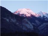 2
2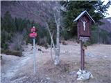 3
3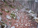 4
4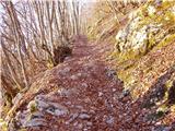 5
5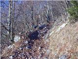 6
6 7
7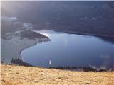 8
8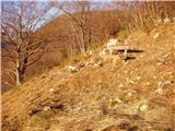 9
9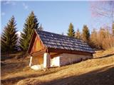 10
10 11
11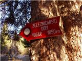 12
12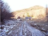 13
13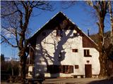 14
14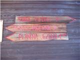 15
15 16
16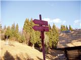 17
17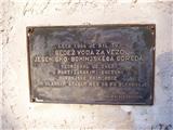 18
18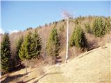 19
19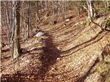 20
20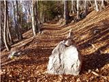 21
21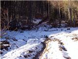 22
22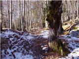 23
23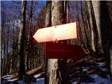 24
24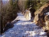 25
25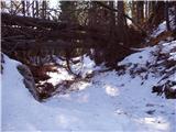 26
26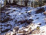 27
27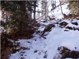 28
28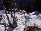 29
29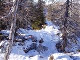 30
30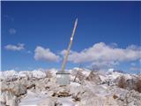 31
31 32
32
Discussion about the trail Stara Fužina - Pršivec (direct way)
|
| Sa8a15. 04. 2018 |
14.4.18 Gozna pot tezje prehodna zaradi podrtih dreves in taljenja snega.sla sem prvic po tej poti, zato je blo kar tezko slediti markacijam zaradi zametov in podrtih dreves.Pot drugace nezahtevna in na zalost brez vmesnih razgledov  
|
|
|