Starting point: Srnjak (955 m)
| Lat/Lon: | 46,4942°N 13,7847°E |
| |
Time of walking: 2 h 45 min
Difficulty: easy unmarked way
Altitude difference: 782 m
Altitude difference po putu: 870 m
Map: Kranjska Gora 1:30.000
Recommended equipment (summer):
Recommended equipment (winter): ice axe, crampons
Views: 8.911
 | 1 person likes this post |
Access to the starting point:
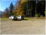
From the motorway Ljubljana - Jesenice, take the exit Jesenice - west (Hrušica), then continue in the direction of Kranjska Gora. In Kranjska Gora, at the crossroads where the road to the pass Vršič branches off to the left, continue straight on, and we will pay attention after the end of the place, because on the right side of the road we will notice signs for the inn Srnjak, which will direct us to the right over the bridge over the river Sava Dolinka. On the other side of the river, follow the signs for Inn Srnjak, which is reached after about 2 km of driving on a steep, mostly dirt road. Park in the large gravel parking lot near the Srnjak Inn.
Path description:
From the parking lot of the Srnjak Inn, take the wide cart track, which goes into the forest and starts to climb steeply. Cart track soon turns to the left and then climbs cross-country over occasionally steeper slopes. At a higher level cart track turns right and splits into two parts. Continue sharp left (the right-hand cart track leads to a nearby animal feeding station) along the partly muddy cart track, which leads through a condensed lane of spruce forest. When the forest thins out a little, a hunting trail branches off to the right, which leads through the dense forest and up a considerable slope to the Brvog hunting lodge, or you can continue on the cart track, which climbs transversely through the forest. The latter soon approaches the bed of the Sravnica stream, where it then turns sharp right and lays completely flat. A few minutes of easy walking follows and the path leads to a point slightly above the aforementioned Brvog hunting lodge.
At the hunting lodge, the two paths merge and lead us to a worse forest road, which we walk along in a few minutes to the junction with the cross road Korensko sedlo - Železnica.
Follow the road to the right, but walk along it for only a few steps, and then on the left you will see the wide and usually quite muddy cart track, which begins to climb along and along the north-west ridge of the Nizka Bavha. Higher up, cart track turns to the right, and we find an old hunting track which continues along the ridge mentioned above. We follow this path, which is harder to follow in a few places (especially where there are a lot of fallen trees and some cart track), in roughly the same direction all the time. Higher up, i. e. at about 1500 m, cross the forest road again. The ascent continues along the less favourable cart track, which turns to the right and leads out of the forest onto a larger and very scenic clearing. Here the cart track gradually ends, and we continue our ascent along an easier transitional trackless path, which leads to the main ridge, where we again reach a nice traceable path.
The main ridge Karawanks will most likely be reached at Nizka Bavha, or a little further east, on a small saddle. Following the old graničar path, which is winding and well-traced, you will then reach the vast and grassy summit of Grpišca in a few minutes. From the top of Grpišce, we start descending towards the east, and the path from the meadow quickly leads us into the forest. We continue along the border ridge, which occasionally opens up some views. A little above the Dolič pass (the lowest point between Grpišca and Tamarča), the path splits into two parts. The left, steeper path leads directly along the border line, while the right, steeper path, retreats slightly to the right as the border ridge passes. Higher up, the two paths merge and lead us to the indistinct Tamarča peak.
From Tamarča, we continue along the border ridge, which is covered with larch forest, and the path quickly leads us out of the forest and onto the vast meadows of nearby Voška. Crossing the meadows, we first just cross the slopes to the north-east, and then climb slightly to a scenic peak, located just 10 m above the ruins of a former caravle.

Pictures:
 1
1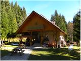 2
2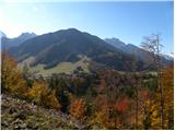 3
3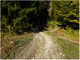 4
4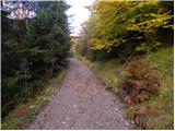 5
5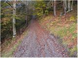 6
6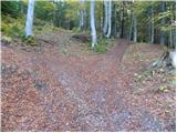 7
7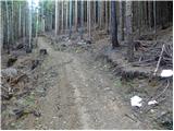 8
8 9
9 10
10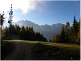 11
11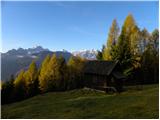 12
12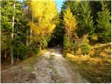 13
13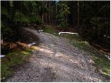 14
14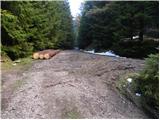 15
15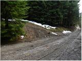 16
16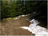 17
17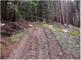 18
18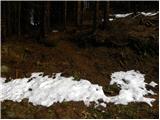 19
19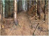 20
20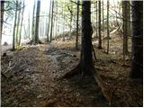 21
21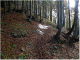 22
22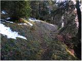 23
23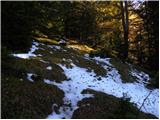 24
24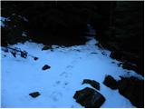 25
25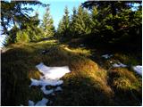 26
26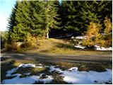 27
27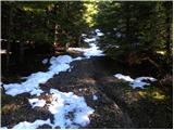 28
28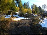 29
29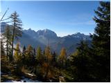 30
30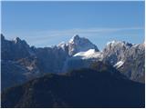 31
31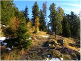 32
32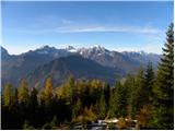 33
33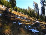 34
34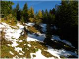 35
35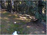 36
36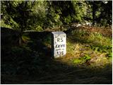 37
37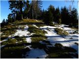 38
38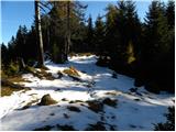 39
39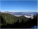 40
40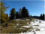 41
41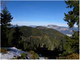 42
42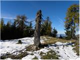 43
43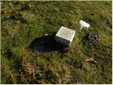 44
44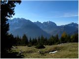 45
45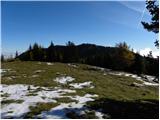 46
46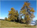 47
47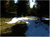 48
48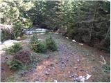 49
49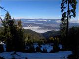 50
50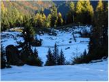 51
51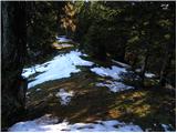 52
52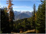 53
53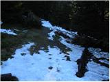 54
54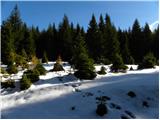 55
55 56
56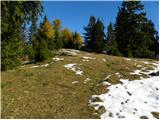 57
57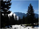 58
58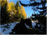 59
59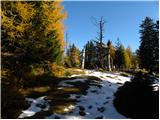 60
60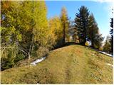 61
61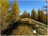 62
62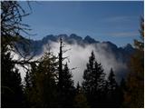 63
63 64
64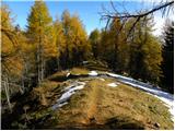 65
65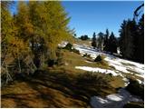 66
66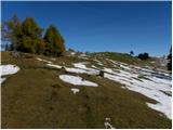 67
67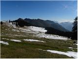 68
68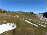 69
69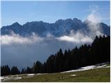 70
70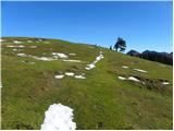 71
71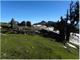 72
72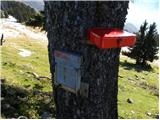 73
73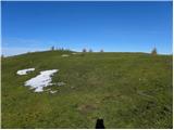 74
74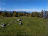 75
75 76
76
Discussion about the trail Srnjak - Vošca
|
| KarmenT7. 03. 2021 |
Čudovita pot! Prvič prehojena danes. Mislim, da je v zapisu napaka - v vrha Grpišce se spustimo proti vzhodu in ne proti zahodu. Sicer sva si zadnji del poti do mejnega grebena nekoliko priredila - v delu zapisa, kjer je zapisano, da zadnjič prečimo gozdno cesto, sva šla kar po gozdni cesti naprej do vzletišča, nato pa strmo navzgor. Iz gozda sva prišla tik pod Grpišco. Nadaljevala po mejnem grebenu na Vošco kot je opisano. Pot je skoraj v celoti zasnežena in do vzletišča dobro shojena. Naprej prosto po snegu, vendar je do mejnega grebena le še nekaj minut. Začetni del je kopen. Hodi se odlično, male derezice so ostale v nahrbtniku. 
|
|
|
|
| KarmenT7. 03. 2021 |
Še tole - midva sva se malo lovila kako priti do izhodišča - takoj za mostom se zavije desno, prve označbe za gostišče Srnjak so šele 100 m naprej.
|
|
|
|
| Tadej8. 03. 2021 |
Hvala za opozorilo. Pravilno je proti vzhodu. Sem popravil v opisu.
|
|
|