Šober (Log) - Tojzlov vrh
Starting point: Šober (Log) (478 m)
| Lat/Lon: | 46,6178°N 15,57831°E |
| |
Time of walking: 50 min
Difficulty: easy marked way
Altitude difference: 225 m
Altitude difference po putu: 240 m
Map:
Recommended equipment (summer):
Recommended equipment (winter):
Views: 316
 | 1 person likes this post |
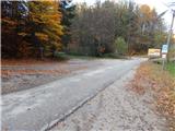
Access to the starting point:
a) From the road Maribor - Dravograd, from the roundabout in Bresternica take the exit for Gaj nad Mariborom, and immediately after the crossroads take another left towards Gaj. The road continues past the Mercator shop and then through part of the Bresternica settlement, and then to the chapel, where you turn left towards Gaj nad Maribor. Continue along the Bresternišek brook, and from the crossroads by Šoberjev Manor, turn right onto the road to Sv. Urbano. Continue along Petka Graba, and follow the road to the Log school bus stop, where there is also a marked crossroads. Park in a suitable place at the crossroads.
b) Drive to Spodnja Kungota, then follow the road to Zgornja Kungota. At Kozjak nad Pesnico, turn left towards Gaj and Urban. Continue uphill, following the signs for Gaj nad Mariborom and then the road leading to Bresternica. When you reach the crossroads where you see the signs for Tojzlov vrh - Večernikova direction, park in a suitable place at the crossroads.
Path description:
From the starting point, take the side road marked for Večernik's direction Tojzlov vrh. At first, cross the macadam road, and when you leave the forest, pass the Večernik homestead on the right. After the homestead, the road becomes passable, and we have a nice view from the road towards the church Sveti Križ in Gaj nad Maribor. The way forward leads us past the chapel, after which we return to the forest, through which we climb steeper. The steepness eases when we reach an asphalt road, which we follow to the left, and we quickly arrive in the village of Gaj nad Mariborom. It is an easy climb through the village and we reach the cemetery, where we turn left, and just after the crossroads we are at the church Sveti Križ, where there is a registration box by the roadside.
Continue past the church and follow the signs for Tojzlov vrh. The village of Gaj above Maribor soon ends and the nearby farm is passed on the right. Just 10 paces further on, turn left off the road onto cart track, which climbs along the edge of the wood, crossing the tarmac road at the chapel. Continue climbing along the edge of the forest, then pass the Iglič homestead, after which, after a short descent, return to the tarmac road.
After a minute or so of easy downhill, the path from the Šiker homestead joins from the right.
Continue straight ahead and climb up the lookout, where another path from Šober joins from the left.
Walk along the scenic road for a short distance, which offers a beautiful view of Sv. Urbán and the surrounding hills, and then the road returns to the forest. A few minutes of moderate climbing follows and we arrive at Planinski dom Kozjak, or the Obrtnik Mountain Home on Tojzl Summit.
In front of the lodge, go right to cart track, next to which there are signs for the summit. After a few steps the path goes into the forest, through which it climbs easily and after a few minutes leads us to the forested summit, where there is a registration box and a NOB memorial.
Starting point - Sveti Križ 0:20, Sveti Križ - Planinski dom Kozjak 0:25, Planinski dom Kozjak - Tojzlov vrh 0:05.
Description and images refer to the situation in November 2021.

Pictures:
 1
1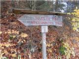 2
2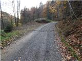 3
3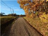 4
4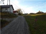 5
5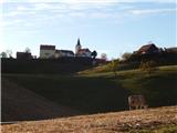 6
6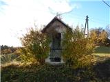 7
7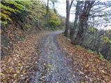 8
8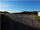 9
9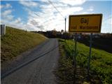 10
10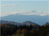 11
11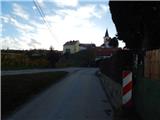 12
12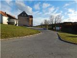 13
13 14
14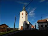 15
15 16
16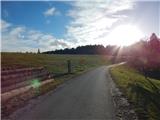 17
17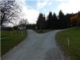 18
18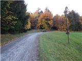 19
19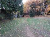 20
20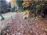 21
21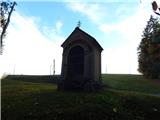 22
22 23
23 24
24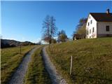 25
25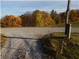 26
26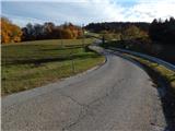 27
27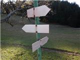 28
28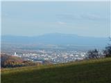 29
29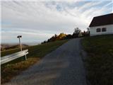 30
30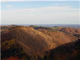 31
31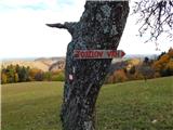 32
32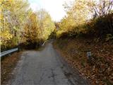 33
33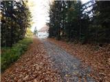 34
34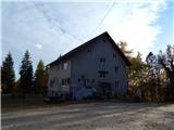 35
35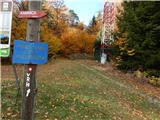 36
36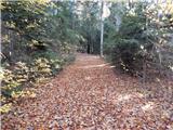 37
37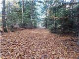 38
38 39
39
Discussion about the trail Šober (Log) - Tojzlov vrh