Smrečje - Vrh Svetih Treh Kraljev (by road)
Starting point: Smrečje (708 m)
| Lat/Lon: | 46,0117°N 14,191°E |
| |
Name of path: by road
Time of walking: 45 min
Difficulty: easy marked way
Altitude difference: 176 m
Altitude difference po putu: 176 m
Map: Škofjeloško in Cerkljansko hribovje 1:50.000
Recommended equipment (summer):
Recommended equipment (winter):
Views: 9.474
 | 1 person likes this post |
Access to the starting point:
Access from Horjul: From Horjul, drive past Vrzdenec towards Gorenjska vas. At the first sharp right turn, the road to the village of Šentjošt nad Horjul branches off to the left. Take the road to the next crossroads and turn right. The road then soon leads to the village Smrečje. We follow it through the village and then park in one of the small car parks along the road.
Access from Žiri: In Žiri, take the road that goes up along the river Račeva in the direction of the villages Smrečje and Žirovski vrh. Follow the road in the direction of Smrečje and the Peak of the Holy Three Kings. Before you reach the village Smrečje, the road turns sharp right towards the Peak of the Holy Three Kings. Park in one of the roadside car parks near the junction.
Path description:
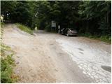
From the small parking lot by the road, go to the crossroads, where you take the upper road towards Vrh Sv. treh kraljev. After a few metres, the road leads out of the wods, where you continue straight ahead. The road then crosses meadows next to individual houses in a slight ascent and soon leads us into the forest again. Here the road climbs a little more and leads to the next crossroads, which is located on grassy slopes. Turn left and follow this road through part of the village to reach the military tunnel of the Rupnik line. I recommend torches to see the tunnels, but to continue along the cave you need to be a trained caver (accompanied by a guide) as the military tunnel turns into a natural cave. From the entrance to the cave to the hut is only a one-minute walk.
At the cottage, turn left onto the road which, after a short climb, leads out of the forest. It is only a few minutes' walk up the increasingly scenic mountainside. The top of the hill on which the church stands can be reached easily in about ten minutes by a gentle climb from the mountain hut.

Pictures:
 1
1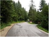 2
2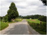 3
3 4
4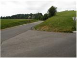 5
5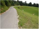 6
6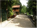 7
7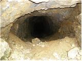 8
8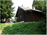 9
9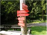 10
10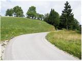 11
11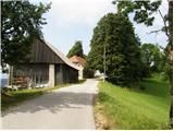 12
12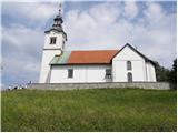 13
13 14
14
Discussion about the trail Smrečje - Vrh Svetih Treh Kraljev (by road)
|
| Guest2. 09. 2007 |
Prijeten nedeljski popoldanski sprehod,in veliko okoliških hribov za še malo bolj zahtevne.Priporočam tudi za manjše otroke. Mojca 
|
|
|
|
| Guest2. 01. 2008 |
Če imate še kak prost dan je tale izlet primeren za te dni. Svetujem, da s seboj vzamete svetilko, da si ogledate vojaški rov.
|
|
|
|
| Guest3. 01. 2008 |
Ta vojaški rov oziroma Rupnikova linija ni bila dokončana saj so med kopanjem prišli do naravne podzemne kraške jame.
|
|
|