Starting point: Senožeti (275 m)
| Lat/Lon: | 46,0905°N 14,7336°E |
| |
Time of walking: 1 h 30 min
Difficulty: easy marked way
Altitude difference: 561 m
Altitude difference po putu: 561 m
Map: Ljubljana - okolica 1:50.000
Recommended equipment (summer):
Recommended equipment (winter):
Views: 10.387
 | 1 person likes this post |
Access to the starting point:
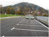
a) From the Ljubljana - Celje motorway, take the Šentjakob exit and follow the road towards Litija. A few kilometres after Dolsko, the road leads to a roundabout, where we head towards the village of Senožete. The road then leads immediately into the village, where you turn right at the junction and drive for about 100 metres to a large parking lot near the school playgrounds.
b) From Litija, drive towards Ljubljana but only as far as the roundabout where signs direct you towards the village of Senožete. The road then leads immediately into the village, where you turn right at the crossroads and drive about 100 m further to a large parking lot near the school playgrounds.
Path description:
From the parking lot, continue along the road, which leads over a small stream to a crossroads where you continue to the left. The road then leads us after a few metres to the next crossroads, where markings direct us to the left of the chapel on the footpath. The path is short, as after a few metres you rejoin the road. Walking along the road continues for only a few minutes, as the signs for Miklavža then direct us left steeply upwards. Next, follow the path as it climbs through the forest and leads us a little higher to a larger clearing beyond which we join the road. The road then leads to a crossroads at Velika vas, where signs direct you to the right. The road then takes us above the village in a few minutes. Here the signs direct us left to cart track, which soon turns into a footpath. Next, follow the path as it ascends crosswise and leads us slightly higher to a crossroads where we continue left in the direction of Ciclja. The way forward has quite a few unmarked crossroads so follow the markings carefully, but they are quite rare. The path, which mostly passes through the forest, then leads us without major problems to the non-visible summit.

Pictures:
 1
1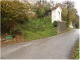 2
2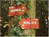 3
3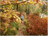 4
4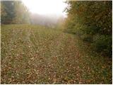 5
5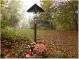 6
6 7
7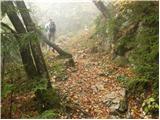 8
8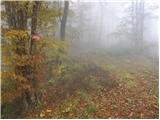 9
9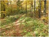 10
10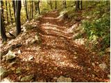 11
11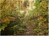 12
12 13
13
Discussion about the trail Senožeti - Cicelj
|
| Suriljana23. 04. 2016 |
Danes po tej poti, ki je krasna izbira za izlet v okolici Ljubljane. Pot je odlično markirana. Predlagam še kratek ovinek do cerkvice sv. Miklavža. Za hitrejši povratek pa gre iz vrha Ciclja lovska pot direktno do Velike vasi, ki pa je precej strma.
|
|
|