Seichenbrunn - Kruckelkopf
Starting point: Seichenbrunn (1668 m)
| Lat/Lon: | 46,91536°N 12,77544°E |
| |
Time of walking: 4 h 30 min
Difficulty: difficult marked way, difficult pathless terrain
Altitude difference: 1513 m
Altitude difference po putu: 1585 m
Map:
Recommended equipment (summer): helmet, ice axe, crampons
Recommended equipment (winter): helmet, ice axe, crampons
Views: 4.934
 | 4 people like this post |
Access to the starting point:
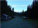
Drive through the Karavanke Tunnel into Austria, then continue to Spittal and on to Lienz (the motorway ends a little after Spittal). We continue along a relatively nice and wide road through the Drava Valley. Shortly before Lienz, at a roundabout, turn right towards Iselsberg and Winklern. The road starts to climb, but then you have to be careful, because soon the road to the Debanttal valley (green sign) branches off to the left. The road to the Debanttal valley becomes a dirt road, and later joins the slightly nicer road from Nußdorf-Debant. Then, driving through the Debanttal valley, follow the signs for hut Lienzer Hütte and Wangenitzseehütte. Follow the road all the way to the lock where you park in a large parking lot (Parkplatz Seichenbrunn).
Path description:
From the parking lot, continue along the macadam road, which is closed to traffic. After a few dozen metres you will reach a marked crossroads where you continue right over a bridge after the "Wangenitzseehütte" signs. Straight ahead on the dirt road leads to the Linzer Hütte hut.
Our path then turns right and climbs over a grassy slope and leads us into the forest. We then walk along a wide path heading east for a while before signs point us left and the path starts to climb steeply. The path here is mainly on grassy slopes with increasingly sparse forest. Higher up, you then cross a fence and the path leads you to mountain pasture where cattle graze in the summer months.
The path becomes more level here and crosses the grassy slopes below the funicular to the north-west. From the path there is a fine view, especially of the mountains above the Debanttal valley. The path with mountain pasture then turns slightly to the right and starts climbing steeply again, leading to a marked crossroads.
The path to the left leads to the Linzer Hütte, and we continue to the right towards the Wangenitzseehütte. From the crossroads, the path then crosses the slightly steeper slopes below the Feldkopf peak to the east, followed by another slightly steeper climb to the Untere Seescharte.
At the notch, where the view to the east opens up, the path descends gently and leads past the high mountain lakes Kreuzsee and Wangenitzsee to the Wangenitzseehütte hut.
At the hut, continue north-east following the signs for "Petzeck". After a short climb, the trail leads to a marked crossroads where you turn left uphill after the "Kruckelkopf" signs, and straight ahead the trail leads to the Petzeck summit.
From the crossroads, the path starts to climb northwards on an initially still grassy slope. You have to pay a little more attention to the markings as you climb up, as the path is not very visible. Higher up, the path leads to a rocky slope where we soon reach a crossroads, which is very difficult to see. Straight down the valley there is a marked trail to the Perschitzscharte notch, and slightly up to the right there is a direct trail to the Kruckelkopf summit. Which route to take depends mainly on the snow conditions. The route from the notch to the summit is much steeper, but it is also much more likely to be overland. If we decide to continue along the path towards the notch, the path will lead us along the right side of the valley. On the ascent to the stumps we will be able to cross some snowfields, even in summer, which is less steep than the direct route to the top. However, in case of hard snow, it is advisable to use a snowshoe and snowshoes.
When you reach the Perschitzscharte notch, continue right up the ridge. Here you will look in vain for markings, as the path from the notch to the summit is not marked. Occasionally, you will see a few cairns along the ridge. The climb up the ridge is quite steep and there is some easy scrambling along the ridge. The ridge then becomes less steep and there is an easy climb to the top.
Do not be misled by the markings at the top, as they do not lead back to the Perschitzscharte notch.
You can descend via the ascent route via the Perschitzscharte notch, or follow the marked route along the south-western slopes of the mountain. If descending by the marked route, bear in mind that there may be snowbanks on the route long into the summer and that you will most likely need a snowshoe and ice-crampons.

Pictures:
 1
1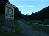 2
2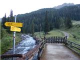 3
3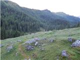 4
4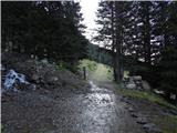 5
5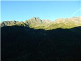 6
6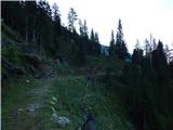 7
7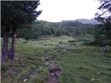 8
8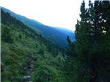 9
9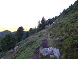 10
10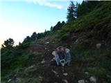 11
11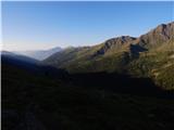 12
12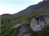 13
13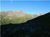 14
14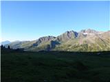 15
15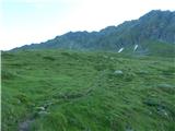 16
16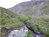 17
17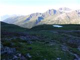 18
18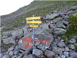 19
19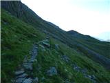 20
20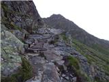 21
21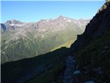 22
22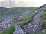 23
23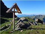 24
24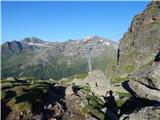 25
25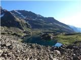 26
26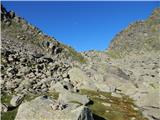 27
27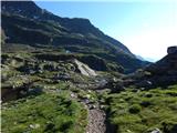 28
28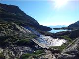 29
29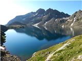 30
30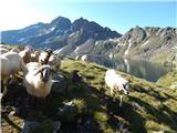 31
31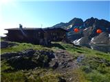 32
32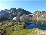 33
33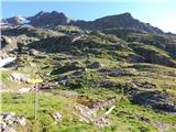 34
34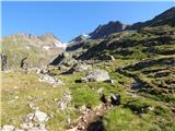 35
35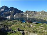 36
36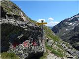 37
37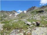 38
38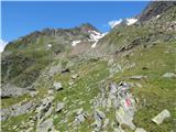 39
39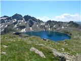 40
40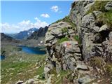 41
41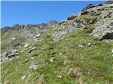 42
42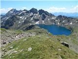 43
43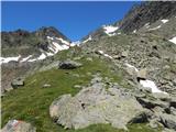 44
44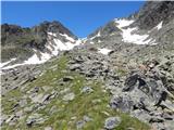 45
45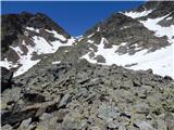 46
46 47
47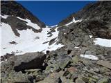 48
48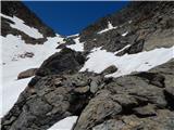 49
49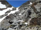 50
50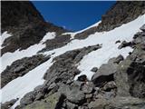 51
51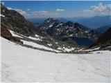 52
52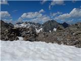 53
53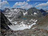 54
54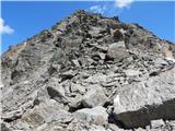 55
55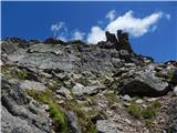 56
56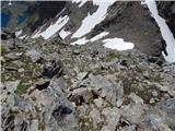 57
57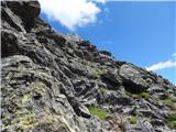 58
58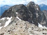 59
59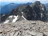 60
60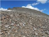 61
61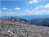 62
62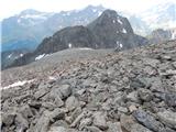 63
63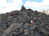 64
64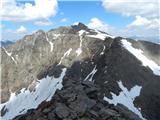 65
65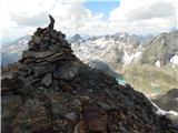 66
66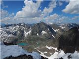 67
67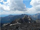 68
68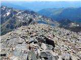 69
69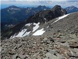 70
70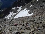 71
71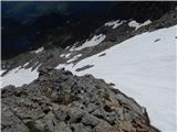 72
72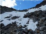 73
73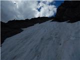 74
74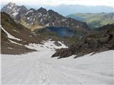 75
75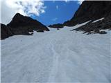 76
76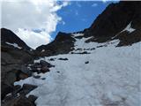 77
77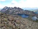 78
78
Discussion about the trail Seichenbrunn - Kruckelkopf
|
| Bandzo27. 09. 2013 |
Lani sem bil na Petzecku in moram priznati, da je ta pot do Wangenitzee hutte res čudovita! Dolina Debental tudi. Super izlet in tura!
|
|
|
|
| Janiel744. 07. 2022 20:01:40 |
Devet let nobene objave, zato je fajn kaka osvežitev. Pot je po JZ pobočjih označena vse do vrha, je pa letos pot popolnoma kopna že sedaj (prvo strmo snežišče se da brez večjih težav obiti po desni strani). Izjemen razglednik na okoliške vrhove in tudi daleč naokoli. Že ob vzponu pa se hočeš nočeš vedno znova obrneš nazaj in se čudiš lepoti obeh jezer ob koči. Tako sem zaokrožil trojček 3000m+ tu naokoli poleg Petzecka in Hoher Perschitzkopfa in se povzpel na svoj že 25. tritisočak 
|
|
|
|
| Robie17. 08. 2023 13:07:23 |
Priporočam pot preko kraja Nußdorf-Debant bistveno boljša asfaltirana cesta (v spodnjem delu) kot ta opisana iz leta 2013. Prav tako je v celoti označena a markacije kličejo po prenovi. Pot je v celoti kopna oziroma je manjša snežišča možno enostavno obiti tako da ni bilo potrebe po cepinu in derezah. Prav tako pot ni tehnično zahtevna.
|
|
|