Schiestelscharte - Klomnock
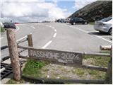
Starting point: Schiestelscharte (2024 m)
| Lat/Lon: | 46,89°N 13,7941°E |
| |
Time of walking: 1 h
Difficulty: partly demanding marked way
Altitude difference: 307 m
Altitude difference po putu: 307 m
Map:
Recommended equipment (summer):
Recommended equipment (winter): ice axe, crampons
Views: 5.092
 | 2 people like this post |
Access to the starting point:
From Spittal, drive towards Salzburg or vice versa, but only as far as Kremsbrücke (from Spittal, take the Gmünd exit; from Salzburg, take the St. Peter exit). In Kremsbrücke, you will see signs for the Nockalmstrße Alpine road, which you will then follow over a number of switchbacks to the pass at 2024m.
Path description:
From the parking lot, follow the footpath towards the Klomnock and Mallnock peaks and Lake Falkertsee. The trail crosses a pasture fence at the very beginning, after which it starts to climb up the left side of the mountain. The relatively steep path then leads over relatively steep slopes, over which the fixed safety gear are helpful but not strictly necessary. After the first steep part, the path changes to moderately steep grassy slopes, over which it then climbs in a moderate transverse ascent. A little further on, the path becomes steeper again and, with the help of a cable car, leads to a crossroads just below the summit. Here you continue to the right and, after a few minutes, reach the top of the mountain on a steep slope.
Pictures:
 1
1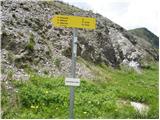 2
2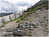 3
3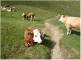 4
4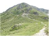 5
5 6
6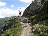 7
7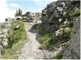 8
8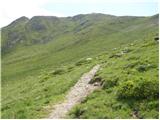 9
9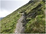 10
10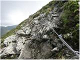 11
11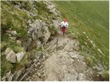 12
12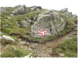 13
13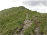 14
14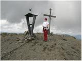 15
15
Discussion about the trail Schiestelscharte - Klomnock
|
| Pi_is_exactly_322. 06. 2017 |
S prelaza gre na vrh še ena pot, ki se začne po desni strani hriba - 20 minut - in nato nadaljuje 40 minut po grebenu do vrha. Meni se je bolj dopadla kot ta, ki je opisana. Je pa mogoče narediti lepo krožno turo.
|
|
|