Starting point: Sant'Uberto (1421 m)
| Lat/Lon: | 46,60229°N 12,1072°E |
| |
Time of walking: 4 h 45 min
Difficulty: partly demanding marked way
Altitude difference: 1373 m
Altitude difference po putu: 1470 m
Map: Tabacco 03 1:25.000
Recommended equipment (summer):
Recommended equipment (winter): ice axe, crampons
Views: 414
 | 1 person likes this post |
Access to the starting point:
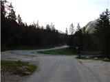
Via Border crossing Rateče, take the road to Trbiž / Tarvisio, where you take the motorway towards Udine. Leave the motorway at the exit for Tolmezzo and follow the road to the above-mentioned place. From Tolmezzo, continue in the direction of Ampezzo and the Passo della Mauria mountain pass. The road then begins to descend and leads into the Cadore valley, where you continue to the right (Belluno and Cortina d'Ampezzo on the left) in the direction of Auronzo. After a few more km of driving, you reach the next major crossroads, where you turn right towards Misurina (left Tre Croci Pass). From here, follow the road down to a major crossroads, where you turn left towards Cortina d'Ampezzo (right Austria). From this crossroads, you continue for about 10 km towards Cortina d'Ampezzo, and then, at a sharp left turn, you turn right onto the road towards the Rifugio Ra Stua hut. Park in the parking lot at the very beginning of the road.
Path description:
From the parking lot, turn left onto cart track after the "Valle di Fanes" signs (route No 10). Cart track starts descending from the parking lot and quickly leads to a marked crossroads. At the crossroads, turn right onto the footpath, following the signs for "Valle di Fanes". From the crossroads, the path descends through the forest and leads to a tarmac road.
Continue right along the road and cross the bridge over the Rio di Fanes stream. The road along the stream then leads to a crossroads.
To the right is a more difficult path called Sentiero dei Canyons, and we turn left (path 10) onto a road that is paved for a short distance and then becomes gravel. The road then climbs gently through the forest, with occasional views of the nearby peaks.
Later, a footpath branches off to the left towards the Posporcora saddle, and we continue along the dirt road. The road then turns slightly to the right and crosses the deep gorge of Gola di Fanes via a bridge. We continue along the road and soon we are at the crossroads again. There are also some benches and tables near the crossroads.
At the crossroads we continue left along the road, straight ahead is the Scorciatoia (short cut), which is slightly steeper and later rejoins the road. At the crossroads to the right, the path leads to the Cascata di Fanes waterfall, which is only a few minutes' walk along an exposed ledge (self-propelled vehicles recommended).
We continue to the left and continue climbing on the dirt road, which is also suitable for mountain bikers. After a short climb, we come to another crossroads where the 401 trail branches off to the left towards the Forcella Posporcora notch. We continue to the right and continue climbing along the road through the forest, from which views of the surrounding peaks become more and more frequent. The road climbs steeply a few times and is occasionally paved. Higher up, the Sentiero dei Canyons trail branches off to the left, also leading to the Val Travenanzes valley.
The trail then turns slowly to the right and approaches the Rio di Fanes again. Here, the Scorciatoia trail joins from the right, and shortly afterwards the trail to the last waterfall on the Rio di Fanes branches off to the right. The waterfall is only a few minutes' walk along an exposed path. Here again, self-propulsion is recommended.
At the crossroads, the road turns slightly left and continues along the stream. The path then soon leads us out of the forest and opens up to wonderful views of the surrounding peaks. The scenic route then leads to Lago di Fanes.
At the end of the lake, cross the bridge and continue along the cart track along the stream. The path leads to a fence where you leave the Dolomites d'Ampezzo Nature Park and enter the Fanes-Senes-Braies Nature Park. This is also the border between the Veneto and the South Tyrol (Trentino-Alto Adige). Continue along the cart track, which follows the stream for a short distance and then climbs a little more steeply and leads from the grassy slope into the woods. The woods become thinner and thinner and from the path we have a fine view of the peaks above the Valle di Fanes. Our path follows the stream again for a while and leads us to a crossroads.
The road to the left leads to mountain pasture Malga Fanes Grande, and we leave the road here and turn right onto route 10A, which leads to hut Rifugio Fanes. We then climb up the grassy slopes along the rare dwarf pines and rejoin the dirt road. Continue to the right and follow the scenic road to Lago di Limo.
At the lake, leave the dirt road leading to hut Rifugio Fanes and turn right onto the footpath marked "Col Bechei". The path first runs along the lakeside and then starts to climb up the slope on the eastern side of the lake. Here the path follows a mainly grassy slope and turns slightly to the right at a slightly higher elevation, leading to the southern slopes. There are also a few benches along the way and a spring with drinking water. Further on, we climb up a small valley to the east and from the path we start to get better and better views, especially to the south where the Tofana mountain group is clearly visible. We continue to climb on mostly grassy terrain eastwards to a small saddle on the south side of the Col Bechei peak where there are also signposts.
At the crossroads where we join the slightly less beaten eastern path, continue left towards the Col Bechei peak where we are also directed by signposts. From the crossroads we start to climb a little steeper up the grassy slope, which turns into rocky terrain a little higher up. The trail turns slightly to the right here and follows a slightly steeper slope. As there is quite a bit of rubble on the path, some caution is needed here. Technically, the ascent is not difficult. The path then leads us to a ridge from where we open up a view of the north side and to the top, which we can already see in front of us followed by only a short climb.
You can descend either by the ascent route or by the eastern route, which branches off from the above-mentioned route at the small grassy saddle on the south side of the summit.

Pictures:
 1
1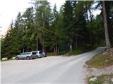 2
2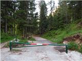 3
3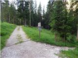 4
4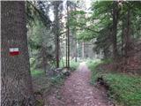 5
5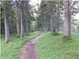 6
6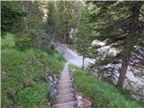 7
7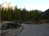 8
8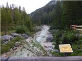 9
9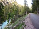 10
10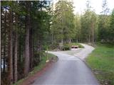 11
11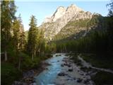 12
12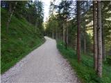 13
13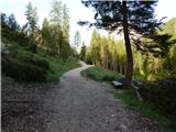 14
14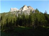 15
15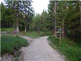 16
16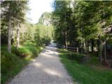 17
17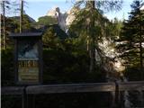 18
18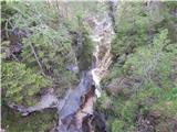 19
19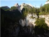 20
20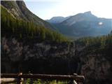 21
21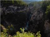 22
22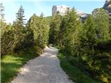 23
23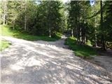 24
24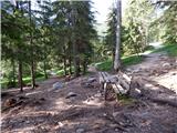 25
25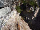 26
26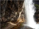 27
27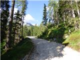 28
28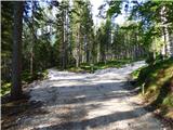 29
29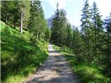 30
30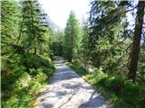 31
31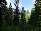 32
32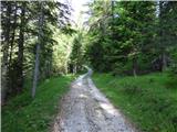 33
33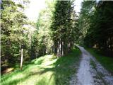 34
34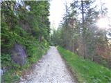 35
35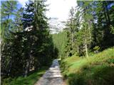 36
36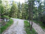 37
37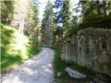 38
38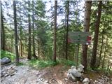 39
39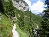 40
40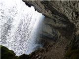 41
41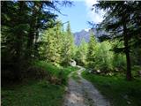 42
42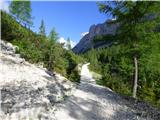 43
43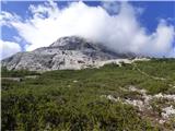 44
44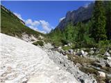 45
45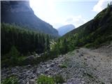 46
46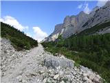 47
47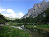 48
48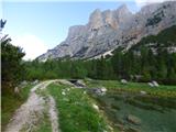 49
49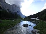 50
50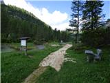 51
51 52
52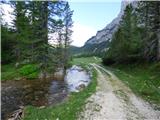 53
53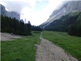 54
54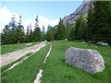 55
55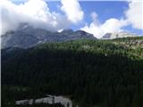 56
56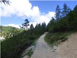 57
57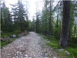 58
58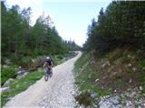 59
59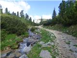 60
60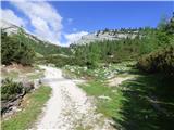 61
61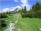 62
62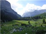 63
63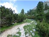 64
64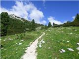 65
65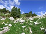 66
66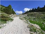 67
67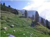 68
68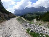 69
69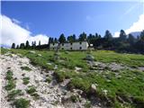 70
70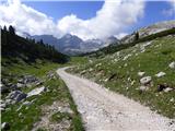 71
71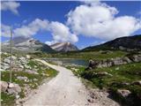 72
72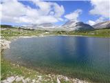 73
73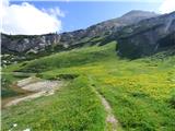 74
74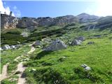 75
75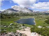 76
76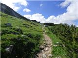 77
77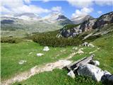 78
78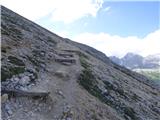 79
79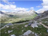 80
80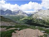 81
81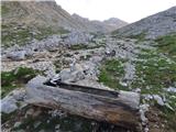 82
82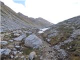 83
83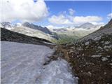 84
84 85
85 86
86 87
87 88
88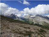 89
89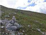 90
90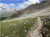 91
91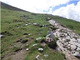 92
92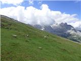 93
93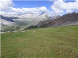 94
94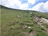 95
95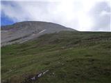 96
96 97
97 98
98 99
99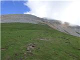 100
100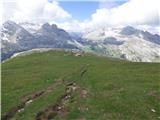 101
101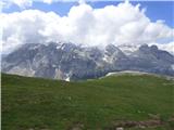 102
102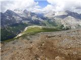 103
103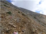 104
104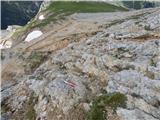 105
105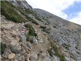 106
106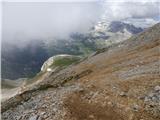 107
107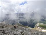 108
108 109
109 110
110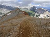 111
111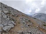 112
112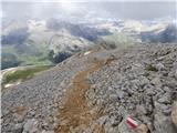 113
113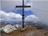 114
114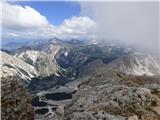 115
115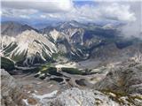 116
116 117
117 118
118 119
119 120
120
Discussion about the trail Sant'Uberto - Col Bechei