Starting point: Ruski križ (1000 m)
| Lat/Lon: | 46,4444°N 13,7746°E |
| |
Time of walking: 4 h 45 min
Difficulty: very difficult marked way
Altitude difference: 1410 m
Altitude difference po putu: 1490 m
Map: Triglav 1:25.000
Recommended equipment (summer): helmet, self belay set
Recommended equipment (winter): helmet, self belay set, ice axe, crampons
Views: 19.827
 | 3 people like this post |
Access to the starting point:
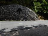
First drive to Kranjska Gora, then continue driving towards the Vrh Leh pass just before the 3rd serpentine of the Ruska or vršiška road, you will see the Russian Cross on the right and a small parking lot on the left, where you park. As the parking lot is relatively small and quickly full, you can also park a little higher up in the larger parking lot just above the 4th serpentine (in this case we have to descend a little to our starting point at the Russian Cross).
The starting point can also be reached from the coastal side via the Vršič Pass.
Path description:
Just before the 3rd serpentine of the Ruska cesta, we will notice the mountain signs for Koča v Krnici along the road, which direct us slightly to the left to the wide cart track, which immediately starts to descend moderately. After a few minutes of descending through the forest, the path is laid and leads us to the dry Pišnica riverbed. Just after crossing the stream, the path turns slightly to the left and leads us out of the forest onto the vast grassy slopes of the mountain pasture in Klin, where we see a secluded hut on the right and the small memorial park of Mali Tamar on the left. The path ahead is completely laid out and then joins the forest road coming from the former Hotel Erika or the bridge over the Velika Pišnica. Here, continue to the right and follow the relatively steep forest road or parallel mountain trail all the way to Koča v Krnici, which is reached after about 20 minutes of further walking.
From the hut, where there is a pleasant shade, continue straight ahead in the direction of the Kriška Stena along the valley Cirque, gently at first and then steeply upwards. The path soon leaves the forest, where a beautiful view of the nearby cliffs opens up. Next, cross the rubble brought by storms from the surrounding ravines. The path ahead becomes steeper and continues in the same direction. The last trees are already behind us and we are slowly crossing the scree below the walls of the Kriška Stena. In the upper part of the scree, the path turns slightly to the left to the entrance to the Kriška wall. Here the climbing part of the route begins, where you put on your helmet. The path turns left at the start of the wall and climbs steeply. In the wall, the route is mostly along natural passages, and in some places we are also helped by fixed safety gear. Be careful not to break any rocks during the climb! After a good hour of climbing up the wall, which is quite difficult in places, we get off. A few steps of walking follow to the crossroads, where we continue right up in the direction of Križa and the path which passes on a wide ridge, quickly leads us to Bovška vratica, from which we have a view of the Kriška Pods, where we can see the highest Slovenian lake. Continue left towards the top of Križa (directly Pogačnikov dom), which is only a 10-minute walk away. The way forward first climbs steeply along an increasingly narrow ridge, then climbs steeply with the help of a rope over a slightly exposed rock slab, behind which you reach an interesting passage through a natural chute. With some skill, the narrow chute leads to the Križ lookout. Start point - Koča v Krnici 45 minutes, Koča v Krnici - Križ 4:00.

Pictures:
 1
1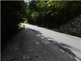 2
2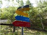 3
3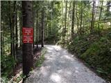 4
4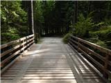 5
5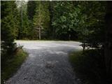 6
6 7
7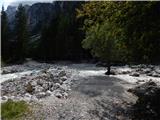 8
8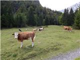 9
9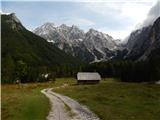 10
10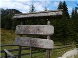 11
11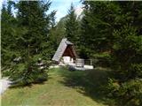 12
12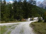 13
13 14
14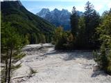 15
15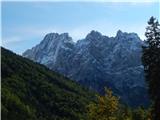 16
16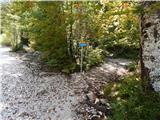 17
17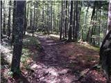 18
18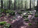 19
19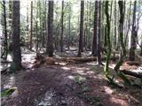 20
20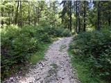 21
21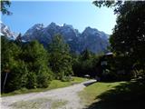 22
22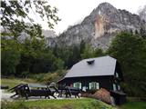 23
23 24
24 25
25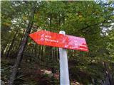 26
26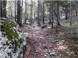 27
27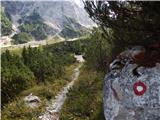 28
28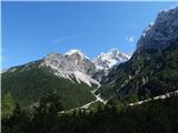 29
29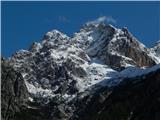 30
30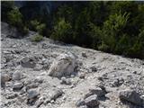 31
31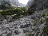 32
32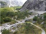 33
33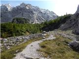 34
34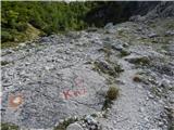 35
35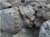 36
36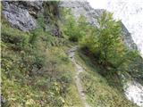 37
37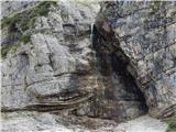 38
38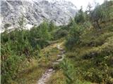 39
39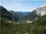 40
40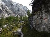 41
41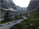 42
42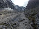 43
43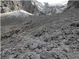 44
44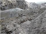 45
45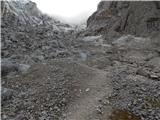 46
46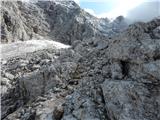 47
47 48
48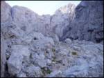 49
49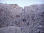 50
50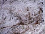 51
51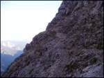 52
52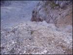 53
53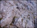 54
54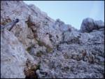 55
55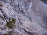 56
56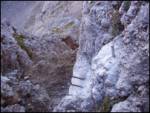 57
57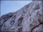 58
58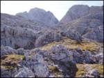 59
59 60
60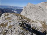 61
61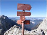 62
62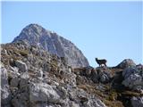 63
63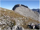 64
64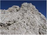 65
65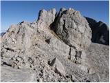 66
66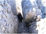 67
67 68
68
Discussion about the trail Ruski križ - Križ
|
| kitina12. 09. 2009 |
Hojla!zanima me kakšna je pot čez Kriško steno na Križ?
|
|
|
|
| nisa12. 08. 2011 |
Jutri se odpravljam na Križ čez Kriško steno. Mogoče kdo ve če je kaj snega na poti.
Veliko planinskega uživanja med podaljšanim vikendom.
|
|
|
|
| folpo12. 08. 2011 |
kakšen mesec od tega je bil neposredno pod vstopom v steno veliko in strmo snežišče, šririne cca. 30 do 40m, ki se je po vsej verjetnosti še vedno ohranilo, saj je v celoti v senci, plast snega pa je bila takrat zelo debela. da se ga sicer prečit z veliko previdnosti in brez cepina, ampak to odsvetujem, ker v primeru zdrsa ni rešitve
|
|
|
|
| Ceri29. 08. 2011 |
včeraj se podali po tej poti na Križ in je zlo luštna tura  ko prideš pod Kriško steno, ti sicer ni povsem jasno kako bo šlo preko, ampak je pot res lepo speljana po naravnih prehodih in zaradi obilice "prostega plezanja" predstavlja pravi užitek za nas "gorniške gamse"  je pa zaradi krušljivega terena in obilice kamnčkov na kamniti podlagi, potrebna malce večja previdnost ob spustu... ob "premagani" steni pa zgoraj čaka nagrada, ko ob počitku na mehkih travnatih zaplatah, lahko uživaš v čudovitih razgledih!
|
|
|
|
| metod15. 08. 2012 |
Pot je fino prehodna, snega ni. Plezanje prijetno. Samovarovalni komplet skoraj ne koristi, ker je zelo malo jeklenic: večinoma se pleza po lepi skali, sem ter tja so klini. Bolje za gor kot za dol.
|
|
|
|
| andrejp1. 08. 2013 |
Čao,
ima kdo kakšne informacije, kako je čez Kriško steno s snegom.
Lp Andrej
|
|
|
|
| skočnik1219. 07. 2014 |
zdravo,
ali ima kdo informacije če je pot čez križko steno prehodna brez derez?
že vnaprej hvala
|
|
|
|
| tcanka24. 07. 2016 |
Lep izlet, priporočam pa vzpon po tej smeri, sam sem šel malo daljšo turo s končnim spustom v krnico, pa je za navzdol pot sicer lepa, ampak z veliko grušča, tako da je potrebna previdnost.
|
|
|