Starting point: Ruše (308 m)
| Lat/Lon: | 46,53857°N 15,51315°E |
| |
Time of walking: 45 min
Difficulty: easy unmarked way
Altitude difference: 270 m
Altitude difference po putu: 270 m
Map: Pohorje 1:50.000
Recommended equipment (summer):
Recommended equipment (winter): ice axe, crampons
Views: 206
 | 1 person likes this post |
Access to the starting point:
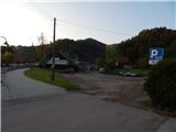
a) Drive to Maribor, then follow the signs for Ruše. When you arrive in Ruše, park in one of the car parks in the village, preferably near the Ruše post office.
b) From the road Dravograd - Maribor, after Selnica ob Dravi, turn right towards Ruše. Then drive over the bridge over the Drava river (the bridge is expected to be closed until 31. 10. 2022), and then arrive in Ruše, where you can park in one of the car parks in the settlement, preferably near the Ruše post office.
Path description:
From where we parked, we first walk to Trg vstaje, where we see red mountain direction signs, and we turn onto the road in the direction of Ruška hut, Glažuta and Martnice. For a short time we walk along the asphalt road towards Lobnica, and then the signs direct us to the left, where we first climb up between the houses, and then the path goes into the forest. After a few minutes of climbing, you will reach a lookout point, which offers a beautiful view of Ruše, the surrounding area and Kozjak, and is flanked by three crosses. The path continues into the forest and climbs up to an asphalt road, which you follow to the left. Walk along the asphalt road, passing individual houses, and higher up you will come to a small saddle with the Dobnikov Cross.
Leave the marked trail here, which continues towards Ruška koča na Arehu, and follow the trail sharp left to the unmarked cart track (left along the Dobnik Homestead road, straight ahead Areh). After a short climb, you reach the wider cart track, and continue climbing along it. When we reach the meadow a little further on, the cart track ends, and we continue along the edge of the forest to the nearby fence, where we continue right along the fence on the beaten track, which takes us into the forest and quickly to Lorbekov vrh.
Description and pictures refer to the situation in May 2022.

Pictures:
 1
1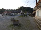 2
2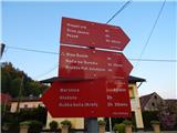 3
3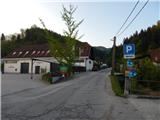 4
4 5
5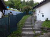 6
6 7
7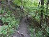 8
8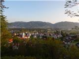 9
9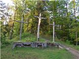 10
10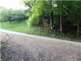 11
11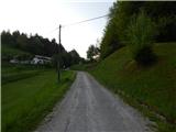 12
12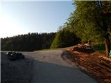 13
13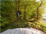 14
14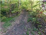 15
15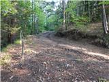 16
16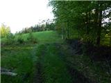 17
17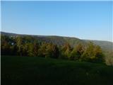 18
18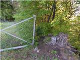 19
19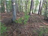 20
20 21
21
Discussion about the trail Ruše - Lorbekov vrh