Rudnik v Topli - Velika glava (Peca)
Starting point: Rudnik v Topli (1080 m)
| Lat/Lon: | 46,4859°N 14,7647°E |
| |
Time of walking: 2 h 30 min
Difficulty: easy unmarked way
Altitude difference: 997 m
Altitude difference po putu: 1000 m
Map: Kamniške in Savinjske Alpe 1:50.000
Recommended equipment (summer):
Recommended equipment (winter): ice axe, crampons
Views: 6.881
 | 1 person likes this post |
Access to the starting point:
a) Drive to Črna na Koroškem (to get here from Ravenna na Koroškem or from Šoštanj via the Spodnje Sleme pass), then continue to Koprivna. The road continues along the Meži River, and we follow it to a crossroads where the road to the Topla valley branches off to the right. The road continues along the Topla stream, and we follow the ascending road to the parking lot at the entrance to the Topla mine.
b) We drive to Luce (to get here from Mozirje or from Kamnik via the Volovljek (Kranjski Rak) pass), and then continue driving towards the Logar valley. In the village Solčava, leave the main road towards the Logar valley and turn right towards Podolševa, the pass Spodnje Sleme and Črna na Koroškem. The road then loses its asphalt surface, and after a few kilometres we turn right at the crossroads in Podolševa towards Črna na Koroškem. The road, which continues to climb mainly in a transverse direction, leads us after a while to the Spodnje Sleme Pass. From the pass the road starts to descend and we follow it in the direction of Črna na Koroške. After a few kilometres, when we descend into the valley, we turn right at the crossroads towards Črna na Koroškem (Koprivna on the left). We follow the main road down for a short distance, and then the signs for the Tople valley direct us left onto the ascending road. The path ahead leads us along the stream Topla, and we follow the ascending road to the parking lot at the entrance to the mine in Topla.
Path description:
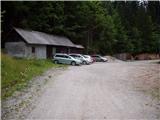
At the end of the parking lot, you will reach a junction of two worse macadam roads, where you take a sharp left in the direction of Doma na Peci. The road then crosses a clearing above the parking lot and leads us just a little higher to the next crossroads, where we continue to the right (left entrance to the mine - 5 minutes). The way forward leads us along a road that gradually changes to cart track, which leads us a little further to the next marked crossroads.
At this crossroads, continue left (slightly right Dom na Peci) in the direction of Knipsovo sedlo (Knepsovo sedlo on the signs) and continue climbing along the grassy cart track. Higher up, we join the rocky cart track, which crosses the slopes to the left, and we follow it up to a point where the signs for Peca and Knipsovo sedlo point us steeply right up the bank.
After 10 minutes of steep ascent, the path crosses a grassy gully and then climbs even steeper on the other side of the gully. The very steep path leads us higher up to a small lookout point, from which we have a beautiful view towards Raduha. Just a little higher up in the trees we see a signpost pointing to the left. The way forward leads us through a gradually increasingly sparse forest, from which we occasionally get some views. The path then passes between dwarf pines, where the steepness starts to ease. After about 15 minutes of easy walking, the path leads to Knipsovo sedlo, where there are information boards.
At the saddle where the information boards stand, continue straight along the barely visible and unmarked path (Petzen on the right, Bistriška špica on the left). After a few steps on the right side, you will see a narrow clearing between dwarf pines, which is a less visible path. Take the above-mentioned path and after a climb of about 10 minutes you will reach the top of Velika head.

Pictures:
 1
1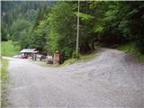 2
2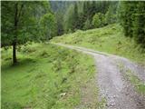 3
3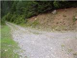 4
4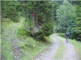 5
5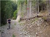 6
6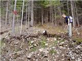 7
7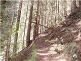 8
8 9
9 10
10 11
11 12
12 13
13 14
14 15
15 16
16 17
17 18
18 19
19 20
20 21
21 22
22 23
23 24
24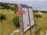 25
25 26
26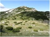 27
27 28
28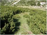 29
29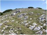 30
30 31
31
Discussion about the trail Rudnik v Topli - Velika glava (Peca)