Rovišče - Zasavska Sveta gora (footpath)
Starting point: Rovišče (665 m)
| Lat/Lon: | 46,1212°N 14,8978°E |
| |
Name of path: footpath
Time of walking: 30 min
Difficulty: partly demanding marked way
Altitude difference: 187 m
Altitude difference po putu: 187 m
Map:
Recommended equipment (summer):
Recommended equipment (winter): ice axe, crampons
Views: 21.075
 | 2 people like this post |
Access to the starting point:
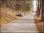
First, drive to Litija, and from there continue in the direction of the village of Sava. Follow the narrow road parallel to the Sava River to Mošenik, where it begins to climb. Continue along the macadam road, which joins the wider road from Kisovec near Zagorje at a higher level (access is also possible from this direction). Continue left and the road soon leads to the village of Rovišče. Just beyond the village, park in one of the roadside car parks (there are not many of them).
Path description:
From the starting point, continue along the road along which we parked, which after a few 10 steps leads us to a crossroads, where we continue along the right ascending road. Just a little further on, the path leads us to a marked crossroads where the path splits into two parts (steep and sloping).
If you have chosen to climb the steep path (the signpost says "difficult path"), continue slightly left on cart track, which starts to descend slightly. Follow this cart track to a left turn at the beginning of which an initially slightly less visible path branches off to the right and begins to climb through the forest. After a few minutes of further walking, the path turns slightly to the left and passes onto the steep slopes of the mountain, where it climbs over a crumbling rocky cliff (the path is not difficult, but a little more caution is needed). The steepness then quickly subsides and the path leads us further along a partly grassy slope, which is covered with sparse forest. Slightly higher up, the path changes to a wide path which we follow to the left. The path then climbs steeply once more and leads us in a few further steps to the mountain home on Zasavska Gora.
Just behind the mountain home, the road splits into two parts (circular route). Continue along the left road, which is more pleasant and leads us to the summit within a few minutes of further walking.

Pictures:
 1
1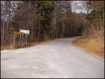 2
2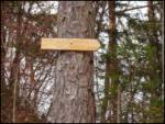 3
3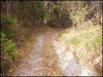 4
4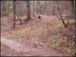 5
5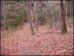 6
6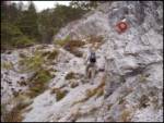 7
7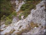 8
8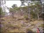 9
9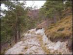 10
10 11
11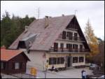 12
12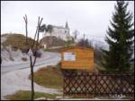 13
13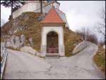 14
14 15
15 16
16 17
17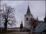 18
18
Discussion about the trail Rovišče - Zasavska Sveta gora (footpath)
|
| fpetel123. 03. 2008 |
Osebno sem moral na poti nekajkrat uporabiti tudi roke - samo za ravnotežje in boljši občutek, da ne bo pomote. Del pod kočo je kar močno strm in oznaka, da je pot zahtevna ni napačna. Sicer pa lepa, položna pot vse od Save - slabi dve uri - čeprav je nekaj tudi hoje po asfaltu.
|
|
|