Rotek - Sveti Marko (Spodnje Danje)
Starting point: Rotek (968 m)
| Lat/Lon: | 46,2272°N 14,032°E |
| |
Time of walking: 20 min
Difficulty: easy unmarked way
Altitude difference: -90 m
Altitude difference po putu: 5 m
Map: Škofjeloško in Cerkljansko hribovje 1:50.000
Recommended equipment (summer):
Recommended equipment (winter):
Views: 582
 | 2 people like this post |
Access to the starting point:
a) First drive to Škofja Loka, then continue driving in the direction of Železniki and Tolmin. A few kilometres after Zali Log we reach a crossroads at Podrošt, where we continue straight on in the direction of Sorica and Soriška planina (to the left Petrovo Brdo and Tolmin). When the road from Petrovo Brda joins us above Sorica from the left, we continue to the right, and then drive towards Soriška planina only as far as a crossroads, where the roads to Zgornji and Spodnje Danje branch off to the right. Park in a suitable place on the roadside. Recently, the road Podrošt - Sorica is often closed due to the rehabilitation of the road. In this case, use the detour by continuing towards Tolmin at Podrošt and then turning right at the first crossroads. After a fairly steep road, you will arrive in Sorica, where you will join the main road back to Soriška planina.
b) From the direction of Baška grapa, drive to Petrovo Brda, and from there turn left towards Soriška planina. Shortly after joining the road from Sorice, you will reach a crossroads where the roads to Zgornji and Spodnje Danje branch off to the right. Park in a suitable place on the roadside.
c) From Bohinjska Bistrica, continue driving towards Soriška planina, and from there start descending towards Sorice. After a few kilometres of descending to the left, the roads to Zgornji and Spodnje Danje branch off and park at a suitable roadside location.
Path description:
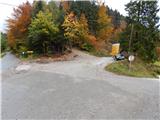
From the starting point, continue along the lower road towards the village of Spodnje Danje. The road first descends in a few serpentines, then continues crosswise to the right, where it first leads us past two successive waterfalls (in dry periods, the Presahneta stream). After a few minutes of crossing, we enjoy beautiful views of the surrounding hills, including a good view of our destination, St Mark's Church. When you reach the village, turn right at the crossroads in the middle of the village, then pass a few more houses to reach the hay meadow, along which you can walk to the aforementioned church.
Description and pictures refer to the situation in 2015 (October).
Pictures:
 1
1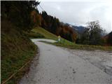 2
2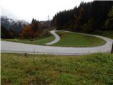 3
3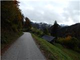 4
4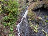 5
5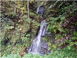 6
6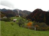 7
7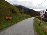 8
8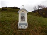 9
9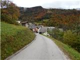 10
10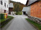 11
11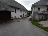 12
12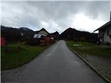 13
13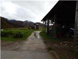 14
14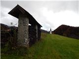 15
15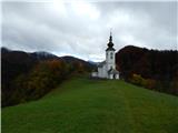 16
16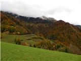 17
17
Discussion about the trail Rotek - Sveti Marko (Spodnje Danje)