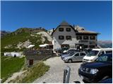
Rifugio Valparola - Setsas
Starting point: Rifugio Valparola (2175 m)
| Lat/Lon: | 46,53169°N 11,98868°E |
| |
Time of walking: 2 h 30 min
Difficulty: easy marked way
Altitude difference: 396 m
Altitude difference po putu: 600 m
Map: Tabacco 07 1:25.000
Recommended equipment (summer):
Recommended equipment (winter): ice axe, crampons
Views: 4.418
 | 2 people like this post |
Access to the starting point:
Access from Gorenjska: Via Border crossing Rateče or Predel to Trbiž / Tarvisio and then along the motorway towards Udine to the Tolmezzo exit. From Tolmezzo, follow the road towards Ampezzo and the Passo della Mauria mountain pass. The road then descends and leads to a crossroads where you turn left (possibly right) towards Cortina d'Ampezzo. At all subsequent junctions, follow the signs for Cortina d'Ampezzo.
In Cortina d'Ampezzo, follow the signs for the Passo di Falzarego Alpine pass. Follow this ascending road to the pass and then turn right towards Passo Valparola. At the pass, park in one of the car parks near the Rifugio Valparola hut.
From the coastal side: Take the motorway towards Venice/Venezia. At Portogruaro, leave the motorway towards Venice and turn right on the motorway towards Pordenone. At the next motorway junction near Conegliano, turn right towards Belluno. The motorway ends near Belluno and we continue towards Cortina d'Ampezzo at the next junctions. Continue as described above.
Path description:
From the Rifugio Valparola, continue south-west following the "Settsass" signs. The path then crosses the grassy slopes on the right side of Lake Lago di Valparola and leads to a crossroads. Continue right on route 24, which leads to the summit of Settsas.
The trail then begins to climb gently up the still mostly grassy slopes on the south side of the summit of Piz Ciampei. This trail then leads to a nondescript saddle where you cross a grazing fence.
The path then becomes a little more level for a while and leads to the foot of the slopes of Le Pale de Gerda, where there are some ruins from the First World War. The path then turns slightly to the right and climbs gently a few times before descending a little further and crossing under the northern slopes of the Setsas peak. Here the path offers a very fine view of the Val Badia valley and the Puez and Lavarella mountain groups. The trail, which descends about 200 metres, then passes through a short lane of larch forest and leads to the grassy slopes on the north-west side of Setsas Peak. Here the path climbs steeply again and leads to a crossroads.
The path to the right leads to hut Pralongia, and we continue to the left following the 'Setsas' signs. From the crossroads, the path then climbs gently parallel to the ridge and follows a mostly grassy terrain southwards. When you reach the ridge, continue left, and a second trail joins from the Pralongia hut on your right. Here you also have a very nice view of the Marmolada and Sella mountain groups. For a while we continue to climb gently on the wide grassy terrain, and then the path leads us to the rocky slopes. The path then follows the ridge to the north and climbs mostly transversely to the east. Soon we will also see the cross at the top of the mountain and there is only a short climb to the summit, from which we can enjoy magnificent views on all sides.

Pictures:
 1
1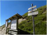 2
2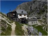 3
3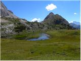 4
4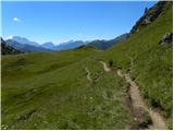 5
5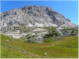 6
6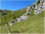 7
7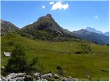 8
8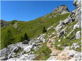 9
9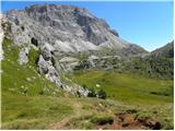 10
10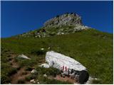 11
11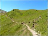 12
12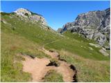 13
13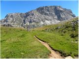 14
14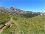 15
15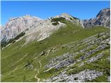 16
16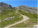 17
17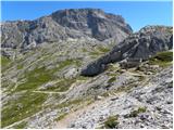 18
18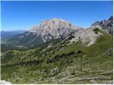 19
19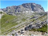 20
20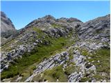 21
21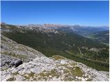 22
22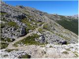 23
23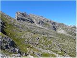 24
24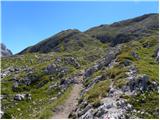 25
25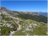 26
26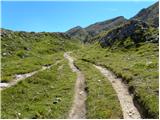 27
27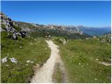 28
28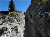 29
29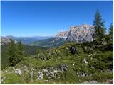 30
30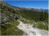 31
31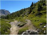 32
32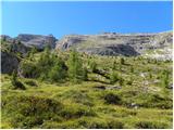 33
33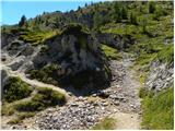 34
34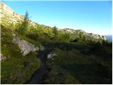 35
35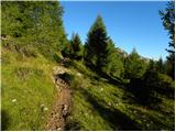 36
36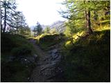 37
37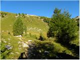 38
38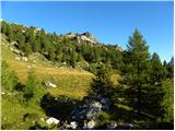 39
39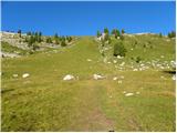 40
40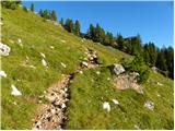 41
41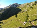 42
42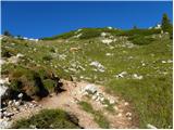 43
43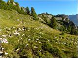 44
44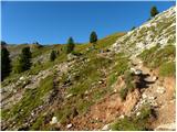 45
45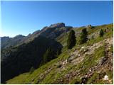 46
46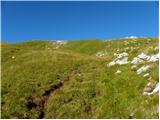 47
47 48
48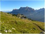 49
49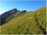 50
50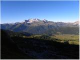 51
51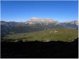 52
52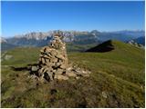 53
53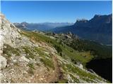 54
54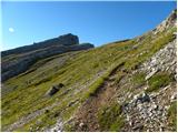 55
55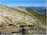 56
56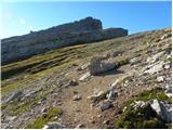 57
57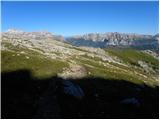 58
58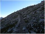 59
59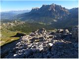 60
60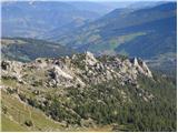 61
61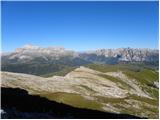 62
62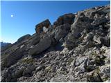 63
63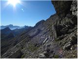 64
64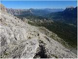 65
65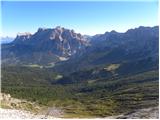 66
66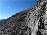 67
67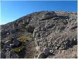 68
68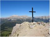 69
69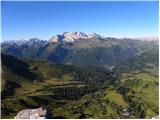 70
70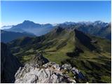 71
71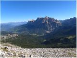 72
72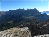 73
73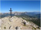 74
74
Discussion about the trail Rifugio Valparola - Setsas
|
| Savinja1120. 07. 2024 10:19:27 |
Parkiranje na prelazu Valparola je brezplačno, cene v koči podobne našim. Pot na goro je glede na njeno nadmorsko višino enostavna in nudi čudovite razglede na vse strani. Vredna obiska.
|
|
|
|
| jprim20. 07. 2024 16:07:01 |
Ja, se strinjam, da so cene primerljive našim, samo razlika je v tem, kaj ti nudijo za to ceno. Sem pred leti prespala dve noči v tej koči, poznam dobro naše planinske razmere, tako da ta trditev @savinja je brezpredmetna. Samo primerjaj bivanje v tej koči in jedilnici s Planiko.   LP!
|
|
|
|
| mirank20. 07. 2024 20:46:21 |
Primerjate obcestno krčmo z visokogorsko postojanko. Je pa dejstvo, da je razlika v kvantiteti, kvaliteti in še čim. Za primer lani junija s kolegico spijeva kavo in si podeliva en šnopček na K podih za 10eur. Čez kak mesec v koči Marinelli za tri kapučine, pivo in kozarec ledenega čaja ali nekaj takega pa 11eur. Tu lahko primerjaš vsaj po legi je podobno.
|
|
|
|
| dprapr21. 07. 2024 06:06:12 |
Točno takšno stanje je s cenami, kot je zapisal mirank.
|
|
|
|
| gor_nik21. 07. 2024 13:18:45 |
Tudi sam sem bil pred kratkim v Dolomitih in sem še vedno pod njihovimi vtisi. Hočeš ali nočeš, človek primerja njihove cene, storitve in razmere z našimi. Na splošno je ljudi vsako leto več v teh krajih. Sklepam, da zaradi cen, storitev in lepot, ki jih lahko dobijo tam v primerjavi z drugimi kraji (tudi našimi).
Čeprav tudi Italijani postavljajo vse več zapornic/parkirišč, so to urejena, velikokrat asfaltirana parkirišča, z narisanimi oznakami. Cene parkiranja na teh parkiriščih je bistveno ceneje, kot v Vratih ali v Bohinju. Lahko pa se brez težav parkira kakšnih par deset metrov naprej ali prej, ne da bi bil v prekršku.
Pivo (0,5 l) je običajno 6€. Tudi tam, kjer ga morajo pripeljati s helikopterjem (n.pr. jezero Sorapis itd). Cena dobre kave je primerljiva našim. Poti so dobro vzdrževane in označene, da o cestah ne izgubljam besed. Opazil sem tudi veliko lokalnih avtobusov, ki povezujejo kraje v Dolomitih in ogromno ljudi, ki se poslužuje le-teh. Sam nisem koristil teh storitev, vendar glede na število potnikov v avtobusih in na postajališčih sklepam, da je zadeva ugodna in uporabna.
Glede na to, da je debata v temi Valparola – Setsas: Koče na Valparoli in na Planiki se dejansko ne da primerjati. Ne v dobrem in ne v slabem, saj prva leži ob asfaltirani cesti, druga pa pod Triglavom. Na poti na Setsas in na vrhu pa ni nobene koče. Če pa bi bila, hm, hm, takrat pa bi lahko kakšno rekli okrog storitev, urejenosti, sanitarij itd. Dejansko je parkiranje na izhodišču Valparola za Setsas brezplačno, kot je napisala Savinja11, medtem ko so izhodišča za Planiko/Kredarico/Dolič druga pesem, ki se obravnava v drugih temah na tem forumu.
|
|
|