Rifugio Auronzo - Croda Fiscalina di Mezzo / Oberbachernspitze
Starting point: Rifugio Auronzo (2320 m)
| Lat/Lon: | 46,6122°N 12,2941°E |
| |
Time of walking: 2 h 30 min
Difficulty: easy marked way
Altitude difference: 355 m
Altitude difference po putu: 500 m
Map: Tabacco 10 1:25.000
Recommended equipment (summer): lamp
Recommended equipment (winter): ice axe, crampons, lamp
Views: 9.278
 | 1 person likes this post |
Access to the starting point:
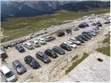
Access from Gorenjska: Take the Border crossing Rateče road to Trbiž / Tarvisio, where you take the motorway towards Udine. Leave the motorway at the exit for Tolmezzo and follow the road to the above-mentioned place. From Tolmezzo, continue in the direction of Ampezzo and the Passo della Mauria mountain pass. The road then begins to descend and leads into the Cadore valley, where you continue to the right (Belluno and Cortina d'Ampezzo on the left) in the direction of Auronzo. After a few more km of driving, we reach the next major junction, where we turn right towards Austria and Tre Cine / Tre Cime (left Cortina d'Ampezzo). We leave the road towards Austria after a few more 100m, as the signs for Tre Cine / Tre Cime direct us right onto a toll mountain road, which after 7km leads us to a large parking lot near the rifugio Auronzo hut.
From the Primorska side: Take the motorway which leads via Border crossing Sežana to Trieste. Continue on the Italian motorway towards Padua, but only as far as the motorway junction where you continue towards Veneto and Belluno. Near Belluno the motorway ends and we continue towards Cortina d'Ampezzo and Auronzo. As the road enters the Cadore valley, we come to a large junction where the road towards Cortina d'Ampezzo goes left and the road towards Auronzo goes right. Here we continue to the right towards Auronzo. Continue as described above.
Path description:
At the Auronzo hut, take the macadam road leading slightly east towards the Lavaredo hut. After about 20 minutes' walk along a very scenic road that leads under the mighty walls of the Three Cinquefoils, you will reach the Lavaredo hut.
From the hut, continue along the road, which quickly leads to a crossroads where you turn right towards Piani di Lavaredo. The path, which continues along the mulatiera, descends past a small lake and then, after crossing scree, leads to extensive meadows where, especially in the morning and evening, you can see many marmots. Here, a less visible path on the left leads to Monte Paterno, and we continue on the mulatier, which begins to climb and, after a short ascent, leads us to the beautiful high-mountain lake "Laghi di Cengia". Just after the lake, the path starts to climb steeply and turns slightly to the left. During the ascent, a mountain path branches off from the mulatiera to the right in the direction of the 'bivacco de Toni', and we continue straight on along the path, which leads us past ruins and a small spring to the next meadow, which we cross in a cross-climb to the left. At the top of this ascent, the path leads to a crossroads where we continue to the right (Monte Paterno to the left, straight down rifugio Locatelli). The scenic route then leads us past a cross to a slightly exposed but very wide artificial shelf, after which the path turns left and, after a short descent, leads us to the Pian di Cengia hut.
To ascend to the Croda Fiscalina di Mezzo summit, continue along the left-hand side of the hut, following a slightly less well-marked, but still clearly visible, path. The scenic route, which ascends only gently, slowly turns to the right and leads us a little higher to a notch, from which a fine view of a mighty ravine opens up on the left. The path then retreats to the right and leads us to a military tunnel through which the mountain trail passes (the tunnel is short, so a torch is not mandatory but is recommended due to the puddles in the tunnel). The way forward begins to climb steeply and after a further 10 minutes of walking leads us to a precipitous peak.

Pictures:
 1
1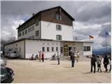 2
2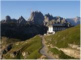 3
3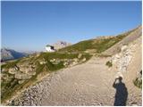 4
4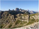 5
5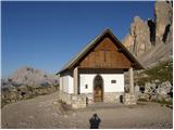 6
6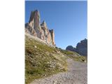 7
7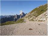 8
8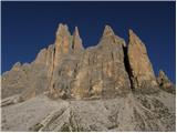 9
9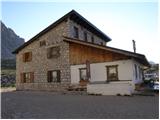 10
10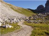 11
11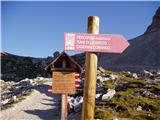 12
12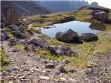 13
13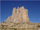 14
14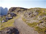 15
15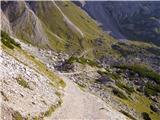 16
16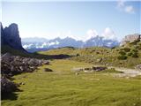 17
17 18
18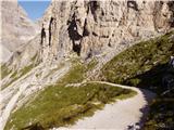 19
19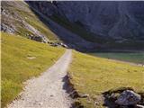 20
20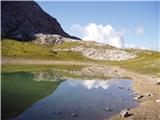 21
21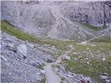 22
22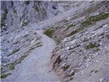 23
23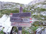 24
24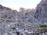 25
25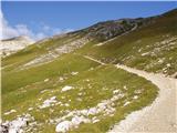 26
26 27
27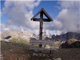 28
28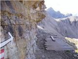 29
29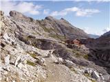 30
30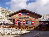 31
31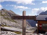 32
32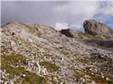 33
33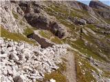 34
34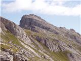 35
35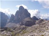 36
36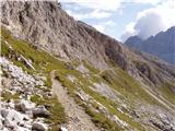 37
37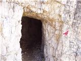 38
38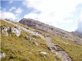 39
39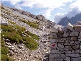 40
40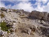 41
41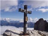 42
42
Discussion about the trail Rifugio Auronzo - Croda Fiscalina di Mezzo / Oberbachernspitze
|
| mirank3. 08. 2012 |
Pripomnil bi, da je opis dostopa preko Italjanskih avtocest zelo površen. Mesto Veneto ne obstaja pač pa je pravilno Vittorio Veneto. Do tja ni nobene potrebe riniti v smeri Padove pač pa v Portogruaru desno v smeri Pordenona in Conegliana skrajšaš po lepi avtocesti, ki vodi v smeri Longarona po dolini Piave. Zna biti še krajši dostop mimo Udin, Tolmezza in preko prelaza Mauria.
|
|
|
|
| Borut14. 09. 2018 |
Ob povratku lahko na razpotju na prevalu (slika 27) zavijemo desno proti koči Rifugio Locatelli in naredimo krožno pot do izhodišča. Slikovita pot proti Rifugio Locatelli, ki se najprej strmo spušča, vodi mimo lepega jezera in ponuja čudovite razglede, kasneje pa nam omogoči, da si ogledamo Tre Cime še z druge strani. S to izbiro si užitke na poti podaljšamo še za kakšne tri četrt ure.
|
|
|