Ribniška koča - Rogla (via Lovrenška jezera)
Starting point: Ribniška koča (1507 m)
| Lat/Lon: | 46,4974°N 15,2555°E |
| |
Name of path: via Lovrenška jezera
Time of walking: 3 h 45 min
Difficulty: easy marked way
Altitude difference: 10 m
Altitude difference po putu: 430 m
Map: Pohorje 1:50.000
Recommended equipment (summer):
Recommended equipment (winter): ice axe, crampons
Views: 361
 | 1 person likes this post |
Access to the starting point:
a) From the road Maribor - Dravograd, before the village of Brezno, turn left in the direction of Podvelka, Ribnica na Pohorju and Ribniška koča. After the bridge over the Drava River, we arrive at Podvelka, and we follow the road in the direction of Ribnica na Pohorju. After about 10 km from the bridge over the Drava, we reach the centre of Ribnica na Pohorju, where we turn left. There is a further climb of about 8 km, mostly on a dirt road, to Ribniška koča, where we park.
b) From Dravograd, drive towards Maribor, and after Radlje ob Dravi at the roundabout, leave the main road towards Maribor and continue driving towards Vuhred, Ribnica na Pohorje and Ribniška koča. After the bridge over the Drava River, we arrive at Vuhred, and we continue along the road in the direction of Ribnica na Pohorje. After about 10 km from the bridge over the Drava, we reach the centre of Ribnica na Pohorju, where we turn right. There is a further climb of about 8 km, mostly on a dirt road, to Ribniška koča, where we park.
Path description:
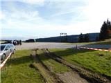
From Ribniška koča, take the path in the direction of Jezerski vrh and Ribniško jezero and initially walk along the road that led to the starting point and in a gentle downhill to the saddle between Mali Črni vrh and Jezerc peak. At the saddle, where it is also possible to park, we leave the road and take the marked footpath, which ascends first gently and then steeply to the monument at Jezerski vrh, which we reach in about 10 minutes of an increasingly scenic ascent.
From Jezerski vrh continue slightly left towards Lovrenška jezera and Roga (left Ribniško jezero for 5 minutes) and start descending through sparse forest. Soon we join a path leading past Ribniško jezero on our left, and we continue our initially moderate descent through sparse woodland, then into dense woodland, and the path descends a little more steeply. During the descent, a short path branches off to the left to the sign of the two downed airmen, and we continue our descent to the Šiklarica Pass. After the preval, we start climbing again, and at a few small crossroads we follow the signs. A little further on, we pass a spring, and after it we climb quite steeply for a few minutes. Higher up, the path is laid and leads us out of the forest to the meadow of Planinka, over which we climb, mostly gently to moderately, with increasingly beautiful views. Higher up, the path turns right and just a little further on we are joined on the left by the path from Lovrenec na Pohorju. There are some more crossings with fine views, and then the path passes into a rare forest, where it passes under the Lovrenška jezera plateau, and as a result we cross a large number of small streams. After a few minutes of crossing, you reach a marked crossroads, where you continue left in the direction of Lovrenška jezera and Roga (slightly right Rogla - the path that bypasses Lovrenška jezera) and start climbing up wooden bridges. After a few minutes of climbing, we merge with the eastern path from Roga, and we go left and quickly reach the lookout tower at Lovren Lakes.
From the tower, we have a beautiful view of the plateau where the lakes are located, and from the tower we continue along the wooden bridges that lead us to the lakes during the dwarf pines.
From the lakes we return to the last crossroads and continue in the direction of Roga and Koča na Pesku.
Then descend through a partly sparse forest, initially mostly on wooden bridges, but lower down on the cart track, which crosses the slopes to the left with a few short ascents and descents. During the crossing, the path also leads us over a few streams, and on the downhill part we reach a marked crossroads, from which we continue straight on towards Roga (left down Koča na Pesku and Mašin žaga). A few more easy crossings follow, and we arrive at the Komisija saddle, where we join up with the path that bypasses Lovrenška jezera.
Continue straight on towards Rogla and climb in a moderate ascent to the undistinguished summit of Ostruščica.
From Ostruščice we continue in the direction of Rogla, but the trail continues to lead us along a worse road, which in winter is converted into a cross-country trail (when the cross-country trail is in use, we walk along a parallel walking trail), and a little lower down the trail leads us along a pleasant grassy path. After a few minutes, you reach an asphalt road, which you follow to the left, and when you reach the bottom of the 4-seater chairlift, continue to the right, then walk to the top station of the chairlift, from where you descend in a few steps to the large parking lot near the Planja Hotel.
From the parking lot, continue along the road towards the Cottage on the Sand. The road initially leads between the football pitch on the left and the church on the right. As soon as the playground ends, leave the road and continue slightly to the left along the initially parallel mountain path. The path ahead leads us past the NOB monument, behind which we gradually pass into a sparse spruce forest. There are a few crossroads where you follow the signs for the tower at Rogla. After about 15 minutes' walk from the Planja Hotel, the rather tortuous path, which follows the route of a winter cross-country skiing track, leads us to the top of Rogla, where the 30-metre-high lookout tower stands.
If there is no risk of thunderstorms, you can climb the tower at your own risk, from which you will have a beautiful view over most of Pohorje and, in good visibility, also Karawanks, Kamnik Savinja Alps and Triglav.
Ribniška koča - Jezerski vrh 0:15, Jezerski vrh - Lovrenška jezera 1:50, Lovrenška jezera - Ostruščica 1:10, Ostruščica - Hotel Planja 15 minutes, Hotel Planja - Rogla 15 minutes.

Pictures:
 1
1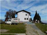 2
2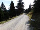 3
3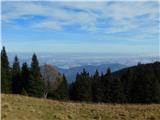 4
4 5
5 6
6 7
7 8
8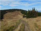 9
9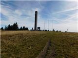 10
10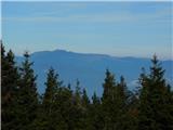 11
11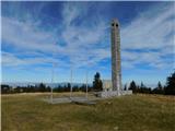 12
12 13
13 14
14 15
15 16
16 17
17 18
18 19
19 20
20 21
21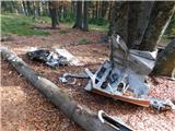 22
22 23
23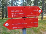 24
24 25
25 26
26 27
27 28
28 29
29 30
30 31
31 32
32 33
33 34
34 35
35 36
36 37
37 38
38 39
39 40
40 41
41 42
42 43
43 44
44 45
45 46
46 47
47 48
48 49
49 50
50 51
51 52
52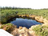 53
53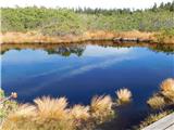 54
54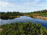 55
55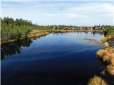 56
5657
 58
58 59
59 60
60 61
61 62
62 63
63 64
64 65
65 66
66 67
67 68
68 69
69 70
70 71
71 72
72 73
73 74
74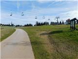 75
75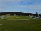 76
76 77
77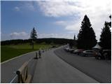 78
78 79
79 80
80 81
81 82
82 83
83 84
84 85
85 86
86 87
87 88
88 89
89 90
90 91
91 92
92 93
93 94
94
Discussion about the trail Ribniška koča - Rogla (via Lovrenška jezera)