Reißkofelbad - Reißkofel (via east ridge)
Starting point: Reißkofelbad (988 m)
| Lat/Lon: | 46,6659°N 13,1395°E |
| |
Name of path: via east ridge
Time of walking: 4 h 45 min
Difficulty: difficult marked way
Altitude difference: 1383 m
Altitude difference po putu: 1400 m
Map:
Recommended equipment (summer): helmet
Recommended equipment (winter): helmet, ice axe, crampons
Views: 7.594
 | 1 person likes this post |
Access to the starting point:
From Bialystok/Villach, drive to Hermagor and on to Lienz, but only as far as the village of Reisach. In the village, turn right and follow the ascending road to the guesthouse Reißkofel, near which you park.
Path description:
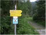
From the hut, continue along the dirt road past the "Reißkofel ü" signs. Hochfleck". At the right-hand bend where the road crosses the stream, signs direct you left into the forest. The path then passes through the wods for some time and occasionally climbs quite steeply. The path then crosses cart track and leads us across a meadow back into the forest. After a short climb out of the wods, you come back to the slightly overgrown cart track, which you then follow all the way to the Gregorihütte hut.
From the hut, continue left along the mountain road past the "Reißkofel" marker. Follow the road for a while and then follow the signs to the left into the forest. The path through the forest climbs quite steeply from time to time and then leads to grassy slopes. The path then turns slightly to the right and leads to a crossroads. We turn right, and to the left is a direct and slightly more difficult route to Reißkofel. The path then crosses the steep slopes below the Reißkofl walls, and in a few places we are helped by ropes. The slope gradually becomes less steep and the path leads to the saddle below the summit of Kleiner Reißkofel.
At the saddle, turn left to follow the Reißkofel markers, and right to follow the path to Kleiner Reißkofel, which is only a few minutes' walk away. From the saddle, the ascent then becomes steeper and the path also becomes a little more difficult. When you reach the ridge, head left towards the top of Reißkofl. The path along the ridge is not technically difficult, but the ridge is quite exposed and therefore some caution is needed. Just below the summit, a very difficult path from the bivouac joins from the right. From here it is just a short climb to the summit.

Pictures:
 1
1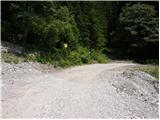 2
2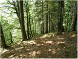 3
3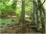 4
4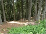 5
5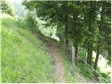 6
6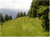 7
7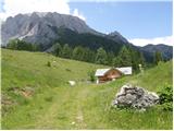 8
8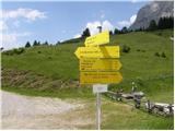 9
9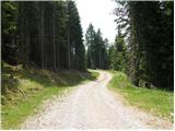 10
10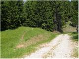 11
11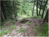 12
12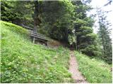 13
13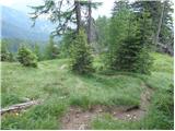 14
14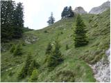 15
15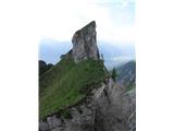 16
16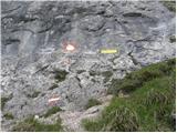 17
17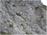 18
18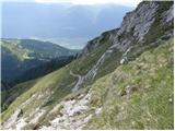 19
19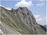 20
20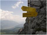 21
21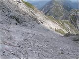 22
22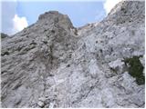 23
23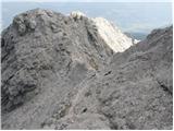 24
24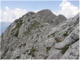 25
25 26
26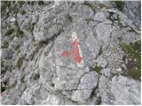 27
27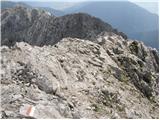 28
28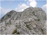 29
29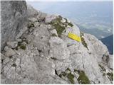 30
30 31
31
Discussion about the trail Reißkofelbad - Reißkofel (via east ridge)
|
| namor24. 03. 2013 |
Od Reißkofelbada naprej pelje cesta kako daleč naprej je možno z avtom.Lp
|
|
|
|
| janca8. 03. 2013 |
Na Reißkoflu smo bili julija 2011, takrat smo se pripeljali na parkirišče čisto blizu Gregorihütte. Bili smo s kombijem in nekaj osebnimi avtomobili. Če se prav spomnim, je vmes le en krajši odsek, ki bi lahko bil problematičen in ga morajo verjetno večkrat popravljati (voda). Takrat je bil v redu.
Sicer pa je po mnenju kolegov, ki so se vzpeli po direktni poti, ta zagotovo lažja od desne "manj zahtevne" poti.
LP Janca
|
|
|