Razglednik - Altemaver (Ratitovec)
Starting point: Razglednik (1205 m)
| Lat/Lon: | 46,2523°N 14,0046°E |
| |
Time of walking: 3 h 10 min
Difficulty: easy marked way
Altitude difference: 473 m
Altitude difference po putu: 600 m
Map: Škofjeloško in Cerkljansko hribovje 1:50.000
Recommended equipment (summer):
Recommended equipment (winter): ice axe, crampons
Views: 6.542
 | 1 person likes this post |
Access to the starting point:
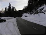
a) From the motorway Ljubljana - Jesenica take the exit Lesce and follow the road towards Bled and on to Bohinjska Bistrica. From Bohinjska Bistrica turn left towards Tolmin and Soriška planina. Above the village Nemški Rovt you will reach a marked crossroads, where you continue right in the route Soriška planina (slightly left Škofja Loka and Železniki). On the road to Soriška planina, pass the trail (road) turnoff to Orožnovo hut (the turnoff for Orožnovo hut is marked, but it branches off the main road to the right), and then follow the main road for about 1 km, where you will see a small parking area on the right, and on the left you will see a road that branches off sharply to the left and continues towards mountain pasture Pečana. At the crossroads, you can also see the first markings and a mountain direction sign for Ratitovec.
b) From Železniki or Podbrdo, take the first exit to Soriška planina and then continue towards Bohinjska Bistrica. From the parking lot at Soriška planina drive for about 1 km and then you will see a forest road turning off to the right, leading to mountain pasture Pečana. Park at the crossroads on the left side of the road in a small parking lot.
Path description:
From the starting point, first cross the road carefully and then turn onto the macadam road towards Ratitovec. The road quickly enters the forest, through which it starts to climb moderately. Higher up, the road lays down and leads to a small marked crossroads.
Continue slightly to the left (to the right is the road leading to the nearby Črnji vrh 1486 m) and continue along the road, which climbs slightly and then descends again a few times. From the road, which continues through the forest, you will only rarely get some views of the western Karawanks and central Julian Alps. After about an hour and a half of walking, the road descends more visibly and brings us to a crossroads where the road from Bitenjska mountain pasture joins from the left.
Continue slightly to the right and start to climb gently, initially still through the forest, and then cross a short scenic slope. Quickly return to the forest and then reach the next crossroads, where you continue right in the direction of Ratitovec (straight ahead Rovtarica). The way forward leads us along the road, which continues through a small valley, and we are joined by the marked path from Bitenjska mountain pasture from the left only a few 10 metres further on. The road we are walking on soon ends and leads us to a parking and turning place under mountain pasture Pečana.
From the parking lot, continue along the wide cart track, which starts to climb relatively steeply through the forest. After about 10 minutes' walking, cart track lays down, and then only a little further on leads to the huts at mountain pasture Pečana.
A few steps above these huts we emerge from the forest onto grassy slopes, and we continue along the right side of mountain pasture for a few metres, then at the crossroads we continue right in the direction of Krek's hut (straight ahead Kosmati vrh and Vratca). The way ahead begins to climb moderately through an increasingly sparse spruce forest. Higher up, we finally emerge from the forest onto the vast pastures of Ratitovec, where we leave cart track and continue our ascent along a slightly less visible, but marked path which, after a few minutes of further walking, leads us to the top slopes of Ratitovec, where we join the path from Krekova koča to Altemaver. Here continue right (Krekova koča 5 minutes on the left) and start climbing steeply along the pasture fence. After a few minutes of climbing, the path leads us to the eastern front of Altemaver. There is a short descent, and then the marked path turns slightly to the right. Exactly at the point where the marked path leading to Soriška planina turns slightly to the right, we leave it and continue our ascent along a clearly visible path towards the summit of Altemaver, which continues along the ridge of Ratitovec. Follow this scenic route to the highest peak of Ratitovec, which is reached after a further 10 steps.

Pictures:
 1
1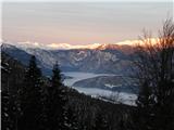 2
2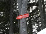 3
3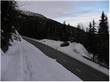 4
4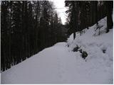 5
5 6
6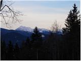 7
7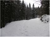 8
8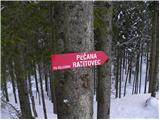 9
9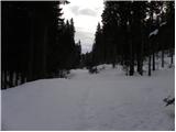 10
10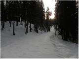 11
11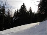 12
12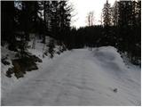 13
13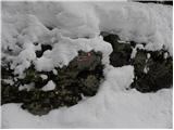 14
14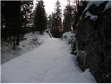 15
15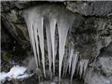 16
16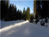 17
17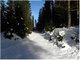 18
18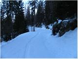 19
19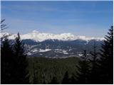 20
20 21
21 22
22 23
23 24
24 25
25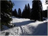 26
26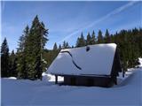 27
27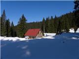 28
28 29
29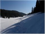 30
30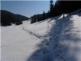 31
31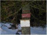 32
32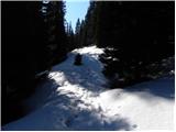 33
33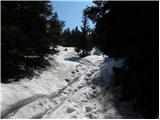 34
34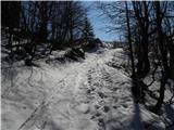 35
35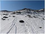 36
36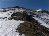 37
37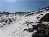 38
38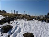 39
39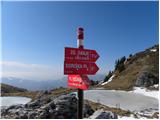 40
40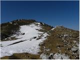 41
41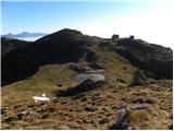 42
42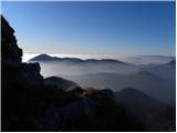 43
43 44
44
Discussion about the trail Razglednik - Altemaver (Ratitovec)