Ravne - Klek (direct way)
Starting point: Ravne (1200 m)
| Lat/Lon: | 46,4678°N 13,9917°E |
| |
Name of path: direct way
Time of walking: 2 h 5 min
Difficulty: difficult unmarked way
Altitude difference: 553 m
Altitude difference po putu: 700 m
Map: Kranjska gora 1:30.000 in Karavanke - osrednji del 1:50.000
Recommended equipment (summer):
Recommended equipment (winter): ice axe, crampons
Views: 5.735
 | 2 people like this post |
Access to the starting point:
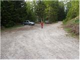
Leave the Gorenjska motorway at the Hrušica exit and follow the road in the route Kranjska Gora, but only as far as the village Dovje near Mojstrana. Turn right here (direction Dovje) and the road will quickly lead you to the mentioned village from where you will continue in the route Frauenkogel. The road will lead you to a crossroads shortly after the village, where you will continue on the right road (sharp left Mittagskogel and Borovje). Continue for some time to the next crossroads, where you turn sharp left in the direction of Frauenkogel (straight ahead Plavški Rovt). Follow this road, which then leads you past the grassy hay meadows called Ravne (a few holiday homes), to a ramp which prohibits further driving. You can park a little further down the road in one of the car parks along the road (from Dovje to the starting point is about 6. 5 km).
Path description:
From the parking lot, continue along the road along which you parked. The road, which climbs moderately and takes us past the ramp, then climbs higher and takes us to a small saddle between Bele peči on the left and Frauenkogel on the right. The road turns right here and after a few further steps leads to a point where a marked footpath branches off up to the left.
Continue along the road as it crosses the slopes in a moderate ascent to the east. After about an hour's walk from the starting point, the road makes a sharp left turn. In the middle of this bend, you will see a path, at first less visible, which climbs steeply, then turns right and crosses the slopes of Karawanks to the east. This is occasionally quite a scenic path, which occasionally ascends gently and then descends again, crossing a number of torrential ravines (some of which are a little more difficult to cross). However, as the path also runs on steep grassy slopes, there is also a high risk of slipping in wet conditions. The path continues on to the slopes of Rosenkogel, where we will see the mountain pasture pear to the right below us. The path that climbs a little more visibly leads us to the hunting huts on Rožca, where we also get on the marked path.
From the hunting lodge, we then immediately leave the marked path and continue our ascent along the less well-trodden path, which leads us in a few 10 steps to the border ridge (direction north). Here, we continue to the right towards the east along the border line on a path which gradually begins to climb steeper along the path surrounded by dwarf pines. Higher up, the path turns slightly left, flattens out and in a few further steps leads to the top of Klek.

Pictures:
 1
1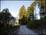 2
2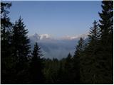 3
3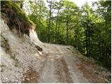 4
4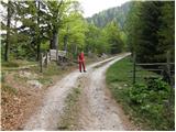 5
5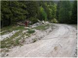 6
6 7
7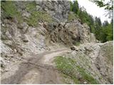 8
8 9
9 10
10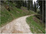 11
11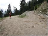 12
12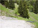 13
13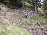 14
14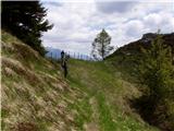 15
15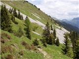 16
16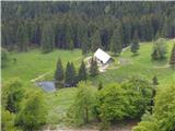 17
17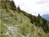 18
18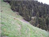 19
19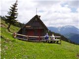 20
20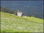 21
21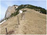 22
22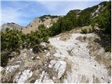 23
23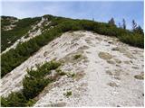 24
24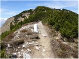 25
25 26
26
Discussion about the trail Ravne - Klek (direct way)