Ravne - Bela peč (above Dovje)
Starting point: Ravne (1200 m)
| Lat/Lon: | 46,4678°N 13,9917°E |
| |
Time of walking: 45 min
Difficulty: easy unmarked way
Altitude difference: 260 m
Altitude difference po putu: 260 m
Map: Kranjska Gora 1:30.000
Recommended equipment (summer):
Recommended equipment (winter): ice axe, crampons
Views: 769
 | 1 person likes this post |
Access to the starting point:
a) Leave the Gorenjska motorway at exit Jesenice West (Hrušica), then continue in the direction of Kranjska Gora. Follow the main road towards Kranjska Gora to the first road turnoff towards Dovjem, and follow the signs for Dovško Baba through and above the settlement. Continue for some time to the next crossroads, where you turn sharp left in the direction of Frauenkogel (straight ahead to Plavški Rovt). Follow this road, which then leads you past the hay meadows called Ravne (a few holiday homes), to a ramp that prohibits further driving. You can park a little further down the road in one of the car parks along the road (from Dovje to the starting point is about 6. 5 km).
b) First drive to Kranjska Gora, then continue to Jesenice. Leave the main road to Jesenice when the signs for Dovje direct you to the left, and follow the signs for Dovško Baba through and above the village. Continue for some time to the next crossroads, where you take a sharp left in the direction of Frauenkogel (straight ahead Plavški Rovt). Follow this road, which then leads you past the hay meadows called Ravne (a few holiday homes), to a ramp that prohibits further driving. You can park a little further down the road in one of the car parks along the road (from Dovje to the starting point is about 6. 5 km).
Path description:
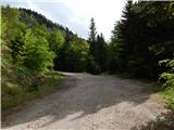
From the starting point, continue along the road along which you parked, which quickly leads to a ramp and a road sign prohibiting further driving. At first, the road opens up some views, and then we gradually climb up to the saddle between Bele peči and Frauenkogel, where, at the notice board "How to cross the pastures safely", we continue to the left on the marked trail leading towards Dovje. After a few steps, leave the marked trail, which turns left and continues parallel to the road, and continue straight ahead on the unmarked trail, which begins to climb towards Bela Peča. The sometimes quite steep path, where extra care is needed especially in the wet, leads us higher up or along the ridge, where the path is slightly laid, and we are only a few minutes walk away from the top.
Description and pictures refer to the situation in May 2020.
Pictures:
 1
1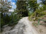 2
2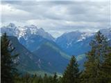 3
3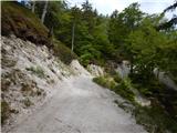 4
4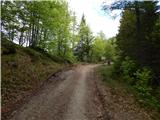 5
5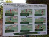 6
6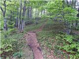 7
7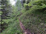 8
8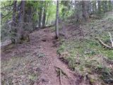 9
9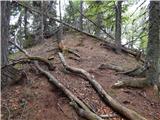 10
10 11
11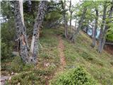 12
12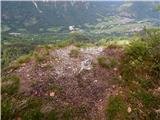 13
13 14
14
Discussion about the trail Ravne - Bela peč (above Dovje)
|
| Inja123421. 08. 2022 18:26:40 |
Lahko parkiraš tam, kjer piše, da je cesta dalje le za lastnike parcel in greš peš do rampe- el. pastirja, kjer je tabla za planino Dovško rožco, 50m pred rampo-zapora električni pastir, zavije levo v gozd strma stezica z eno samo markacijo na začetku. Po 20 min prideš na Belo peč.Zdaj je gor klopca. Jaz sem se odpravila na Dovško Babo in prišla pomotoma sem gor, a se splača...nato sem se vrnila na cesto in 100m naprej za el. pastirjem našla potem levo v gozd stezo za Dovško babo ter šla še tja. Vse skupaj 2,5 ure.
|
|
|