Rakovica - Sveti Jošt above Kranj
Starting point: Rakovica (370 m)
| Lat/Lon: | 46,2504°N 14,3226°E |
| |
Time of walking: 1 h 20 min
Difficulty: easy marked way
Altitude difference: 475 m
Altitude difference po putu: 475 m
Map: Škofjeloško in Cerkljansko hribovje 1:50.000
Recommended equipment (summer):
Recommended equipment (winter):
Views: 33.081
 | 3 people like this post |
Access to the starting point:
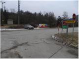
a) From Ljubljana, take the old road to Kranj, then follow the main road to the bridge over the Sava River. Just before the bridge, we leave the main road and continue straight ahead towards Besnice. Continue to the village of Rakovica, where you can park in a suitable space next to the bus stop.
b) From Jesenice or Bled, take the motorway towards Ljubljana and follow it to the Kranj - West exit. Continue along the old regional road towards Ljubljana, and we follow it to Kranj, where we turn right towards Besnice, just after the bridge over the Sava River. Continue to the village of Rakovica, where you can park in a suitable space next to the bus stop.
Path description:
From the parking lot next to the bus station, follow the asphalt road towards Zabukovje village. The road soon turns right into the forest, where it climbs moderately and leads to a small crossroads, where you continue left in the direction of Sveti Jošto. Continue along the road for some time, observing some individual markings along the way, and then pass a few houses and a small well, leading to an unmarked crossroads. Here we continue along the left "main" road, which leads us only a few 10 steps higher to a small hamlet where the markings direct us right between two houses. Leave the road behind the two houses and continue the ascent to the left along the marked footpath, which first climbs over a meadow and then passes into a forest, through which it climbs for some time along the cart track. Cart track turns into a steeper path higher up, which leads to a marked crossroads where the path from the village of Stražišče joins us on the left.
Here we continue to the right in the direction of Sveti Jošto and the path continues in a cross-climb to the right. A little higher you reach a larger chapel and above it the Puščava Home (Rod zelenega Jošta Association).
Near the above-mentioned home there is another chapel, next to which stands a mountain direction sign informing us that we can choose the left or right steep path for the climb to Jošt. Whichever way you choose, you will reach the top in a few minutes.

Pictures:
 1
1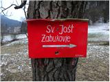 2
2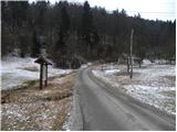 3
3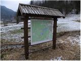 4
4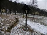 5
5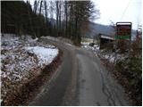 6
6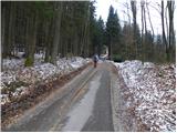 7
7 8
8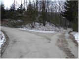 9
9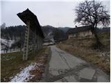 10
10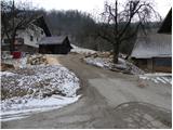 11
11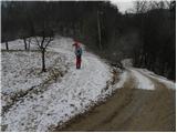 12
12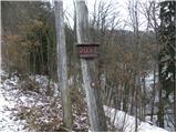 13
13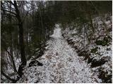 14
14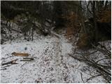 15
15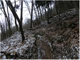 16
16 17
17 18
18 19
19 20
20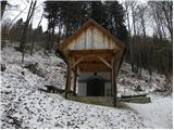 21
21 22
22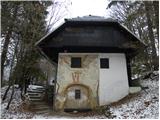 23
23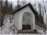 24
24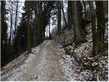 25
25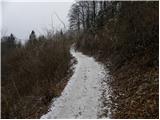 26
26 27
27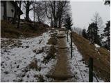 28
28 29
29 30
30
Discussion about the trail Rakovica - Sveti Jošt above Kranj
|
| vencelj131. 01. 2011 |
Lep izlet. Po fotkah sodeč je bilo to včeraj dopoldne (30.1.)...sem bil ravno gor. No, jaz sem prišel od cerkve Sv. Jedrt nad Lajšami čez Mohorja...
|
|
|
|
| Tadej1. 02. 2011 |
Slike so res od nedelje 30.1. Škoda, ker je bila nizka oblačnost in ni bilo razgleda. Sicer pa je bilo vseeno lepo.
|
|
|
|
| Lisica10. 02. 2011 |
Sama sem šla gor iz Zabukovja in sem hodila počasi 40 min. Tistim ki hočejo daljši izlet bi priporočila tega iz Rakovice-ob glavni cesti pustit avto preden se zavije proti Zabukovju in potem je še cca 10-15 min po lepi neprometni cesti čez vas. Za parkirat je kar problem, ker je cesta ozka in strma ob njej pa ni ravno veliko prostorov.
Po moje je ta pot max 1 h normalne hoje, nikakor pa ne 1,20 h. Žig se dobi v oštariji na vrhu-je treba vprašat zanj.
|
|
|
|
| EUGEN11. 02. 2011 |
Naša ekipa (žena,psička in jaz) smo šli:
Spod.Besnica(ribogojnica)-Špičasti hrib-Sv.Jošt-Ribogojnica.Dan (vreme )je bilo čudovito,razgledi fantastični.Priporočam.
|
|
|
|
| J.P.27. 03. 2021 |
Zelo lepa je krožna pot: Rakovica-Jošt- Špičasti hrib-Besnica-Rakovica. Lp
|
|
|
|
| Kranj27. 03. 2021 |
Se gre potem z ribogojnice do Rakovice po cesti???
|
|
|
|
| J.P.27. 03. 2021 |
Tako ja. Hitreje prehodiš ta del pa je manj naporno 
|
|
|