Starting point: Rakitna (789 m)
| Lat/Lon: | 45,8907°N 14,4397°E |
| |
Time of walking: 1 h 15 min
Difficulty: easy marked way
Altitude difference: -20 m
Altitude difference po putu: 100 m
Map: Ljubljana - okolica 1:50.000
Recommended equipment (summer):
Recommended equipment (winter):
Views: 2.706
 | 2 people like this post |
Access to the starting point:
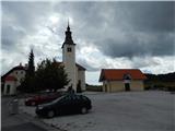
a) From the Ljubljana - Koper motorway, take the Brezovica exit and then continue in the direction of Podpeč (Podpeč can also be reached from Črna vas or Ig). In Podpeč, continue in the direction of Borovnica, Krima and Rakitna and continue along the edge of the Ljubljana Moor for a short distance before the signs for Rakitna direct you to the left onto a steeply ascending road. The road then leads through Preserje, where it also begins to descend. After a short descent, continue left towards Krima and Rakitna, and we then follow the mostly ascending road to Rakitna (after the turnoff for Krim, the road starts to descend), where we park in the parking lot next to the church.
b) First drive to Cerknica, then continue in the direction of Begunje, and when you arrive in Begunje follow the signs for Rakitna. When you arrive at Rakitna, park in the parking lot next to the parish church in Rakitna.
Path description:
From the parking lot, follow the marked trail or road in the direction of Krima, Doma v Iški Vintgar, Benko and Ustje farms, Vrbice and Osredek village. The road initially leads us past the chapel, the Mercator shop, and then after a short climb leads us to a place where a road branches off to the left to the nearby Café Krimček, and we continue slightly to the right and continue along the marked road. The road then leads us past a few pastures and houses, and then splits into two parts.
Continue up the road to the left (the road to the spa MKZ Rakitna leads off to the right) and after a short climb it splits again. This time continue to the right in the direction of Krvavice and Iški Vintgar (straight ahead Krim, Rotovc and Županov vrh) and continue along the asphalt road for a short distance. At the end of the settlement, turn left onto the macadam road, at which you will see a sign indicating that you will continue on the forest road. The road then leads us across to the right across what is at first a scenic slope, and then into the lane of the forest. A little beyond a small abandoned quarry, we arrive under a high-voltage power line, from where we get some views. Continue under the power line for a while, then the path turns right and passes into a dense forest. A little further on, on the right-hand side of the road, we see a rubbish dump behind a mesh fence, and a little further on, a path marked with a triangle joins us from the left.
Continue straight ahead, following the road, which ascends and descends gently a few more times, and then reaches a small crossroads where the carriageway, which is closed by a gate due to private land, continues to the right, and we continue straight ahead on the cart track, which descends quite steeply. When the two paths merge, you will see a cottage on the left, and a little lower down you will come to the farm Ustje, after which the road finally changes to cart track. Follow cart track along the edge of the fenced pasture to a marked crossroads, from where you continue along the right-hand path towards Vrbica (Benko homestead and Gornji Ig on the left).
After the crossroads, the path enters the forest and begins to climb gently. A little further on, the path gradually passes onto an initially still unmarked ridge, along and along which we continue a slight ascent. After a short cross-climb over a less vegetated slope, we reach the top of Trenko in a few steps. From the top, it is worth taking care to descend to the viewing pier, which rises steeply above Iški Vintgar. If you continue along the marked trail, you will reach the NOB memorial within a minute's walk.

Pictures:
 1
1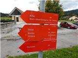 2
2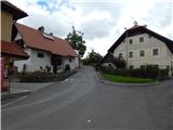 3
3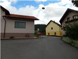 4
4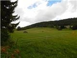 5
5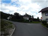 6
6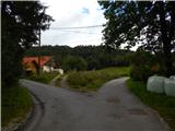 7
7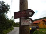 8
8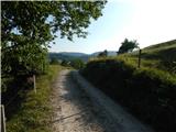 9
9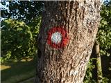 10
10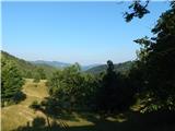 11
11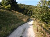 12
12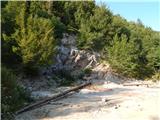 13
13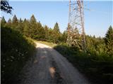 14
14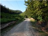 15
15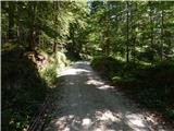 16
16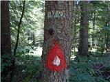 17
17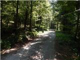 18
18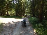 19
19 20
20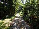 21
21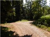 22
22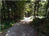 23
23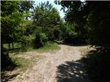 24
24 25
25 26
26 27
27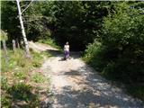 28
28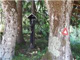 29
29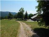 30
30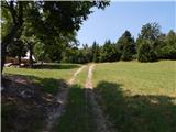 31
31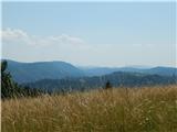 32
32 33
33 34
34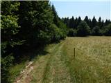 35
35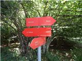 36
36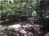 37
37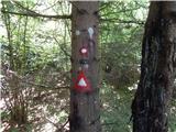 38
38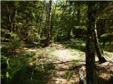 39
39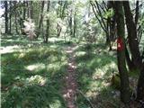 40
40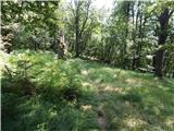 41
41 42
42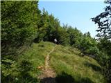 43
43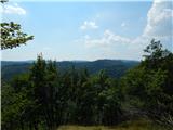 44
44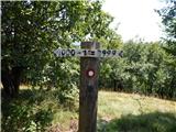 45
45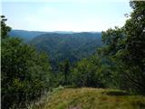 46
46
Discussion about the trail Rakitna - Trenk