Pri Mlinču - Mangartska planina
Starting point: Pri Mlinču (1094 m)
| Lat/Lon: | 46,4234°N 13,5937°E |
| |
Time of walking: 35 min
Difficulty: easy marked way
Altitude difference: 201 m
Altitude difference po putu: 201 m
Map: Julijske Alpe - zahodni del 1:50.000
Recommended equipment (summer):
Recommended equipment (winter): ice axe, crampons
Views: 2.990
 | 1 person likes this post |
Access to the starting point:
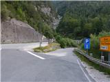
a) Cross Border crossing Rateče into Itali, then turn left at Trbiž / Tarvisio in the direction of Predel / Cave del Predil. After a few 100 m, take another left in the same direction, then at the junction by Lake Rabelais / Lago del Predil, continue straight on the main road towards Slovenia (right Neveje Pass (Na Žlebeh) / Sella Nevea). There are some serpentines and a tunnel, then you reach Border crossing Predel, after which you take the exit to Slovenia again. Just after the crossroads, a side road branches off, where there is a marked parking area.
b) From Primorska, drive to Log pod Mangartom, and from there continue towards Itali. Before reaching Border crossing Predel, turn right after the Predel bridge (bridge over Mangart stream) in the direction of Mangart. Park just after the bridge in the marked parking lot on the side of the road.
Path description:
From the starting point, we continue along the asphalt road leading to Mangartsko sedlo, and we follow it up to the first right turn, or to the place where it crosses the Mangart stream. At this bend, before crossing the bridge, continue straight on the footpath towards Mangart mountain pasture. Continue along the path with a fine view of Mangart, following the path which climbs parallel to the stream, and a little higher up, crossing the Stože landslide, which was triggered in November 2000. As you leave the area of the landslide, you gradually enter the woods, through which you climb moderately to the western edge of Mangart mountain pasture.
Description and pictures refer to the situation in 2016 (July).
Pictures:
 1
1 2
2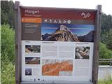 3
3 4
4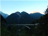 5
5 6
6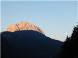 7
7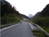 8
8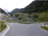 9
9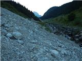 10
10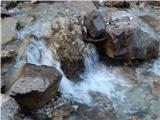 11
11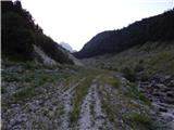 12
12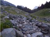 13
13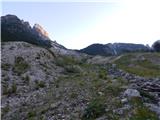 14
14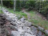 15
15 16
16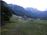 17
17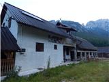 18
18
Discussion about the trail Pri Mlinču - Mangartska planina