Preval Poljance - Mengore (steep path)
Starting point: Preval Poljance (253 m)
| Lat/Lon: | 46,1642°N 13,7291°E |
| |
Name of path: steep path
Time of walking: 30 min
Difficulty: easy unmarked way
Altitude difference: 200 m
Altitude difference po putu: 200 m
Map: Julijske Alpe - zahodni del 1:50.000
Recommended equipment (summer):
Recommended equipment (winter):
Views: 7.267
 | 2 people like this post |
Access to the starting point:
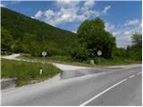
a) From Podbrdo or Idrija, drive to Most na Soči, then continue to Nova Gorica. The road quickly climbs above the village of Modrejce and leads to the Poljance Pass, where you turn right and then park after a few 10 m in a larger macadam parking lot.
b) First drive to Nova Gorica, then continue driving towards Bovec. Shortly before the village Čiginj, you will come to a crossroads where you leave the main road and continue driving to the right towards Kozaršče, Modrejce and Most na Soči. The road quickly leads to Kozaršče, and we follow it in a few serpentines to the Poljance Pass, where we turn left and then park after a few 10 m in a larger macadam parking lot.
c) From Bovec or Kobarid, drive towards Nova Gorica and turn left at a small crossroads above the village of Volče onto a local road, which leads quickly past the local factory and meadows to the village of Kozaršče, where we join the wider road. Here, turn left and follow the asphalt road to the nearby Poljance Pass, where you turn left and then, after a few 10 m, park in a larger gravel parking area.
Path description:
A few metres away from the parking lot, you will see an information board and the start of the "shorter" route to Mengore. From the information board, go into the woods and start climbing up the old military causeway. Higher up, we leave the mulatier, as the few signs on the trail direct us to the left onto a steeper footpath, which quickly climbs to a number of caverns. The path leading to Mengore turns right just before the caverns and climbs along them to a nearby, rather overgrown meadow. The partly overgrown path ascends to the nearby undergrowth, and just above the undergrowth we cross a wide cart track. From the crossing of cart track there is only a short steep climb and the path leads to the summit, in the middle of which stands the Church of St Mary.
Pictures:
 1
1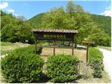 2
2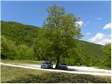 3
3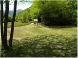 4
4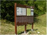 5
5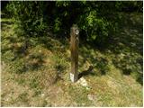 6
6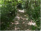 7
7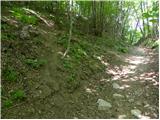 8
8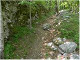 9
9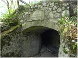 10
10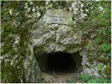 11
11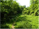 12
12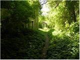 13
13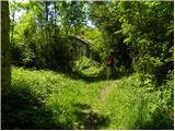 14
14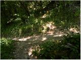 15
15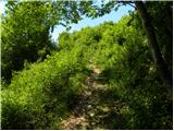 16
16 17
17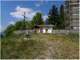 18
18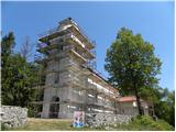 19
19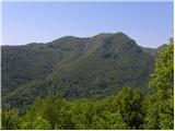 20
20
Discussion about the trail Preval Poljance - Mengore (steep path)
|
| Laščan21. 04. 2014 |
Zanima me, če tale pot sovpada z traso "Pot miru" in če je pot iz Volč tudi del "Poti miru"? Hvala!
|
|
|
|
| Laščan23. 04. 2014 |
Še enkrat prosim poznavalca teh koncev! Hvala !
|
|
|
|
| Laščan23. 04. 2014 |
Vseeno hvala za trud, čeprav so mi obe povezavi poznani! Varen korak in lepe razglede ti želim!
|
|
|