Predmeja - Kucelj na Čavnu (by road)
Starting point: Predmeja (1020 m)
| Lat/Lon: | 45,956°N 13,8541°E |
| |
Name of path: by road
Time of walking: 1 h 45 min
Difficulty: easy marked way
Altitude difference: 217 m
Altitude difference po putu: 300 m
Map: Goriška 1:50.000
Recommended equipment (summer):
Recommended equipment (winter):
Views: 13.259
 | 3 people like this post |
Access to the starting point:
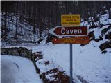
From central Slovenia, we drive to Logatec and on to Idrija, but only as far as Godovič. Here, turn left in the direction of Črni vrh. Follow this road towards Predmeja. After the village Predmeja, turn right towards the village of Lokve. Then follow the forest road to a sharp right turn where the road to Čaven turns left. Park here in a suitable parking space. There are a few small car parks nearby.
From the Primorska side, drive into the Vipava valley and follow the signs for the village of Lokavec. From here on, drive in the direction of Predmeje. The road, which is quite scenic in places, leads to a crossroads in front of Predmeja. Here, head straight in the direction of the village of Lokve and follow the road to a sharp right turn where the road to Čaven branches off to the left. Park here in a suitable space. There are a few small parking places nearby.
Path description:
From the parking lot, take the road towards Čavno. The road through the forest climbs gently and after about 15 minutes leads to a crossroads where you take the lower left road. Just a few minutes before the cottage, beautiful views of Primorska open up on the left side of the road. After that, it's just a short descent and we see the Čavno hut in front of us.
After the cottage, we come to the next crossroads, where we turn left downhill. The road soon enters the forest and starts to descend. After this descent, there is a short climb and you reach the signposts, where the sign for Kucelj directs you left up along the fence. After a few metres the path turns right and crosses the fence. Cross the grassy slope to where the path leads to a ridge. This part of the trail is difficult to follow as the trail is poorly visible in places. Once on the ridge, the path starts to climb steeply. The climb up the wide ridge is very pleasant as new views open up from step to step. Just a few metres below the summit, the path gives way to the ridge so that the summit is reached from the north.
Starting point - hut at Čavnu 1:00, hut at Čavnu - Kucelj 45 minutes.

We can extend the trip to the following destinations: Veliki Rob
Pictures:
 1
1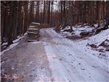 2
2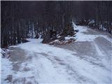 3
3 4
4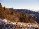 5
5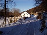 6
6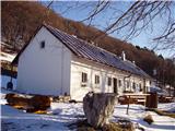 7
7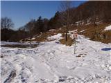 8
8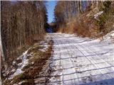 9
9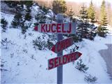 10
10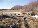 11
11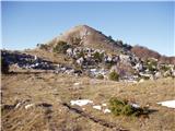 12
12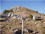 13
13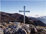 14
14
Discussion about the trail Predmeja - Kucelj na Čavnu (by road)
|
| Guest22. 04. 2007 |
bomo videli če je kucelj res kucelj ali je gora

|
|
|
|
| Guest25. 04. 2007 |
Zelo lepa pohodniška pot,prelep pogled na Vipavsko in Ajdovsko.Priporočamo!
|
|
|