Starting point: Prebersee (1514 m)
| Lat/Lon: | 47,1855°N 13,8537°E |
| |
Time of walking: 3 h 30 min
Difficulty: easy marked way
Altitude difference: 1226 m
Altitude difference po putu: 1226 m
Map:
Recommended equipment (summer):
Recommended equipment (winter): ice axe, crampons
Views: 7.742
 | 2 people like this post |
Access to the starting point:
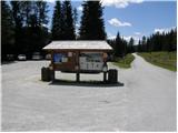
From the motorway Bialjak / Villach - Salzburg take the St. Michael exit and follow the road to Tamsweg, where you turn left in the direction of Sauerfeld (you can also get here from Murau). In Sauerfeld you will see signs for the Prebersee lake, which direct you to the ascending road, which you follow to a large parking lot in front of the lake.
Path description:
Along the main road near the parking lot you will see signs directing you to the dirt mountain road in the direction of Preber, Roteck. After walking a few dozen metres, you will come to a crossroads where you will continue straight along the road, which is blocked by wods. At the right-hand bend, signs then direct you to a footpath through the forest. After a short climb, the path leads us back to the road, which we follow for a short time, and then the signs direct us to the footpath again. The path later joins the mountain road twice more for a short time and then climbs up towards the cottage. If you miss the signs along the way, you can also follow the mountain road, which also leads to the PreberXXhalterhütte mountain hut.
Just above the hut, signs on a rock point slightly to the right (to the left is a direct route to the summit of Roteck). The path then climbs over grassy slopes to the north and leads to signposts. Continue straight up (to the right is the path to the Grazerhütte hut). The path then climbs up the left-hand side of the mountain stream and comes quite close to it a few times. Soon you reach the signposts again where you continue slightly to the left. The path then leads us in a slight ascent to the western slopes of the mountain where we come again to the crossroads of the path. Bear right after the Preber markers, and the path to the left leads to the Müchbachtörl saddle and on to Roteck. The trail then ascends the slopes towards the Rossscharte notch to reach the southern ridge of the mountain. Here the path turns left and there is a slightly steeper climb along the ridge towards the summit. The whole route to Preber is not difficult and is also very popular with touring skiers.

Pictures:
 1
1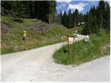 2
2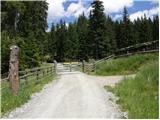 3
3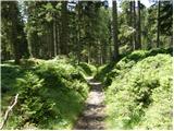 4
4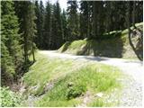 5
5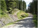 6
6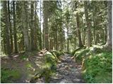 7
7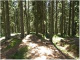 8
8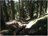 9
9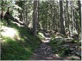 10
10 11
11 12
12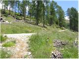 13
13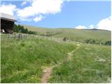 14
14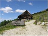 15
15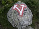 16
16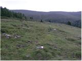 17
17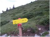 18
18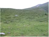 19
19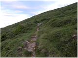 20
20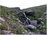 21
21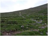 22
22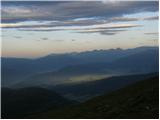 23
23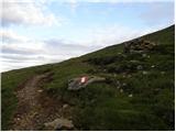 24
24 25
25 26
26 27
27 28
28 29
29 30
30 31
31 32
32 33
33
Discussion about the trail Prebersee - Preber
|
| katty16. 05. 2013 |
Včeraj se nas je družba 7 planincev odpravila na Preber....Zaradi snega smo turo še vedno šteli v zimsko,zato so bile dereze in cepin kot obvezna oprema v nahrbtniku....a zaradi manjših zaplat snega nismo ne enega in ne drugega niti potipali. Pot je sicer zelo razgledna,tako lahko vržemo oko tudi na Visoke ture....Kar močen veter nas je prisilil k hitremu sestopu....No,smo se veselil,da se bo veter nekje nižje kej umiril,pa je tud po grebenu kar vztrajal,šele pol v zadnji tretjini poti ga ni blo nč več....Se je pa vreme pol občutno izboljšalo,tko da smo imel res super razgled deleč naokoli....
Bil je lep dan,k smo ga preživel v dobri družbi in spremenljivem vremenu.
|
|
|