Starting point: Povlje (710 m)
| Lat/Lon: | 46,3296°N 14,3768°E |
| |
Time of walking: 2 h 5 min
Difficulty: easy unmarked way
Altitude difference: 769 m
Altitude difference po putu: 775 m
Map: Karavanke - osrednji del 1:50.000
Recommended equipment (summer):
Recommended equipment (winter): ice axe, crampons
Views: 3.232
 | 1 person likes this post |
Access to the starting point:
a) From the motorway Ljubljana - Jesenice take the exit Brnik, and when you reach the road Mengeš - Kranj, turn left towards Kranj. Follow the main road towards Kranj to the first roundabout, from where you take the first exit to the right towards Šenčur. Continue on the main road through Šenčur, and when you reach the road Kranj - Zgornje Jezersko, turn right towards Jezersko. When you reach Preddvor, leave the main road and turn left towards the centre of the town, and from there follow the signs for Bašelj. A little after Bašelj, the road descends to the Milka stream and crosses it via a bridge. Here, the road first branches off to the right into the village of Babni, Vrt, and then, a good 100 m further on, into the village of Povlje. Continue on the ascending road towards Povlje, and park in a small parking lot above the village. At the starting point there is a small crossroads, several mountain direction signs and a larger information sign for the Trstenik walking and learning trail "the path under Storžič".
b) From the motorway Jesenice - Ljubljana take the exit Kranj West, then continue towards Golnik. When you arrive at Tenetiše, leave the main road towards Golnik and turn right towards Trstenika. Approximately 1km after Trstenik you will reach a small crossroads where you turn left towards Povlje. Continue on the ascending road towards Povlje, and park in a small parking lot above the village. At the starting point there is a small crossroads, several mountain direction signs and a larger information sign for the Trstenik walking and learning trail "the trail under Storžič".
Path description:
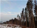
From the parking lot, take the road to the left in the direction of Velika and Mala Poljana (the path between the two roads leads to mountain pasture Javornik, also Dolenec's path to Velika Poljano). The road soon turns left, where it leads you past the waterworks and the quarry. A little further on, the road changes to cart track, and it climbs steeply. Shortly after cart track lays down and turns right into the forest, a marked footpath branches off from it a little further to the right, along which the ascent continues. Continue ascending along the stream for a short distance, then the path turns left and ascends cross-country, crossing a slightly undercut ravine in the last part. At the top of the ravine, we come to a kind of ridge between two streams, where the path from the villages of Goriče and Zalog joins us on the left. There is a short climb along a ridge with a view, and then we arrive at a marked crossroads, from where we continue to the right in the direction of Velika Poljane (slightly to the left Mala Poljana and Tolsti vrh).
The way forward leads us past the lookout point, where a small bench used to stand, but today it is just a stand. After enjoying the views across Gorenjska, we return to the path, which turns into a forest, through which it sometimes climbs quite steeply. The path climbs up the slope for a few minutes before returning to the wooded ridge where Andrej's bench stands. Here the path lays down transiently and then becomes steeper again. A little further on, the path turns right and climbs up a moderately steep ridge to a point where it joins the Dolenč path and the cart track path.
Continue along the initially gently sloping cart track, which leads past the "second refreshment room". After the refreshment room, cart track continues straight ahead, and we follow cart track slightly to the right on a parallel track which climbs slightly above the track. Higher up, we cross a track and some kind of grazing fence, and then gradually move out of the woods and onto grassy slopes. A little further on, we rejoin the track, and we can already see the hut on Velika Poljana in front of us, which is only a short, increasingly scenic climb away.
From the shepherd's hut we continue crosswise to the left (straight ahead Dom pod Storžičem, Mala Poljana and Storžič, sharp right mountain pasture Javornik), where in less than 5 minutes we reach Koča na Grebencu, from where a fine view opens up further west to the south-west.
Behind the hut, a fainter path branches off to the right, crossing the fence and leading further towards the top of Grebenec. The way forward is not the best, but it is relatively easy to follow, as most of the time it runs on or along the ridge. Higher up, the path crosses a few strips of forest, but keeps to the main ridge throughout, with the more difficult spots mostly to the right. During the ascent, the path climbs quite steeply a few times and occasionally crosses slopes prone to slipping, but in dry conditions the path does not pose a major danger as the harder parts can always be retreated to the right into the forest and then returned to the ridge. After about 15 minutes of ascent from Koča na Grebencu, you reach a fairly scenic summit.
Description and pictures refer to the situation in 2015 (January).

Pictures:
 1
1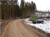 2
2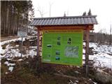 3
3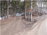 4
4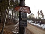 5
5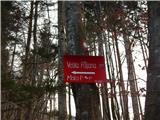 6
6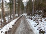 7
7 8
8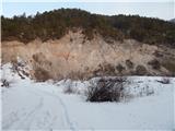 9
9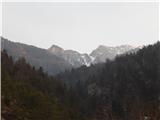 10
10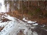 11
11 12
12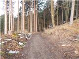 13
13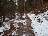 14
14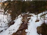 15
15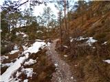 16
16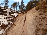 17
17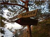 18
18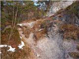 19
19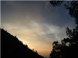 20
20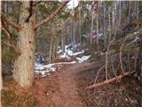 21
21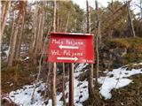 22
22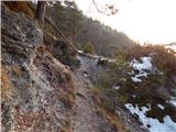 23
23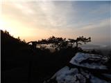 24
24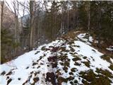 25
25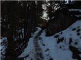 26
26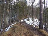 27
27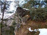 28
28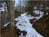 29
29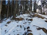 30
30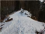 31
31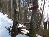 32
32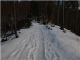 33
33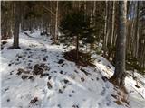 34
34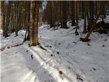 35
35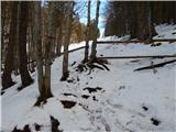 36
36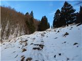 37
37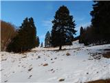 38
38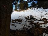 39
39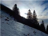 40
40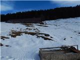 41
41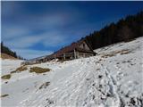 42
42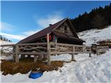 43
43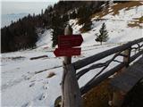 44
44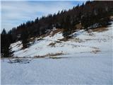 45
45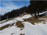 46
46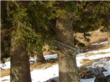 47
47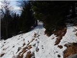 48
48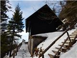 49
49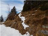 50
50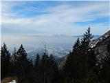 51
51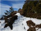 52
52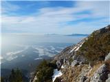 53
53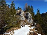 54
54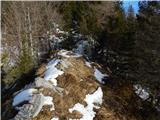 55
55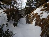 56
56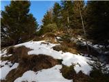 57
57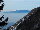 58
58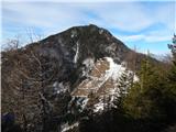 59
59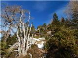 60
60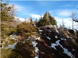 61
61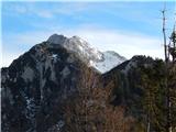 62
62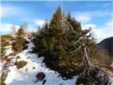 63
63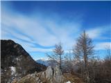 64
64 65
65
Discussion about the trail Povlje - Grebenc
|
| ločanka9. 04. 2024 07:29:50 |
Čudovit vrh, včeraj obiskan, a opazovan že dolgo vrsto let. Umeščen med Tolsti vrh in Storžič, značilen mali trikotnik tam vmes, dobro viden s kranjskih koncev in še od dalj. Pred veliko leti ga je en učitelj geografije predstavil z imenom Srna. To ne vem, je res kaj na tem. Vreden obiska v vsakem primeru!
|
|
|