Starting point: Potoki (600 m)
| Lat/Lon: | 46,4174°N 14,1209°E |
| |
Time of walking: 1 h
Difficulty: easy marked way
Altitude difference: 446 m
Altitude difference po putu: 446 m
Map: Karavanke - osrednji del 1:50.000
Recommended equipment (summer):
Recommended equipment (winter): ice axe, crampons
Views: 30.089
 | 5 people like this post |
Access to the starting point:
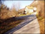
From the motorway Ljubljana - Jesenice take the exit Vrba and follow the road towards Jesenice. Shortly after Žirovnica, when we see a sign on the right side of the road for the municipality of Jesenice, we put the right turn signal as just a few dozen metres after this sign we turn right into the underpass (under the railway). The road on the other side of the railway turns left and we follow it to the end of the fence, where we park in a small parking lot along the road.
Path description:
Start walking along the road where you parked. When you get to the first houses, turn right onto a minor road that leads you to where the logs are stored. From here on, take the right cart track, which goes along the right-hand side of the brok. The path starts to climb steeply and eventually leads to a place where water comes out of the path. This spring dries up during dry periods. This part of the path is also quite muddy. The path continues to climb along the cart track and leads to a crossroads at a small stream.
Bear right after the Ajdna markers. Cart track has from here onwards quite a lot of crossroads marked everywhere but in some places the marking is poorly visible. But even if you don't see the markings, go right. Cart track then turns into a footpath that connects us to the upper path, which comes from Valvasor's home (or from the starting point Na Sušeh). Here we turn right and after a few minutes of climbing from the connection of the upper path the path leads us to the lookout point where we turn left along the ridge. This path leads us in a few steps to the archaeological settlements. The path goes left over the old settlements and leads to a ridge where a climbing path joins. From here we have only a few metres to the summit.

Pictures:
 1
1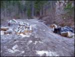 2
2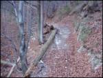 3
3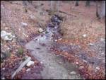 4
4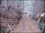 5
5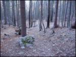 6
6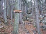 7
7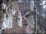 8
8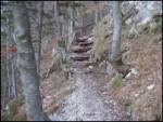 9
9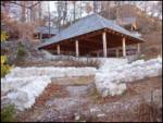 10
10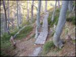 11
11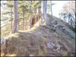 12
12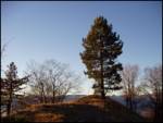 13
13 14
14
Discussion about the trail Potoki - Ajdna
|
| navdušena30. 07. 2015 |
Oj, je v skrinjici tudi žig?
|
|
|
|
| marezt30. 07. 2015 |
Ne...žiga v skrinjici ni že dolgo
|
|
|
|
| andrejazg7. 09. 2016 |
Žiga v skrinjici še vedno ni. Je pa kolovoz in cela pot bolj v slabem stanju (podrta drevesa) in tudi zelo slabo označena. Ta pot je opisana v knjigi Z otroci v gore, ampak je ne priporočam za manjše otroke. Na vrhu pa je prečudovit razgled na okolico.
|
|
|
|
| hribolazecales11. 08. 2019 |
V knjigi Z otroki v gore je opisana smer z druge smeri (od Valvazorjevega doma).
|
|
|
|
| Klemenko202. 01. 2020 |
Super tura  Res je, da je pot malo slabše označena ampak se ne moreš zgubiti. Na vrhu pa je razgled prečudovit 
|
|
|