Starting point: Podlanišče (787 m)
| Lat/Lon: | 46,1104°N 14,0133°E |
| |
Time of walking: 1 h 30 min
Difficulty: easy marked way
Altitude difference: 264 m
Altitude difference po putu: 315 m
Map: Škofjeloško in Cerkljansko hribovje 1:50.000
Recommended equipment (summer):
Recommended equipment (winter): ice axe, crampons
Views: 2.750
 | 1 person likes this post |
Access to the starting point:
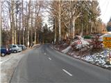
a) First, drive to Gorenjska vas in the Poljane valley (reachable from Škofja Loka, the new bypass road that bypasses Škofja Loka Horjul or Polhov Gradec), then continue driving towards Žire and Cerkno. After Trebija and just before the bridge over the Poljane Sora River, leave the main road towards Žire and turn right towards Cerkno. Continue along a slightly winding road, which quickly leads to the settlement of Sovodenj. From Sovodnja, continue slightly to the right, and we continue to follow the ascending road to the settlement Podlanišče or the Kladje pass, where we park in a suitable place by the pass.
b) Drive to Žiri (to get here from Vrhnika or Logatec), then continue driving towards Škofja Loka. Before Trebija, turn left onto the road towards Cerkno. Continue along a slightly curvier road, which will quickly take you to the settlement of Sovodenj. From Sovodnja, continue slightly to the right, and follow the ascending road to the settlement Podlanišče or the pass Kladje, where we park in a suitable place by the pass.
c) Drive to Cerkno, and from there continue in the direction of Škofja Loka. Continue along the ascending road, which takes you through Planina pri Cerknem, along a winding road to the Kladje pass, where you park in a suitable place along the road.
Path description:
From the Kladje pass on Podlanišče continue towards the Lajše, Bevkov vrh and Sivka sanctuaries, initially following the asphalt road. Walk along the road for a short distance, then at a small crossroads, before the road turns into the forest, continue on the road to the left, and immediately from the road to the right onto a footpath that climbs between the two roads and goes into the forest. Through the woods, first climb cart track, and then signs point you slightly to the right on a marked path which crosses some tracks higher up. When you reach a wider track higher up by the wood pile, follow it and it leads you out of the woods without any major changes in elevation, and a few minutes further on to an asphalt road which you follow to the right. Follow the road a few steps to a small pass where there is a marked crossroads.
From the crossroads, continue left in the direction of Bevkov vrh and the local cheese. At the next crossroads follow the signs for the local cheese, while the road descends approximately 50 metres. The road levels off at a lower level and the marked path from Želin joins us on the right. A few 10 steps further on, we reach the Na Ravan farm, where it is possible to buy some dairy products, and here, a few steps before the farm, we continue left on the track that continues behind the houses. Cart track quickly turns into a path which then climbs up through the pasture, and higher up we reach a slightly wider track which climbs across to the right. As you enter the woods, you will see a larger marking resembling a road sign, and here the track enters the woods and turns left. As you re-emerge from the woods, you will see another larger marker to help you descend. Follow cart track to a pasture fence and then along it to a chapel located by a power line.
From the chapel, where the SPP stamp and the registration box are located, continue left in the direction of Sovodnja. It is a 10-minute walk along the partially overlooked ridge Bevkov vrh. When the path turns into the forest, we are only a few steps away from the top of Bevkov vrh.
Description and pictures refer to the situation in 2016 (January).

Pictures:
 1
1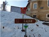 2
2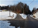 3
3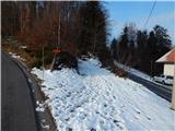 4
4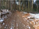 5
5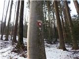 6
6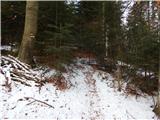 7
7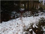 8
8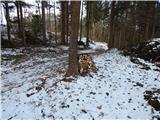 9
9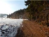 10
10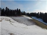 11
11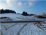 12
12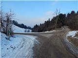 13
13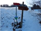 14
14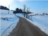 15
15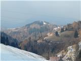 16
16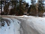 17
17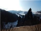 18
18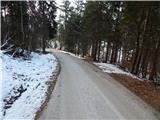 19
19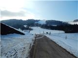 20
20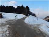 21
21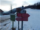 22
22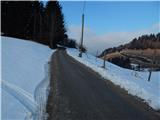 23
23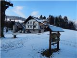 24
24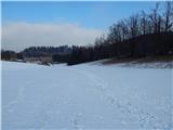 25
25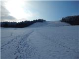 26
26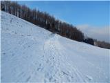 27
27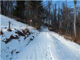 28
28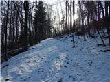 29
29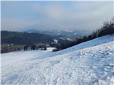 30
30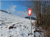 31
31 32
32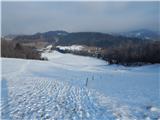 33
33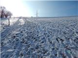 34
34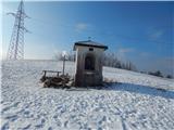 35
35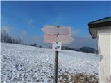 36
36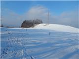 37
37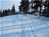 38
38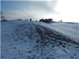 39
39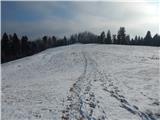 40
40 41
41 42
42 43
43
Discussion about the trail Podlanišče - Bevkov vrh