Podkilavac - Obruč (via Kolci, eastern slopes of Obruč)
Starting point: Podkilavac (320 m)
Name of path: via Kolci, eastern slopes of Obruč
Time of walking: 4 h 15 min
Difficulty: partly demanding marked way
Altitude difference: 1056 m
Altitude difference po putu: 1056 m
Map: SMAND: 14 Gorski kotar IV, 1:30.000, 2007.g.
Recommended equipment (summer):
Recommended equipment (winter): crampons
Views: 2.009
 | 2 people like this post |
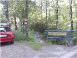
Access to the starting point:
Description in Croatian:
From the autoceste Rijeka - Zagreb, take the exit Čavle (3 km from Rijeka). At the traffic lights, turn left in the direction of Čavle. Drive about 600 metres to the second traffic light and turn right here (direction Zagreb, Grobnik). Drive 650 metres and turn left in the direction of Dražice.
Nakon toga voziti 3,9 km do kružnog toka koji nam se nalazi s desne strane (prilazem priključnom cestom, 250 m od benzinske stanice). Izzaći na drugeom izlazu. Here begins the marked path (there is a sign with the weather to Hahlića i Platka on the right-hand side of the road).
We follow the road for about 550 metres and take a mildly sloping route. Nakon toga idemo još 1,8km do mostića.
The car can be left in the road ahead, but it is also possible to cross the bridge on the lijeom cestom skratiti put. There are marked signs along the road from the footpath which crosses the road. The road leads 5 km to the okretaljka.
Path description:
Description in Croatian:
We leave the bridge on the right and take the road through the oil pipeline. The path leads us along the road, but at some point the path veers off the road and we can walk. Before the end of the road, we reach a crossroads (an easier path, right along the road is more difficult). We are setting off along the road, but there is a turnpike in the place of the road, and here the road starts to rumble.
The road leads us steeply through the pine trees. Povremeno se kroz šumu otvori lijep pogled prema Učki, moru i Kvarnerskom zaljevu. At some point in the day, we emerge from the pine trees and here the view opens up to its own path. The path continues to lead us through the low-lying countryside, over a small scree slope, and we soon emerge from the cold onto the livade. After the livadama, we take a 20-minute walk to a small saddle. Once over the saddle, walk for a few minutes to a small lake, the size of which depends on the amount of cachet. It takes a few minutes of leisurely walking and we reach a small lake (on the left, Ćunina glava, on the right Obruč, Pakleno, etc. , and on the right, the home of Hahlić).
After a few minutes we reach the first crossroads. Setting off in the direction of Obruč, Paklena peaks. At the same time, we move to another crossing where we again set flat (Obruč). At the end of a few minutes, we move to the third crossing. Here is the easy way from Podkilavac. Set right in the direction Obruč, Pakleno, Previjak. Uskoro dolazimo na raskršće gdje strmo lijevo počinje ridenski put na Obruč. We set flat and finally, after a few minutes on the ridge, we turn left in the direction of Pakleno H6/H7.
The path leads us at a leisurely pace through the pouring noise. The noise gives us a cool breeze and sometimes the view opens up a little on the terrain around us. Finally, after 40-odd minutes, we emerge onto the road and turn off the funnel. Nekoliko koraka dalje se u zavoju lijevo odvoji put za Obruč, Pakleno sjev. vrh (desno Pakleno).
The path follows the old overgrown Šum train and then emerges onto the Šum road. We turn left and finally reach the poorly marked crossroads (right Pakleno sjeverni vrh) in 20-odd minutes. We follow the road and finally 10 minutes we arrive at the crossroads where we go down the road prema Obruč. The path leads through noise and foams with interesting stazom. Cijelim putem otvaraju se lijepi vidici. Nakon pola sata stižamo do raskršća za Studenu (right). We set a flat and for ten minutes of leisurely walking we reach the top.

Pictures:
 1
1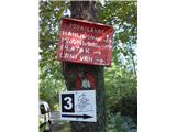 2
2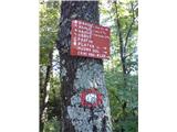 3
3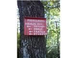 4
4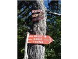 5
5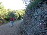 6
6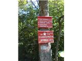 7
7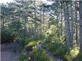 8
8 9
9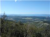 10
10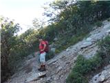 11
11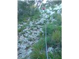 12
12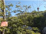 13
13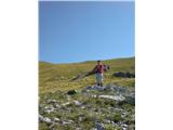 14
14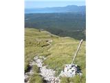 15
15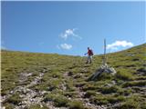 16
16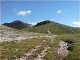 17
17 18
18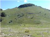 19
19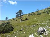 20
20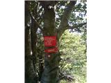 21
21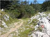 22
22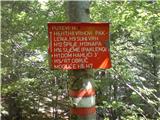 23
23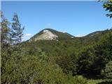 24
24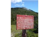 25
25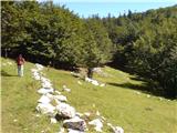 26
26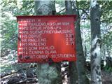 27
27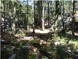 28
28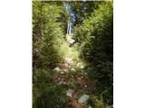 29
29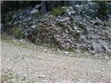 30
30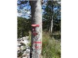 31
31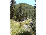 32
32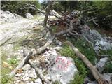 33
33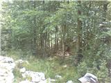 34
34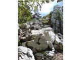 35
35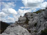 36
36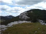 37
37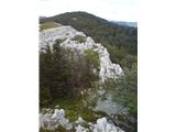 38
38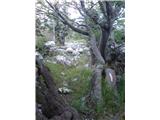 39
39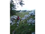 40
40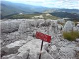 41
41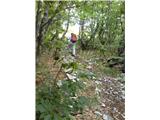 42
42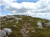 43
43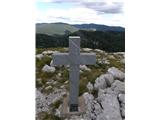 44
44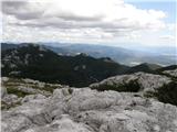 45
45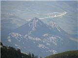 46
46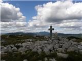 47
47
Discussion about the trail Podkilavac - Obruč (via Kolci, eastern slopes of Obruč)