Starting point: Podbrdo (515 m)
| Lat/Lon: | 46,2151°N 13,9739°E |
| |
Time of walking: 2 h 15 min
Difficulty: easy marked way
Altitude difference: 758 m
Altitude difference po putu: 758 m
Map: Škofjeloško in Cerkljansko hribovje 1:50.000
Recommended equipment (summer):
Recommended equipment (winter): ice axe, crampons
Views: 6.275
 | 1 person likes this post |
Access to the starting point:
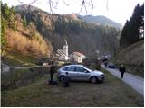
a) First drive to Škofja Loka, then continue to Železniki and Tolmin. When you arrive in Podbrdo, pay attention, because just after the church you will turn right onto a narrow local road that starts to climb along the river Bača. Park in a suitable place on the roadside, or in a small parking lot next to the local cemetery.
b) From the road Idrija - Most na Soči, turn right at Bača pri Modreju, or left if you are coming from the route of Posočje, and continue towards Podbrdo. At the end of Podbrdo, pay attention, because just before the church of St. Nicholas you will turn left onto a narrow local road, which begins to climb along the river Bača. Park in a suitable place on the roadside, or in a small parking lot next to the local cemetery.
Path description:
From the starting point, continue along the initially still asphalted road, from which a marked footpath soon branches off sharply to the left towards Vrhu Bače. Continue past an old residential house, gradually turning into the forest. Through the forest we climb along a relatively well-marked and partly quite steep mountain path, which is higher and leads us out of the forest to a short scenic slope, over which we walk to the nearby church of St Lenart.
At the church, you enter a narrow road, which leads you quickly to the village of Bača near Podbrdo. Through the small and picturesque village, follow the signs and they will lead you to cart track, which begins to climb through the forest. The narrower and at first slightly overgrown cart track, however, joins the old mulatier after a few minutes. Follow the wide mulatier to the right, and after a few minutes it leads to a small crossroads, where you continue along the upper left path in the direction of Vrh Bače (slightly to the right Petrovo Brdo).
We continue to climb for some time on the well-preserved and quite wide mule track, which we leave for a short time higher up, as the path leads us along a marked shortcut. Higher up, the mule track path is stopped a few times by some fallen trees, and we then approach the cliffs of Šance Peak, where we leave the mule track. Next, we climb up a fairly steep path, which takes us 5 minutes to reach the hunting hut on Vrhu Bače.

Pictures:
 1
1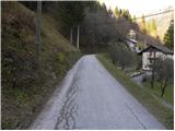 2
2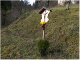 3
3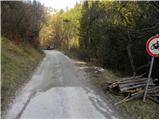 4
4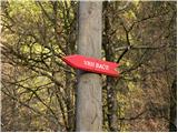 5
5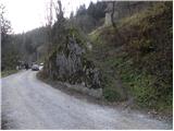 6
6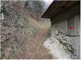 7
7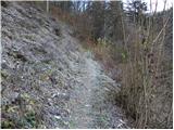 8
8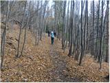 9
9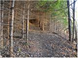 10
10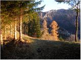 11
11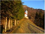 12
12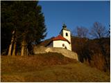 13
13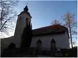 14
14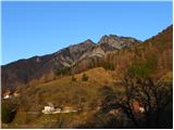 15
15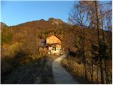 16
16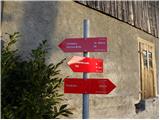 17
17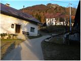 18
18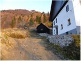 19
19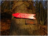 20
20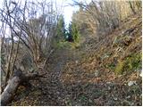 21
21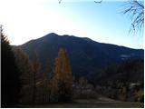 22
22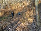 23
23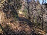 24
24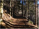 25
25 26
26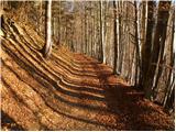 27
27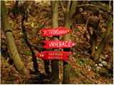 28
28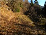 29
29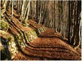 30
30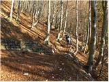 31
31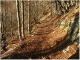 32
32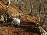 33
33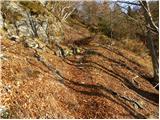 34
34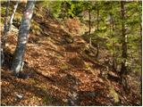 35
35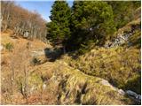 36
36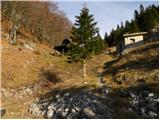 37
37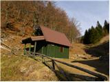 38
38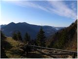 39
39
Discussion about the trail Podbrdo - Vrh Bače
|
| darinka43. 01. 2019 |
Danes smo prehodili to pot. Lepo speljana mulatjera do lovske koče. Nadaljevali smo po grebenu na Koblo in sestopili v Bohinjsko Bistrico na vlak.
|
|
|
|
| darinka42. 06. 2021 21:56:22 |
Prehodili s Podbrda na Bačarsko sedlo. Nadaljevali po spodnji poti . Vsi štirje prvikrat po tej poti. Je speljana Julijana trail. Označena. Se spustili v Nemški Rovt. Potem v Bohinjsko Bistrico. In kar je bilo najbolj zanimivo. V tunel , ki je dolg 6, 3 km v Podbrdo na vlak in domov. 20km hoje je naneslo vsega skupaj.
|
|
|