Starting point: Pod Zjabci (745 m)
| Lat/Lon: | 46,3261°N 13,6982°E |
| |
Time of walking: 4 h 45 min
Difficulty: difficult unmarked way, easy pathless terrain
Altitude difference: 1507 m
Altitude difference po putu: 1530 m
Map: TNP 1 : 50.000
Recommended equipment (summer): helmet
Recommended equipment (winter): helmet, ice axe, crampons
Views: 23.093
 | 2 people like this post |
Access to the starting point:
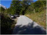
a) First drive to Kranjska Gora, then continue over the Vršič Pass towards Bovec. Shortly after the Berebica Gallery, you will arrive in the village Soča, where you will turn left over the bridge over the Soča River (towards the Jelinčič Tourist Farm and the Korita bivouac). After the bridge, do not turn left towards the bivouac, but continue driving straight ahead on the ascending asphalt road. Continue climbing through vast meadows, in the middle of which stand a few individual huts, and then the road turns into a forest. Higher up, the road turns quite left and leads us to Pod Zjabcev, where we see mountain direction signs for mountain pasture Za skalo, Dom na Komni and Triglav lakes. Park at a suitable place along the road.
b) From the coastal side, first drive to Bovec, then continue driving towards Trenta. Towards the end of the village Soča, turn right in the direction of the Jelinčič tourist farm and the Korita bivouac. After the bridge, do not turn left towards the bivouac, but continue straight on the ascending asphalt road. Continue climbing through vast meadows, in the middle of which stand a few individual huts, and then the road turns into a forest. Higher up, the road turns quite left and leads us to Pod Zjabcev, where we see mountain direction signs for mountain pasture Za skalo, Dom na Komni and Triglav lakes. Park at a suitable place along the road.
Path description:
From Pod Zjabcev, follow the marked trail, which passes the nearby cottage on the right. After the cottages, the path goes into the wods and quickly leads to a small crossroads, where we continue right across the stream. On the other side of the stream, the path turns left and starts to climb moderately through the dense forest. The ascent continues along the old mule track, which is already fairly loaded in several places, but it leads us higher up to a short steep rocky section. A well-maintained and wide mulatier leads us through this part, and the path above this part leads us to a viewpoint from which we have a beautiful view of the Bavški Grintavec.
From the viewpoint, the path returns to the forest and climbs quickly up to an old water trough (there is a small spring along the path, which dries up in dry periods). Above the trough, the path turns slightly left and then climbs through the forest in numerous switchbacks. Higher up, the path bends slightly and leads to a less visible crossroads, where an abandoned path branches off to the left towards mountain pasture Za skalo.
From here we continue straight on, but again a slightly steeper path, after 10 minutes of further walking, leads us to the next, this time completely unmarked crossroads. Here, an unmarked path branches off to the right, leading to a nearby hunting lodge and on towards mountain pasture behind Črni vrh, a hunting trail branches off to the left towards mountain pasture behind the rock, and we continue straight on to the next crossroads nearby, which is slightly better marked.
Here, continue left in the route mountain pasture Za skalo (straight on the trail continues towards Komna and the Triglav Lakes), following the trail that crosses the slopes to the left. Soon we will leave the forest, where the path descends slightly to the left (here another path, not mentioned in the description, joins us from the left), and we continue along the initially visible path, which descends to mountain pasture Za skala and the TNP hut there.
From mountain pasture we go back a little and ahead of us on the slope we will see a path which crosses the scree on the ascent towards the Travnik valley. Take the unmarked path mentioned above, which climbs up the already slightly overgrown scree. The path then crosses a grassy slope, turns slightly to the right and ascends steeply. A steel cable is also helpful on this part of the path. The path then becomes less steep and continues along the grassy slope, past increasingly sparse trees. The path then follows the right side of the valley, where we will see the entrance to the chasm on our right. We continue our ascent up the valley and soon we have a view of Čel on our right. At this point the path becomes increasingly difficult to follow but orientation is not to difficult as we just continue along the wide valley. Ahead of us we can already see the Travnik peak. When the valley starts to turn to the right, turn left and start climbing up the steep grass towards Travniška škrbina (the notch to the left of Travnik). The summit of Travnik can also be reached via the notch at the end of the valley on the right side of Travnika. When you reach Travniška škrbina, turn right and follow the ridge up to the top of Travnik. Under Zjabci - mountain pasture Behind the rock 2:15, mountain pasture Behind the rock - Meadow 2:30.

Pictures:
 1
1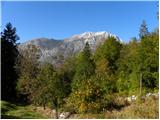 2
2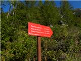 3
3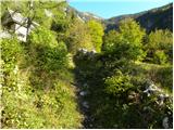 4
4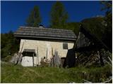 5
5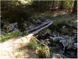 6
6 7
7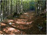 8
8 9
9 10
10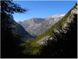 11
11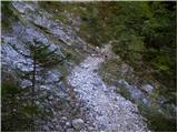 12
12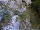 13
13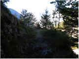 14
14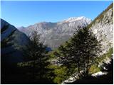 15
15 16
16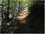 17
17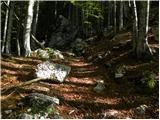 18
18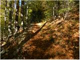 19
19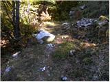 20
20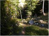 21
21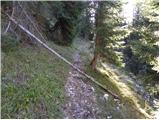 22
22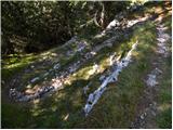 23
23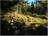 24
24 25
25 26
26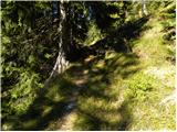 27
27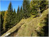 28
28 29
29 30
30 31
31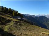 32
32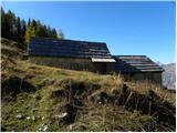 33
33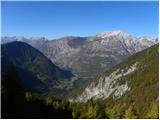 34
34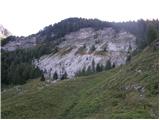 35
35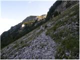 36
36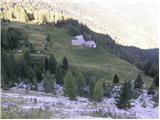 37
37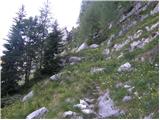 38
38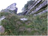 39
39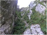 40
40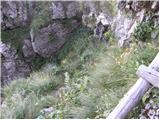 41
41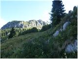 42
42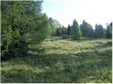 43
43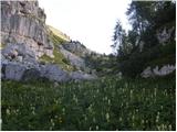 44
44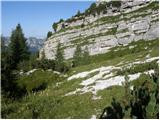 45
45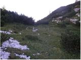 46
46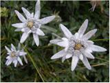 47
47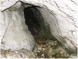 48
48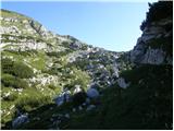 49
49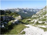 50
50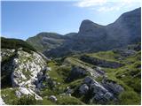 51
51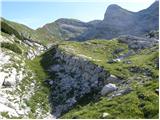 52
52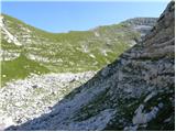 53
53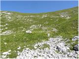 54
54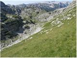 55
55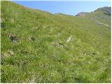 56
56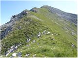 57
57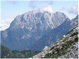 58
58 59
59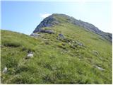 60
60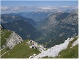 61
61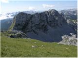 62
62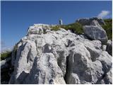 63
63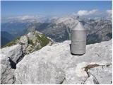 64
64
Discussion about the trail Pod Zjabci - Travnik
|
| igorf28. 06. 2010 |
V nedeljo, 27.06.10 smo opravili zgoraj opisan izlet. Vreme in zazmere odlične (poleti je namreč zelo vroče in ni vode), cvetja pa toliko, da ti zastane dih, še zlasti greben priti travniku ves posejan s prelepimi encijani. Tudi v studenčku pri drevesu nad skalnim skokom dovolj vode za natočiti (poleti namreč presahne). Neverjetno dosti ljudi, najmanj kakih 50.
|
|
|
|
| damijanp17. 08. 2015 |
Zares pravljičen svet, vreden obiska. Nekaj slik je na: Travnik
|
|
|
|
| boštjanko1. 08. 2020 |
Pred nekaj dnevi obiskal čudovito Travniško dolino in Travnik. Po velikosti kopriv ob jeklenici bi rekel, da vsaj 1 teden tu ni bilo pohodnikov. Sama pot po Travniški dolini kar lep čas dokaj uhojena in sledljiva. Cvetje pa te očara na vsakem koraku. V celem dnevu videl le 2 planinca, na poti proti zaključku Travniške doline. Naslednjič pridem pa še po čudovite razglede z vrha, ki jih je motila rahla megla...
|
|
|
|
| Spelcarocket2. 07. 2022 20:01:00 |
Danes šla sem nabirat razglede. Ko se končajo markacije je res lepo sledljiva pot edino pri razgledni točki nad planino za skalo bi veljala pozornost,da se ne nadaljuje kar naravnost koder so sledi poti in pa malo pred ostenjem vrha,ko se preči v dolini na levo stran,je malo slabše opazna pot. Razgledi,ki jih ta kar malo pozabljen in samoten svet ponuja pa so prelepi.
|
|
|
|
| darinka429. 07. 2022 12:58:31 |
Se pridružujem Damjanu , ki pravi , da je ta svet lep in pravljičen.Ker smo bili prvikrat , smo bili še bolj presenečeni nad lepoto cvetja in skalnatih skladov. Krožno smo prehodili turo. Z ogledom vsem vrhov okoli. Le en pohodnik je šel pred nami. Smo ga videli ko je sestopal s Travnika.
|
|
|
|
| mikkeni14. 01. 2023 20:04:13 |
Zimski vzpon po Travniški dolini - predviden Travnik, vendar nato v skrajni sili izbrala Planjo  Razmere zimske, zanimive... sneg žal precej mehak, udiralo do kolen oz. tudi do riti... sicer pa, jutri še en suh dan, nato pa padavine in sprememba razmer varen korak http://ma-uc.blogspot.com/2023/01/travniska-dolina.html
|
|
|
|
| ppegan15. 01. 2023 07:39:57 |
Tale bo pa pravi Travnik  Bravo za turo, to so res lepi konci. Zagotovo bi šlo s krplji ali smučmi lažje, kot je nekdo omenil pod Razmerami
|
|
|
|
| lepenatka19. 06. 2025 08:31:30 |
Kdaj je najbolj idealen čas za obisk cvetoče Travniške doline in Travnika?
|
|
|
|
| mirank19. 06. 2025 12:24:07 |
Je bilo že prejšnji teden vse v cvetju, seveda je junij in začetek julija največ cvetja, a vsako obdobje ima svoje rožce
|
|
|
|
| smatjaz20. 06. 2025 16:23:31 |
lepenatka, kdaj imaš namen it gor?
|
|
|
|
| lepenatka20. 06. 2025 16:40:03 |
Nimam še točnega termina. Se mora še šofer prilagoditi. Verjetno bova šla za 2 dni in obiskala še kak drug hrib. Vožnje do izhodišča je cca 3 ure.
|
|
|
|
| smatjaz21. 06. 2025 10:10:27 |
Midva greva jutri zelo zgodaj, da se izogneva vročinskemu kotlu in še pred pripeko prerineva na pl. za Skalo. Potem bova pa videla ko bo šlo naprej da naju ne scvre.
|
|
|
|
| lepenatka21. 06. 2025 21:49:59 |
Sporoči, kako bo šlo
|
|
|