Pod Luknjo - Matajurski vrh
Starting point: Pod Luknjo (950 m)
| Lat/Lon: | 46,2488°N 13,9145°E |
| |
Time of walking: 3 h 50 min
Difficulty: partly demanding marked way, easy pathless terrain
Altitude difference: 986 m
Altitude difference po putu: 1200 m
Map: TNP 1:50.000
Recommended equipment (summer):
Recommended equipment (winter): ice axe, crampons
Views: 8.422
 | 1 person likes this post |
Access to the starting point:
From the Ljubljana - Jesenice motorway, take the Lesce exit and follow the road towards Bled and on to Bohinjska Bistrica. From Bohinjska Bistrica turn left towards Tolmin and Soriška mountain pasture. Soon we will see signs for Črna prst on the right, but we continue straight ahead. Just a little later we come to a crossroads where a signpost points us right towards the village of Ravne. Take this road, which will take you to the end of the village, where the asphalt ends. Continue along the macadam road, which leads past the former home of Dr Janez Mencinger (now a private house). Follow this road for about 4km to where a worse forest road joins from the right (there is a hunting observatory, numerous cart tracks and a mountain marker for Črna prst). Continue along this road for about 4km to where a worse forest road joins from the right (there is a hunting observatory, numerous cart tracks and a mountain marker for Črna prst nearby).
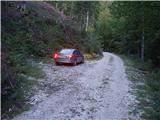
Park in one of several small parking lots along the road, but in such a way as not to interfere with the forestry work (harvesting of timber).
Path description:
Due to the forestry work and the consequent number of tractor trains, the trailhead is relatively difficult to find. Between the hunting observation post and the mountain sign for Črna prst there are three larger cart tracks, which head up from the road to the left (the direction of our arrival). We choose the "first" one, i. e. the one closest to the hunting observation post (the mountain sign for Črna prst directs us to the "last" cart tracks, but if we head in the direction of this sign, we will quickly go astray).
So if we decide to climb the "first" cart track we will see the markings after a few minutes of climbing (the path comes across from the "last" cart track and is completely overgrown). Follow the wide tractor track logging trail slightly to the left, but only to the point where the markings direct you to the right to the slightly narrower cart track. The orientation is much easier further on, as the labyrinth of tracks ends. From the sometimes slightly steeper path, a marked path soon branches off to the left towards Orožno's hut.
Continue straight ahead along the cart track, which leads us higher up into a small valley along which we climb up to a forest road (it takes about 30 minutes to get here). Once on the road, continue a few steps to the left, and then the mountain sign for Črna prst directs you right into the forest, where it starts to climb steeply. The path crosses an overgrown clearing (ferns and raspberries) a little higher up and then returns to the forest, where it continues until mountain pasture Osredki.
From mountain pasture, where there are two small wooden huts (one of them converted into a bivouac), continue along the left side of the watering-hole, following a less visible path which starts to climb moderately among bushes and individual trees. The path continues to be poorly visible, but is well marked and leads us higher to a slightly larger meadow at the edge of which we see the next puddle. The path then climbs steeper and steeper and slowly turns to the left. At the top of the ascent, we come to a small pass, after which the path turns right and ascends crosswise. A few minutes of climbing on a slope covered with dwarf pines follows and the path leads to the main ridge of the Lower Bohinj Mountains.
From the ridge from where we open a beautiful view to the south, continue right in the direction of the Vogel (left Črna prst 10 minutes). The way forward becomes more difficult as it crosses very steep grassy slopes that are dangerous to slip on with the help of ropes, but mostly without them. The path then slightly lays down and leads to the saddle Vrata (1721m). The path then retreats to the left and then crosses the ridge again and climbs over the next steep slope. A commemorative plaque warns us that the route is not entirely easy. The steepness of the slopes then gradually eases and the path again approaches the main ridge (here you can climb to Četrt in 15 minutes - easy off-trail).
Continue along the scenic, mostly grassy ridge (westwards), climbing gently towards Konjski vrh, which the trail passes on the left. After this, the path descends gently and leads to an inconspicuous saddle between Konjski and Poljanski vrh. The latter, which again begins to climb gently, is also bypassed on the left and leads us to the foot of Matajurski vrh, which we will observe on the left-hand side. At the point where the path approaches Matajurski vrh, you will notice a less well-trodden path on the left, which climbs gently southwards at first. The path, which is getting worse, turns slightly to the right and after a short steep climb leads us to a side ridge. Once on the ridge, continue slightly to the left along a faintly visible path, along which you can see some old faded markings. Follow this increasingly scenic "path" to the summit, which is reached after a further 10 steps.
As most of the path is on a ridge, the possibility of lightning means that you should only set off on the path in good weather.
Starting point - mountain pasture Osredki 1:15, mountain pasture Osredki - Matajurski vrh 2:35

We can extend the trip to the following destinations: Črna prst
Pictures:
 1
1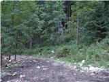 2
2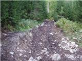 3
3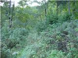 4
4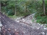 5
5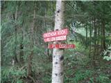 6
6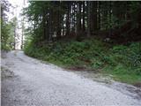 7
7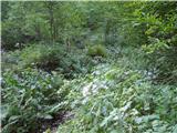 8
8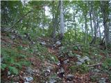 9
9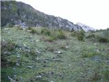 10
10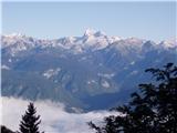 11
11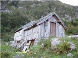 12
12 13
13 14
14 15
15 16
16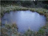 17
17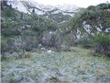 18
18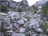 19
19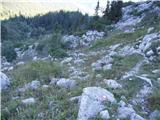 20
20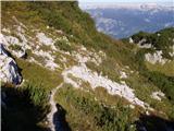 21
21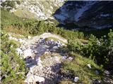 22
22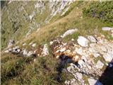 23
23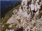 24
24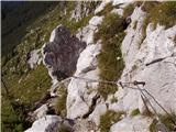 25
25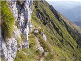 26
26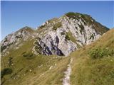 27
27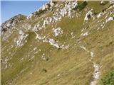 28
28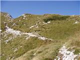 29
29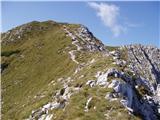 30
30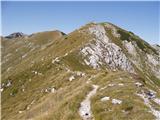 31
31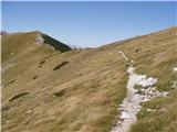 32
32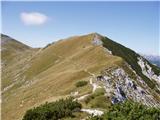 33
33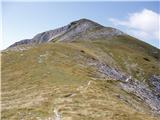 34
34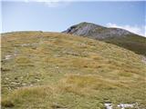 35
35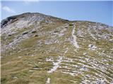 36
36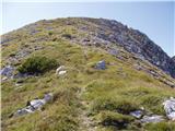 37
37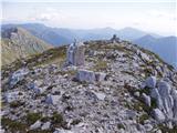 38
38
Discussion about the trail Pod Luknjo - Matajurski vrh
|
| Loerst1. 06. 2020 |
Sicer čisto korekten opis vendarle zahteva manjši popravek - gozdarji so na območju izhodišča izvajali obsežna dela, tako da je kolovoz, na katerega kaže tabla (in ki je zgoraj opisan kot tisti, na katerem bomo zašli) sedaj prava "avtocesta", ki se po kakih 10 minutah združi z opisanim.
Ljubitelji brezpotji si lahko močno skrajšajo pot, če se namesto na Črno prst usmerijo na sedlo Vrata ob vrhu Četrt. Prehod gor na greben je zelo lahek.
|
|
|