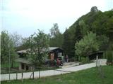
Planinski dom Maks Plotnik - Okić
Starting point: Planinski dom Maks Plotnik (411 m)
Time of walking: 25 min
Difficulty: very difficult marked way
Altitude difference: 88 m
Altitude difference po putu: 88 m
Map:
Recommended equipment (summer): helmet, self belay set
Recommended equipment (winter):
Views: 2.713
 | 1 person likes this post |
Access to the starting point:
a) Via Border crossing Brežice / Bregana, drive into Croatia and leave the motorway at the Samobor exit. When you arrive in the above-mentioned place, go south towards Zagreb. At the petrol station at the southern exit of the city, turn right and continue towards the villages of Mirnovec and Kladje. When the road leads to a serpentine pass, turn right into the village of Konščica and then drive west towards the village of Terihaji. Further along the road you will see signs for Dom pod Okićem (the street is called Starogradska ulica), which direct you to the left.
b) From Prekmurje and the vicinity of Maribor, first drive to Border crossing Gruškovje / Macelj and continue along the motorway to the Jankomir junction, where you turn left in the direction of Ljubljana and Samobor. Leave the motorway at the exit for Samobor, then continue driving as described above.
Since the parking lot at the cottage is too small for all visitors and it is also quite difficult to reach the cottage from the orientation point of view, I recommend to reach the cottage by the footpath from Novi Selo Okićko.
Path description:
From the Maks Plotnikov home, go slightly east and you will reach a crossroads. To the left is an easier path, down to the right is the path towards Sveti Martin and Novo selo Okićko (Podgrađe), and we go straight ahead. The path first goes through a meadow and then turns into a forest. In the forest, the ground becomes rockier and rockier, and we reach a crossroads where the Dragojlina trail branches off in a downward direction, and we go up to the left.
After the crossroads, the path becomes more difficult and we climb up and down the rocks to reach the start of the climbing section.
The most difficult part of the route is right at the start, where we first cross an exposed cliff. Then the route goes vertically upwards along the cliff. There are a few wedges to help you. After we have climbed about ten vertical metres, the path turns slightly left and lays down for a bit. Here the hard part is over.
Now we have a new slope with one quite difficult rocky jump. All the time we have the help of a rope and a few wedges. When this part is over, so is the end of fixed safety gear. behind us, we get a great view to the south-east.
When we leave fixed safety gear, the end of the Žohar route will be near. Now we join the Dragojlina path and overcome some more technically undemanding rocks and then we reach the place where we join the easy path. From here it is only a few minutes to the summit and the old castle of Okić.
Unfortunately, the old Okić Castle is in ruins. As it has been overgrown by forest, there is no better view from the very top.
The path is named after Dragutin Belačić - Žohar, a mountaineer from Samobor.

Pictures:
 1
1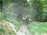 2
2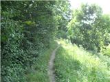 3
3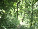 4
4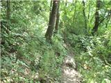 5
5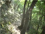 6
6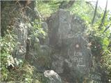 7
7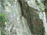 8
8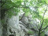 9
9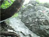 10
10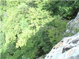 11
11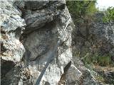 12
12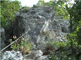 13
13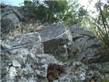 14
14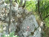 15
15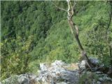 16
16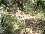 17
17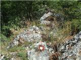 18
18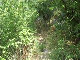 19
19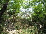 20
20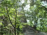 21
21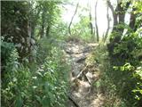 22
22
Discussion about the trail Planinski dom Maks Plotnik - Okić
|
| zeldok22. 09. 2017 |
Škoda pa so slike loše kvalitete.
|
|
|
|
| zeldok22. 09. 2017 |
I še nekaj, Dragojlina staza se začne nekaj već od 200 metri nižje in je na tem delu močno strma in spolska.
|
|
|