Planina pod Golico - Barentaler Kotschna/Struška
Starting point: Planina pod Golico (980 m)
| Lat/Lon: | 46,4706°N 14,0599°E |
| |
Time of walking: 3 h
Difficulty: easy unmarked way
Altitude difference: 964 m
Altitude difference po putu: 964 m
Map: Karavanke - osrednji del 1:50.000
Recommended equipment (summer):
Recommended equipment (winter): ice axe, crampons
Views: 12.190
 | 1 person likes this post |
Access to the starting point:
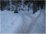
From the motorway Ljubljana - Jesenice take the exit Lipce (also Hrušica) and follow the road in the direction of Jesenice, where the signs for Planina pod Golico direct us to the ascending road (the exit is marked and is located at the health centre in Jesenice). The relatively steep road soon leads us to the above-mentioned village, where in May, in the surrounding meadows, you can admire the bloming of daffodils. With Mountain pasture under Kahlkogel, drive on to the next crossroads, where you will see a number of mountain signposts. Here, continue right and drive another 50m to the parking lot under the Sava Caves.
Path description:
From the parking lot, continue along the lower road in the direction of Kahlkogel and the Savske jame sledding track. After 10 minutes, the toboggan run heads steeply uphill to the left, and we continue along the wide road, which continues to climb moderately along the stream. A little further on, you come to a crossroads where you continue straight on (between the two roads) in the direction of Golice. Next, we climb along the worse, rather overgrown cart track, which after 15 minutes of moderate climbing leads us to a macadam road, which we just cross. Then crossing a pasture fence, the path leads us to the grassy slopes of Markljevje rovt.
From Markl's Gully, continue slightly right (slightly left Kahlkogel) along a track which climbs gently along the bed of a torrent. Higher up, the path becomes slightly steeper, crosses the aforementioned torrent and then turns right, where after a few minutes of further walking it joins the road from Pustje rovt.
Follow the road to the left, but only to the crossroads, where the signs for Barentaler Kotschna direct us to the right (left Kahlkogel). A few steps further on, we enter a newer forest road which we follow to the right (straight old path). Follow this road, which initially passes through the forest, but higher up over the avalanche-prone slope, all the way to Belska planina (Candle), from which we get a nice view.
Follow mountain pasture eastwards, initially only slightly uphill. After a five-minute walk from the hut, the path leads to a less steep ravine, where you continue left on a less visible unmarked path (straight mountain pasture Seča).
Continue up the grass-covered ravine, which is surrounded by dwarf pines. At the top of this gully, the path, which remains difficult to follow, turns right into the vast world of Barentaler Kotschna. The path continues in a moderate ascent crossing the south-western slopes of Barentaler Kotschna, which are partly covered with dwarf pines (as the path is more difficult to follow, it is possible to quickly get lost among the dwarf pines). A little below the summit, the "path" leads to a ridge which is followed to the summit.
Orientation from mountain pasture to the summit is a little more difficult, and very difficult in fog.

Pictures:
 1
1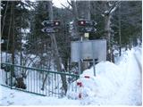 2
2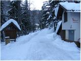 3
3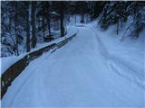 4
4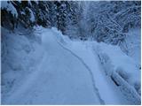 5
5 6
6 7
7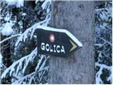 8
8 9
9 10
10 11
11 12
12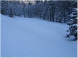 13
13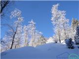 14
14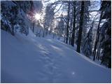 15
15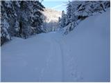 16
16 17
17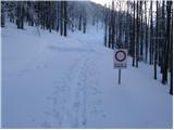 18
18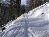 19
19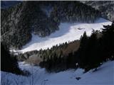 20
20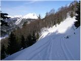 21
21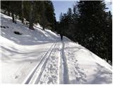 22
22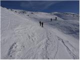 23
23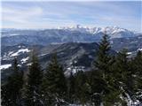 24
24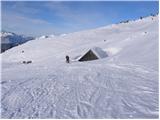 25
25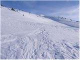 26
26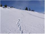 27
27 28
28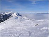 29
29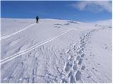 30
30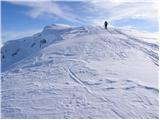 31
31 32
32
Discussion about the trail Planina pod Golico - Barentaler Kotschna/Struška
|
| Jusk1. 09. 2019 |
Danes dopoldne iz Planine pod Golico do sedla Kočna,potem naprej gor,pri razcepu kjer gre naravnost oznacena pot zavijem levo na neoznačeno med rusje,cez nekaj časa zagledam pod sabo kočo na Belski planini..potem pa po labirintu med rusjem do vrha  na vrhu so mi druzbo delali konjicki nadaljujem do planine Seča,tam pa po 'cesti' nazaj do Belske planine in naprej do sedla Suha,od tam pa nazaj do Planine pod Golico(je zacelo kar posteno grmeti  res zelo lepi razgledi celo pot priporocam lp
|
|
|
|
| Jusk12. 07. 2020 |
Parkiral sem na prvem parkingu pod žičnico v Pl.pod Golico.. od tam pa proti Križovcu,Belski planini,Seči in po mejni poti skozi ruševje na vrh. Občasno blatna pot zaradi nočnega deževja,ampak brez problemov na vrhu vetrovno in mrzlo,bil sem sam na vrhu,pa še okoli 20 lenih kravic ki so poležavale v travi za ljubitelje gorskih rastlinic je Struška pravi kraj,vsepovsod polno rožic in cvetov povratek do Pl.pod Golico preko sedla Suha,Križovca.. prijeten pohod
|
|
|