Planina Pecol - Strma peč / Monte Cimone (path 641 on the slope of Viene)
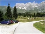
Starting point: Planina Pecol (1500 m)
| Lat/Lon: | 46,4092°N 13,4376°E |
| |
Name of path: path 641 on the slope of Viene
Time of walking: 4 h 45 min
Difficulty: difficult marked way
Altitude difference: 880 m
Altitude difference po putu: 880 m
Map: Zahodni Julijci PZS 1:50000 ali Tabacco 018 1:25000
Recommended equipment (summer):
Recommended equipment (winter): helmet, self belay set, ice axe, crampons, lamp
Views: 17.232
 | 3 people like this post |
Access to the starting point:
Mountain pasture Pecol pod Jôf di Montasio is accessible by a steep asphalted road from the V Žlebeh / Sella Nevea pass, which can be reached from Slovenia via Predel, or from Rateč via Trbiz, or from the Littoral side from the Videm - Trbiz road, where in Kluže / Chiusaforte you turn into the Reklanica / Raccolana valley and follow it to the pass.
Path description:
From the parking lot, head west past the last dairy. Follow the well-marked cart track, which soon turns into an almost horizontal track marked with the number 621. The path passes through the wods below the slopes of Zabuša, and in between you can admire Sart and Kanin on the other side of the valley. After a good hour, we reach a crossroads where the 640 trail heads upwards, and we continue horizontally around the steep towers of Pizzo Viene for another hour or so to the junction with the 641 trail. The path quickly turns into single steps in the very steep grass and heights, in some places the water has carried away the soil and you have to help yourself a little with your hands. Markings are sparse, faded, but the path/direction is clearly visible. After a good hour of downhill, the slope eases a little and we reach the wide saddle of Viene a little more normally. On the right we see the new bivouac, the route signs at the Norina ferry exit and the contact with route 640, and the signs lead us to the left onto the ridge. The summit slope Strma peč is ahead, the marked path along the grassy slope, interspersed with short rock steps, is easy, given the name of the mountain, but we have to be careful on the edge of the wall. There are long precipices below the edge. At the top there are the foundations of a bivouac and two statues of Mary - one in a plastic/glass birdhouse.
There is no sign-in book. The view on all four sides is phenomenal in the right weather. The nearby Zabuš, Jôf di Montasio, Naborjetske Gory over Dunja, Kanin group over Reklanica and the champions Carnic Alps stand out, as do Dolomites and the Austrian two and three-thousanders in the distance.

Pictures:
 1
1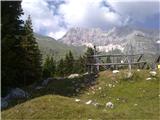 2
2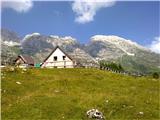 3
3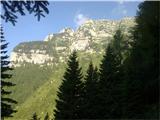 4
4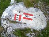 5
5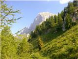 6
6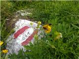 7
7 8
8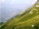 9
9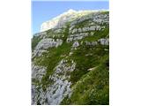 10
10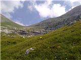 11
11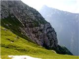 12
12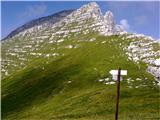 13
13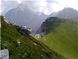 14
14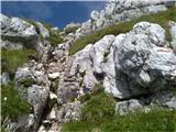 15
15 16
16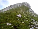 17
17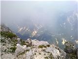 18
18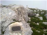 19
19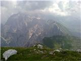 20
20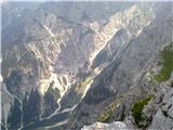 21
21
Discussion about the trail Planina Pecol - Strma peč / Monte Cimone (path 641 on the slope of Viene)