Planina Loka - Lanež (via Durce)
Starting point: Planina Loka (1500 m)
| Lat/Lon: | 46,4034°N 14,7573°E |
| |
Name of path: via Durce
Time of walking: 1 h 25 min
Difficulty: easy marked way
Altitude difference: 425 m
Altitude difference po putu: 440 m
Map: Kamniške in Savinjske Alpe 1:50.000
Recommended equipment (summer):
Recommended equipment (winter): ice axe, crampons
Views: 8.635
 | 2 people like this post |
Access to the starting point:
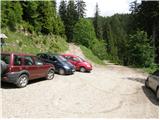
From Mozirje drive towards the Logar valley, but only as far as the village of Strmec (the village between Ljubno and Luce), where the signs for Snežna jama to Raduha direct you right onto a narrower ascending road. Follow the road, which has a few crossroads, in the direction of Snežna jama and the hut at Loka (the crossroads are well marked). After 16 km (9 km of which are macadam) of driving from the town, when we have left the main road, we reach the starting point, where we park near a small crossroads (at the crossroads there are mountain signs for the hut at Loka).
Path description:
At the parking lot we see the mountain direction signs for the hut at Loka and Raduha, which direct us to the worse forest road, which climbs through the lane of the forest. After only a few 10 steps, we emerge from the forest at the lower part of mountain pasture Loka. The ascent continues along a relatively steep road, which takes a few minutes to reach the hut on Loka.
From the hut continue slightly right along the marked path towards the saddle Durce (slightly left Raduha, right Smrekovec and Travnik). Continue on the right side of the ravine (on the left side of the ravine there is a path to Raduha) on a path that gradually starts to climb steeper. After about 10 minutes' walk from the hut, the path leads to a less visible crossroads, where the eastern path to Lanež branches off to the right, and we continue straight on towards Durce, following an initially slightly less visible path. A little further on, the path turns slightly to the left, crosses a pasture fence and then becomes lane of dwarf pines, through which we climb up a small valley. The path then passes a small spring (dries up on dry days) and climbs steeply up a short uncultivated slope slightly above it. In the middle of this slope the path turns to the left, and then after a few minutes of cross-country climbing through dwarf pines, leads to a marked crossroads on the Durce pass.
At Durce, continue right in the route Laneža (left Raduha, straight down Koča na Grohatu) along the gently sloping path which continues north-eastwards. After a short gentle climb, the path descends slightly and then begins to climb towards the summit of Laneža, which is reached after a few minutes of further walking.
Starting point - Koča na Loki 0:15, Koča na Loki - Lanež 1:10.

Pictures:
 1
1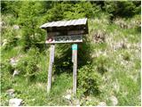 2
2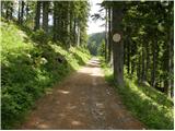 3
3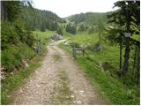 4
4 5
5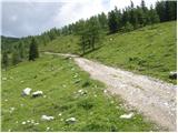 6
6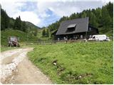 7
7 8
8 9
9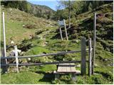 10
10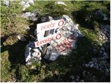 11
11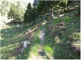 12
12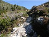 13
13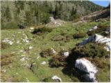 14
14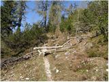 15
15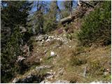 16
16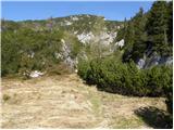 17
17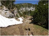 18
18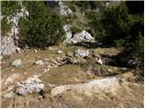 19
19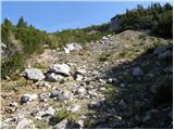 20
20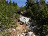 21
21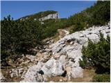 22
22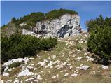 23
23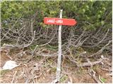 24
24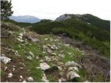 25
25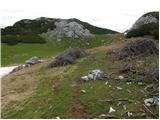 26
26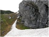 27
27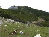 28
28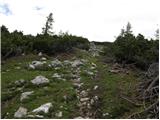 29
29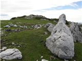 30
30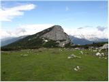 31
31 32
32
Discussion about the trail Planina Loka - Lanež (via Durce)
|
| artur2. 06. 2010 |
Smo šli lani z družino po isti poti. Res lepo.
|
|
|
|
| kkac29. 10. 2019 |
Krajevna tabla ni več Struge, ampak Strmec.
|
|
|
|
| Tadej30. 10. 2019 |
Hvala za opozorilo, sem popravil.
|
|
|
|
| biba30. 10. 2019 |
V soboto smo se v Logarsko dolino peljali še skozi vas Struge.
|
|
|
|
| Tadej30. 10. 2019 |
Še enkrat hvala za opozorilo, sem sedaj popravil nazaj na Struge.
Bom preveril, če je kakšna sprememba.
|
|
|
|
| zokipoki30. 10. 2019 |
Se opravičujem, če se motim, ampak v kraju kjer se zavije za Snežno jamo, itd., po novem stojijo table za Strmec  tako je že najmanj en mesec. Vozil sem se mimo in opazil spremembo. Kraju kjer so bile prej Struge, do dali dva poimenovanja, Raduha in Strmec. Če se pelješ proti Lučam iz smeri Mozirja, je najprej Strmec in takoj za Strmcem je Raduha. Tam živita tudi dva sodelavca in smo se danes o tem pogovarjali. Eden je iz Strmeca, drugi pa iz Raduhe
|
|
|
|
| biba30. 10. 2019 |
Hvala za informacijo. Očitno so oči videle kar so bile navajene videti. Oprostite.
|
|
|