Pfitscher Tal / Val di Vizze - Hochfeiler
Starting point: Pfitscher Tal / Val di Vizze (1718 m)
| Lat/Lon: | 46,98003°N 11,65461°E |
| |
Time of walking: 5 h 40 min
Difficulty: difficult marked way
Altitude difference: 1792 m
Altitude difference po putu: 1850 m
Map:
Recommended equipment (summer): helmet, ice axe, crampons
Recommended equipment (winter): helmet, ice axe, crampons
Views: 7.990
 | 3 people like this post |
Access to the starting point:
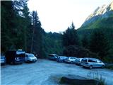
Drive through the Karavanke Tunnel into Austria, then continue to Spittal and on to Lienz (the motorway ends a little after Spittal). We continue along a relatively nice and wide road through the Drava Valley, which leads us into Itali. The road continues past Dobbiaco/Toblach and Brunico/Bruneck. We continue on the main road and then join the motorway towards Austria (direction Brenner, Innsbruck). Instead of the motorway, you can also continue on a parallel road. Leave the motorway at the exit for Vipiteno / Sterzing. At two roundabouts, turn right and follow the signs for Pfitscher Tal / Val di Vizze. Just after the second roundabout, turn left towards the aforementioned Pfitscher Tal / Val di Vizze. Continue following the signs for the valley and the Pfitscher Joch / Passo di Vizze pass. The road becomes very narrow, but is still asphalted at first. As the road turns left towards the last houses in the village of Stein / Sasso, continue right along the narrow dirt road towards the Pfitscher Joch / Passo di Vizze pass. Follow this road to one of the two car parks. The walking route starts at a bend at another slightly smaller car park.
Path description:
At the starting point, take the wide path after the "Hochfeilerhütte" signs. After a few tens of metres, you will reach a crossroads where you turn right down a slightly narrower track towards the Hochfeilerhütte hut. After a short descent, cross the bridge over the Oberbergbach stream and then climb up the well-maintained path. Continue climbing through the forest, then soon cross a fence and arrive at a marked crossroads.
The path to the left leads to the Hochferner bivouac, and we continue to the right following the "Hochfeilerhütte" signs. The trail then crosses slopes with bushes and slightly overgrown grassy slopes, mostly in a gentle ascent, and leads us to the vicinity of mountain pasture Bichl where there is another crossroads.
A path branches off to the right towards the Gliederscharte notch, and we continue to the left, following the signs for hut Hochfeilerhütte. We continue to climb quite steeply and from the trail we start to get beautiful views of the surrounding peaks. We continue to climb along an otherwise well-trodden path, which runs along bushes and slightly overgrown meadows. The path then turns slightly to the right and then crosses relatively steep slopes high above the Gliderbach stream for some time. Later, we cross a pasture fence and the path leads to slightly wider grassy slopes. Here the path climbs a little steeper up the grassy slopes for a short time, then turns slightly to the right again and crosses steep slopes to the east. In some parts where the path crosses steep slopes, we are also helped by a cable car. Soon we arrive again on less steep slopes from which for the first time we have a view towards hut Hochfeilerhütte. The path also descends a little and crosses a few streams via a bridge.
The path starts to climb again and a less well-trodden path from the Gliederscharte notch joins us from the right. We continue to climb along the increasingly scenic path, cross another stream and the path leads us to another marked crossroads.
The path to the right leads to the Hochfeilerhütte hut, and we continue left up towards the Hochfeiler summit. From the crossroads, we climb for a while and the grassy slopes soon give way to rocky slopes. A path then joins us from the right, passing the Hochfeilerhütte. Here you continue slightly to the left and climb along the ridge. When you reach the ridge, which is precipitous on the eastern side, you have a view of the Gliderferner glacier and the peaks above the glacier. In the distance, High Tauern and the Dolomites are increasingly visible. The ridge is then climbed, with numerous cairns along the way.
As the slope to the east side of the ridge becomes flatter, a path over the Gliderferner glacier joins us from the right, quite imperceptibly. Continue along the ridge for a while, then the slope becomes steeper and the path starts to climb up the east side of the ridge. The slope here is quite steep and some caution is needed in a few places. When you reach the ridge again, you have a view of the Weißkarferner glacier, which is located on the west side of the ridge. We then continue to climb along the ridge towards the summit. The ridge is often snow-covered in the last part of the climb, even in summer, so that snowshoes and snowshoes are often needed for the final ascent to the summit. In late summer, the slope on the east side of the ridge can be dry. In this case, the ridge is retreated to the right east side and the summit can be reached without much difficulty by following the rock slabs.

Pictures:
 1
1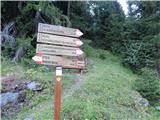 2
2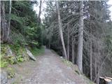 3
3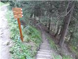 4
4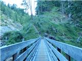 5
5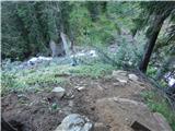 6
6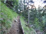 7
7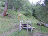 8
8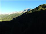 9
9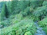 10
10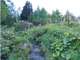 11
11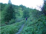 12
12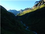 13
13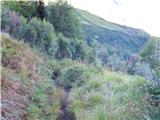 14
14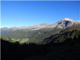 15
15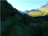 16
16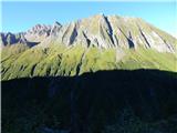 17
17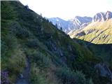 18
18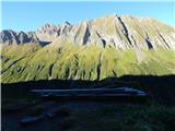 19
19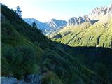 20
20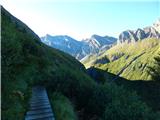 21
21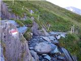 22
22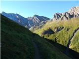 23
23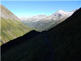 24
24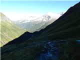 25
25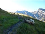 26
26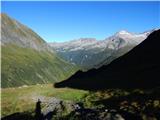 27
27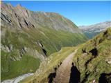 28
28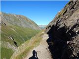 29
29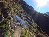 30
30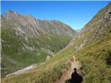 31
31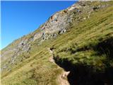 32
32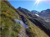 33
33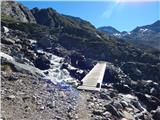 34
34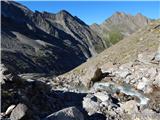 35
35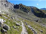 36
36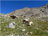 37
37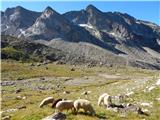 38
38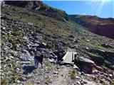 39
39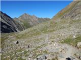 40
40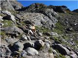 41
41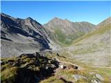 42
42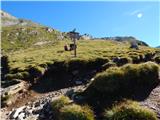 43
43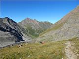 44
44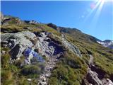 45
45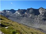 46
46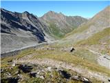 47
47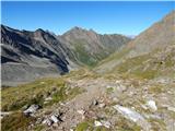 48
48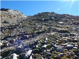 49
49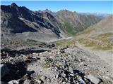 50
50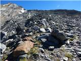 51
51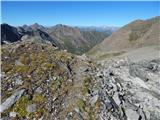 52
52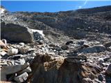 53
53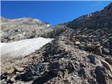 54
54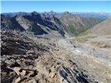 55
55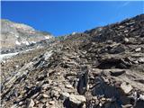 56
56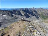 57
57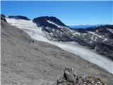 58
58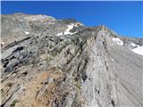 59
59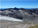 60
60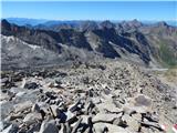 61
61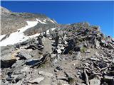 62
62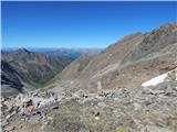 63
63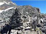 64
64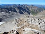 65
65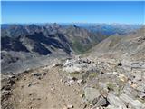 66
66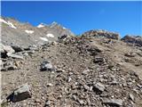 67
67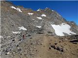 68
68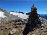 69
69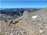 70
70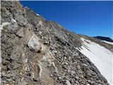 71
71 72
72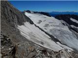 73
73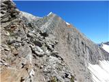 74
74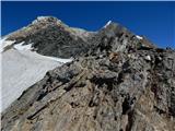 75
75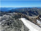 76
76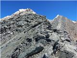 77
77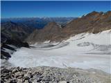 78
78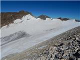 79
79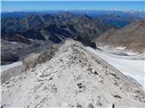 80
80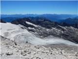 81
81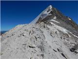 82
82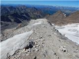 83
83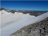 84
84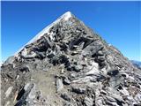 85
85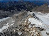 86
86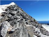 87
87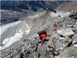 88
88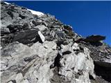 89
89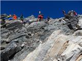 90
90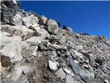 91
91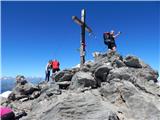 92
92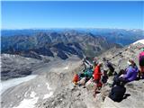 93
93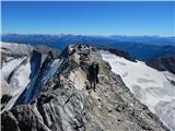 94
94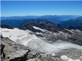 95
95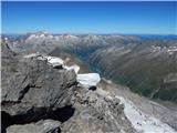 96
96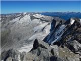 97
97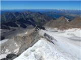 98
98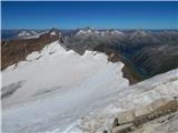 99
99
Discussion about the trail Pfitscher Tal / Val di Vizze - Hochfeiler
|
| NYG25. 08. 2018 |
V torek sem opravil to turo. Bilo je še manj snega kot na fotografijah, tako da sem se brez problema povzpel direkt po grebenu na vrh. Tehnično vzpon ni zahteven, je pa precej strm v drugi polovici.
Vreme je bilo super, razgled odličen. Bil je to moj najvišji vrh doslej in najverjetneje višje ne bom stal. Snežne avanture z derezami me ne zanimajo.
|
|
|
|
| mirank25. 08. 2018 |
Stanje kot opisuješ je tako že nekaj let; zahodni greben kjer poteka dostop na vrh je v avgustu običajno kopen.
|
|
|